College Place
City in Walla Walla County, Washington
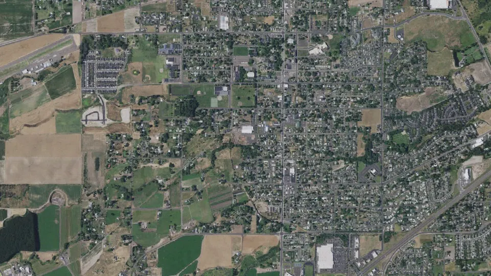
College Place is a city in Walla Walla County, Washington, with 9,902 residents (2020 Census). It sits at 794 ft (242 m) above sea level. The nearest town is Garrett, 1.4 miles NW.
- 9,902residents (2020 Census)
- 794 ftelevation · 242 m
- 3.5 sq miland area · 9.2 km²
- 2,791 / sq mipopulation density
- 99324ZIP code
About College Place
College Place is a city in Walla Walla County, Washington, United States. It neighbors the larger city of Walla Walla, and had a population of 10,090 per Washington State Office of Financial Management (OFM) population estimates.
College Place is the home of Walla Walla University (formerly Walla Walla College, thus the city's name), a Seventh-day Adventist Church operated liberal arts university.
The City has a quaint downtown primarily centered along College Avenue from Rose Street to 13th Street. It is anchored by small businesses such as Happy Wanderer, Andy's Market, Enable Art, and Rogers Bakery. Many businesses downtown are owned by Seventh-Day Adventist owners so they close two hours before sunset on Fridays and then reopen at sunset on Saturday evenings. Downtown has seen significant reinvestment after College Avenue/Rose Street (CARS) Project fully reconstructed the corridor between 2015 and 2017. Economic Development in the corridor is shepherded by the Downtown College Place Association as well as the Cowalla (College Place - Walla Walla) Creative District. Both cities were recognized as a State of Washington Creative District in 2025.
Big box retailers in the city are primarily centered along State Route 125 and Myra Rd. The City in recent years has made significant reinvestment into its park system with Kiwanis Park being rehabbed with pickleball courts in 2017, Veterans Park donated to the City from Hayden Homes out at Homestead in 2019, Korean War Memorial at Veterans Park in 2024, and then the massive Lions Park reconstruction of 2024-2025.
Text: Wikipedia · CC BY-SA 4.0
College Place weather: 7-day forecast
Loading the National Weather Service forecast…
Source: National Weather Service (NOAA).
Live webcams in College Place
Webcams: Windy.com
Living in College Place
- Median household income
- $61,914
- Median home value
- $366,600
- Median rent
- $1,186/mo
- Median age
- 32.3
Do you know College Place? Tell us about it
Help other travelers: share what makes College Place special. We review every message before publishing it.
Map of College Place
Tap any street on the map to see it in Street View below. Map: © OpenStreetMap contributors.
College Place Street View
Drag the image to look around and tap the arrows on the ground to move. If it says there is no imagery, tap a nearby street on the map above.
Open in Google Maps ›College Place, WA population
College Place had 9,902 residents in the 2020 Census.
| 2020 Census | 9,902 |
|---|---|
| Density | 2,791 per sq mi (1,078 per km²) |
Source: U.S. Census Bureau, Decennial Census.
College Place at a glance
| State | Washington (WA) |
|---|---|
| County | Walla Walla County |
| Type | City |
| Population | 9,902 (2020) |
| Land area | 3.55 sq mi (9.2 km²) |
| Elevation | 794 ft (242 m) |
| Coordinates | 46.0418° N, 118.3924° W |
| ZIP code | 99324 |
| Official website | cpwa.us |
| Census code (GEOID) | 5313855 |
Sources: U.S. Census Bureau (Gazetteer, ZCTA), USGS GNIS, Wikidata.
Towns near College Place
- Garrett1.4 mi NW
- Walla Walla3.2 mi NE
- Walla Walla East4.3 mi E
- Umapine, OR6.9 mi SW
- Milton-Freewater, OR7.4 mi S
- Dixie13.4 mi NE
- Touchet13.4 mi W
- Weston, OR15.7 mi S
- Athena, OR16.5 mi S
- Prescott18.2 mi N
- Helix, OR18.4 mi SW
- Waitsburg19.5 mi NE
Straight-line distance between town centers.
Frequently asked questions about College Place
What county is College Place in?
College Place is in Walla Walla County, Washington.
What is the population of College Place, WA?
9,902 people lived in College Place at the 2020 Census.
What is the ZIP code of College Place, WA?
The ZIP code of College Place is 99324.
What is the elevation of College Place?
794 feet (242 m) above sea level.
What towns are near College Place?
Garrett (1.4 mi), Walla Walla (3.2 mi), Walla Walla East (4.3 mi), Umapine (6.9 mi), Milton-Freewater (7.4 mi).
Last updated: