Elliston
Census-designated place in Montgomery County, Virginia
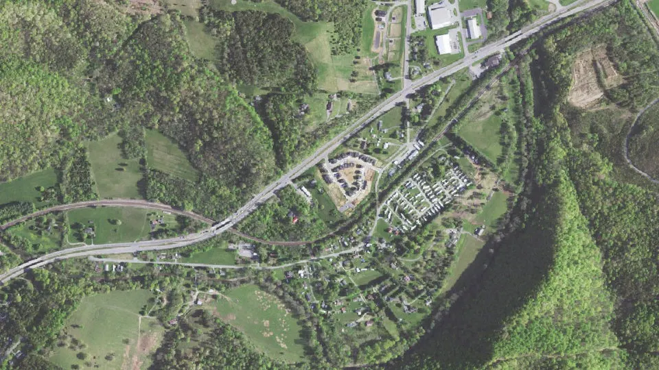
Elliston is an unincorporated community (census-designated place) in Montgomery County, Virginia, with 855 residents (2020 Census). It sits at 1,263 ft (385 m) above sea level. The nearest town is Lafayette, 0.9 miles NE.
- 855residents (2020 Census)
- 1,263 ftelevation · 385 m
- 1.1 sq miland area · 2.8 km²
- 783 / sq mipopulation density
- 24087ZIP code
About Elliston
Elliston is a census-designated place (CDP) in Montgomery County, Virginia, United States. It lies between the city of Roanoke and the town of Christiansburg in the southwestern part of the state. As of the 2020 census, Elliston had a population of 855. It is home to a small fire department, an elementary school, two gas stations, a train stop, and several churches. Most of its residents commute to larger towns. A set of railroad tracks separates the northwestern part of the town from the rest. US highway 11-460 further divides the town into two distinct neighborhoods, "Oldtown," which formed along the Valley Road in the 1850s, and "The Brake," a predominantly African-American area that developed after the Civil War.
Originally known as Big Spring, the town's depot was an important stopping point on the Virginia and Tennessee Railroad and later the Norfolk and Western. In the late 1880s, investors hoped to create a large industrial and railroad center there, to be known as Carnegie City. Instead, the railroad chose the Roanoke County town of Big Lick, later Roanoke, as the location for its main shops.
The Barnett House, Big Spring Baptist Church, Pompey Callaway House, Fotheringay, and Madison Farm Historic and Archeological District are listed on the National Register of Historic Places in 1989.
Text: Wikipedia · CC BY-SA 4.0
Elliston weather: 7-day forecast
Loading the National Weather Service forecast…
Source: National Weather Service (NOAA).
Live webcams in Elliston
Webcams: Windy.com
Living in Elliston
- Median household income
- $47,045
- Median home value
- $255,300
- Median rent
- $920/mo
- Median age
- 42.1
Do you know Elliston? Tell us about it
Help other travelers: share what makes Elliston special. We review every message before publishing it.
Map of Elliston
Tap any street on the map to see it in Street View below. Map: © OpenStreetMap contributors.
Elliston Street View
Drag the image to look around and tap the arrows on the ground to move. If it says there is no imagery, tap a nearby street on the map above.
Open in Google Maps ›Elliston, VA population
Elliston had 855 residents in the 2020 Census.
| 2020 Census | 855 |
|---|---|
| Density | 783 per sq mi (302 per km²) |
Source: U.S. Census Bureau, Decennial Census.
Elliston at a glance
| State | Virginia (VA) |
|---|---|
| County | Montgomery County |
| Type | Census-designated place |
| Population | 855 (2020) |
| Land area | 1.09 sq mi (2.8 km²) |
| Water area | 0.03 sq mi (0.07 km²) |
| Elevation | 1,263 ft (385 m) |
| Coordinates | 37.2232° N, 80.2154° W |
| ZIP code | 24087 |
| Census code (GEOID) | 5125488 |
Sources: U.S. Census Bureau (Gazetteer, ZCTA), USGS GNIS, Wikidata.
Towns near Elliston
- Lafayette0.9 mi NE
- Shawsville4.2 mi SW
- Glenvar6.1 mi NE
- Salem9.8 mi NE
- Cave Spring11.4 mi E
- Merrimac11.5 mi W
- Blacksburg11.6 mi W
- Christiansburg11.9 mi SW
- Roanoke14.7 mi E
- Prices Fork15.0 mi W
- Boones Mill16.3 mi SE
- Riner16.4 mi SW
Straight-line distance between town centers.
Frequently asked questions about Elliston
What county is Elliston in?
Elliston is in Montgomery County, Virginia.
What is the population of Elliston, VA?
855 people lived in Elliston at the 2020 Census.
What is the ZIP code of Elliston, VA?
The ZIP code of Elliston is 24087.
What is the elevation of Elliston?
1,263 feet (385 m) above sea level.
What towns are near Elliston?
Lafayette (0.9 mi), Shawsville (4.2 mi), Glenvar (6.1 mi), Salem (9.8 mi), Cave Spring (11.4 mi).
Last updated: