El Morro Valley
Census-designated place in Cibola County, New Mexico
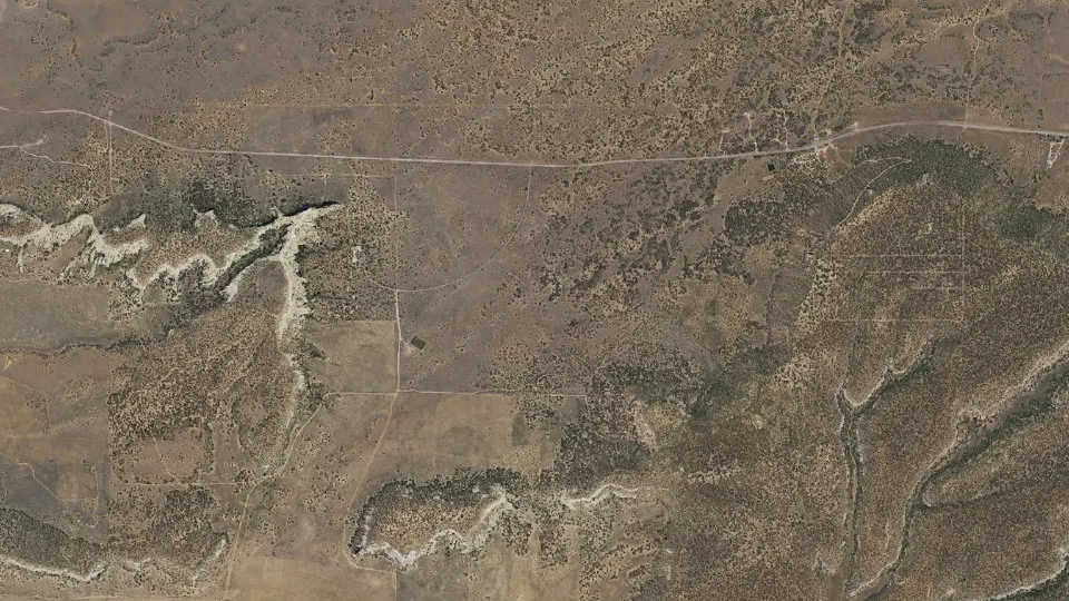
El Morro Valley is an unincorporated community (census-designated place) in Cibola County, New Mexico, with 30 residents (2020 Census). It sits at 7,470 ft (2,277 m) above sea level. The nearest town is Mountain View, 4.1 miles SW.
- 30residents (2020 Census)
- 7,470 ftelevation · 2,277 m
- 13.3 sq miland area · 34.5 km²
- 2 / sq mipopulation density
- 87321ZIP code
About El Morro Valley
El Morro Valley is a census-designated place (CDP) in Cibola County, New Mexico, United States. It includes El Morro National Monument and the unincorporated community of El Morro. The area was first listed as a CDP prior to the 2020 census. As of the 2020 census, El Morro Valley had a population of 30.
The CDP is in northwestern Cibola County along New Mexico State Road 53; it is 12 miles (19 km) southeast of Ramah and 40 miles (64 km) southwest of Interstate 40 at Grants. It is remotely located 38 miles (61 km) west-southwest of Grants along New Mexico State Road 53 (also known as the Ancient Way), and 55 miles (89 km) southeast of Gallup.
El Morro is named after a nearby sandstone promontory with a pool of water at its base, a desert oasis which the Spanish conquistadors called El Morro (The Headland). The Zuni people call it A'ts'ina (Place of Writings on the Rock). Anglo-Americans called it "Inscription Rock". El Morro National Monument is located 1.5 miles (2.4 km) west of the community on Highway 53, along the old Zuni-Acoma Trail, an ancient Pueblo trade route also known as the Ancient Way.
El Morro is an artist community and home of the El Morro Area Arts Council, an art gallery, a trading post, a coffee shop, cafe, RV park & campgrounds, feed & seed store, consignment store and healing arts centre. El Morro is the social hub for artists, homesteaders and individualists who reside in a 1000+ square mile area, from El Malpais National Monument to the east, Ramah to the west, the Zuni Mountains to the north, and Candy Kitchen to the south.
Text: Wikipedia · CC BY-SA 4.0
El Morro Valley weather: 7-day forecast
Loading the National Weather Service forecast…
Source: National Weather Service (NOAA).
Nearest webcams to El Morro Valley
There are no webcams in El Morro Valley itself. These are the closest, 46 miles away or more.
Webcams: Windy.com
Do you know El Morro Valley? Tell us about it
Help other travelers: share what makes El Morro Valley special. We review every message before publishing it.
Map of El Morro Valley
Tap any street on the map to see it in Street View below. Map: © OpenStreetMap contributors.
El Morro Valley Street View
Drag the image to look around and tap the arrows on the ground to move. If it says there is no imagery, tap a nearby street on the map above.
Open in Google Maps ›El Morro Valley, NM population
El Morro Valley had 30 residents in the 2020 Census.
| 2020 Census | 30 |
|---|---|
| Density | 2 per sq mi (1 per km²) |
Source: U.S. Census Bureau, Decennial Census.
El Morro Valley at a glance
| State | New Mexico (NM) |
|---|---|
| County | Cibola County |
| Type | Census-designated place |
| Population | 30 (2020) |
| Land area | 13.34 sq mi (34.5 km²) |
| Elevation | 7,470 ft (2,277 m) |
| Coordinates | 35.0364° N, 108.3378° W |
| ZIP code | 87321 |
| Census code (GEOID) | 3523497 |
Sources: U.S. Census Bureau (Gazetteer, ZCTA), USGS GNIS, Wikidata.
Towns near El Morro Valley
- Mountain View4.1 mi SW
- Pinehill11.1 mi SW
- Ramah11.4 mi NW
- Candy Kitchen12.6 mi SW
- Timberlake13.2 mi NW
- Las Tusas20.6 mi NE
- Bluewater21.2 mi N
- Stoneridge22.6 mi NE
- Homer C Jones23.2 mi NE
- San Rafael24.7 mi E
- McGaffey25.4 mi NW
- Bluewater Village25.6 mi NE
Straight-line distance between town centers.
Frequently asked questions about El Morro Valley
What county is El Morro Valley in?
El Morro Valley is in Cibola County, New Mexico.
What is the population of El Morro Valley, NM?
30 people lived in El Morro Valley at the 2020 Census.
What is the ZIP code of El Morro Valley, NM?
The ZIP code of El Morro Valley is 87321.
What is the elevation of El Morro Valley?
7,470 feet (2,277 m) above sea level.
What towns are near El Morro Valley?
Mountain View (4.1 mi), Pinehill (11.1 mi), Ramah (11.4 mi), Candy Kitchen (12.6 mi), Timberlake (13.2 mi).
Last updated: