San Rafael
Census-designated place in Cibola County, New Mexico
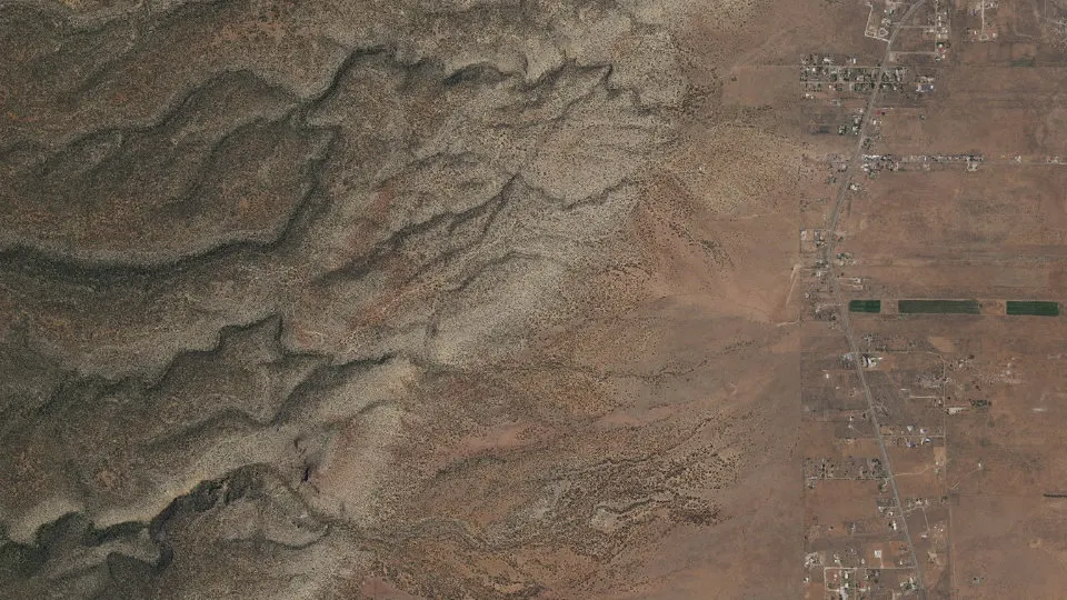
San Rafael is an unincorporated community (census-designated place) in Cibola County, New Mexico, with 1,164 residents (2020 Census). It sits at 6,470 ft (1,972 m) above sea level. The nearest town is Grants, 6.0 miles NE.
- 1,164residents (2020 Census)
- 6,470 ftelevation · 1,972 m
- 15.8 sq miland area · 40.9 km²
- 74 / sq mipopulation density
- 87051ZIP code
About San Rafael
San Rafael is a census-designated place (CDP) in Cibola County, New Mexico, United States. As of the 2020 census, San Rafael had a population of 1,164. Also known as "Bikyaya" or "El Gallo", it lies at an elevation of 6,470 feet (1,970 m) above sea level and is located in north-central Cibola County at (35.1125386, -107.8825580). New Mexico State Road 53 passes through the community, leading north 3 miles (5 km) to Interstate 40 and 5 miles (8 km) to the center of Grants, the county seat.
An 1850 U.S. Army map shows a Hay Camp near San Rafael. Fort Wingate was established (moved from Seboyeta, New Mexico) by Lt. Colonel J. Francisco Chavez, 1st New Mexico Infantry under the orders of General Edward Canby in 1862. It was located near a large spring and designed to house four companies of troops. Colonel Kit Carson and four companies of New Mexico Volunteers used this fort. Carson was ordered by General Carleton to round up first the Mescalero Apache, then the Navajo and send them to Bosque Redondo. San Rafael was a stop on the Navajo's journey to and from Fort Sumner. In 1868 the garrison and name of the fort was transferred to the former site of Fort Lyon, near Gallup.
Text: Wikipedia · CC BY-SA 4.0
San Rafael weather: 7-day forecast
Loading the National Weather Service forecast…
Source: National Weather Service (NOAA).
Nearest webcams to San Rafael
There are no webcams in San Rafael itself. These are the closest, 56 miles away or more.
Webcams: Windy.com
Living in San Rafael
- Median household income
- $83,423
- Median home value
- $120,400
- Median age
- 59.3
Do you know San Rafael? Tell us about it
Help other travelers: share what makes San Rafael special. We review every message before publishing it.
Map of San Rafael
Tap any street on the map to see it in Street View below. Map: © OpenStreetMap contributors.
San Rafael Street View
Drag the image to look around and tap the arrows on the ground to move. If it says there is no imagery, tap a nearby street on the map above.
Open in Google Maps ›San Rafael, NM population
San Rafael had 1,164 residents in the 2020 Census.
| 2020 Census | 1,164 |
|---|---|
| Density | 74 per sq mi (28 per km²) |
Source: U.S. Census Bureau, Decennial Census.
San Rafael at a glance
| State | New Mexico (NM) |
|---|---|
| County | Cibola County |
| Type | Census-designated place |
| Population | 1,164 (2020) |
| Land area | 15.80 sq mi (40.9 km²) |
| Water area | 0.00 sq mi (0.00 km²) |
| Elevation | 6,470 ft (1,972 m) |
| Coordinates | 35.0915° N, 107.9063° W |
| ZIP code | 87051 |
| Census code (GEOID) | 3569875 |
Sources: U.S. Census Bureau (Gazetteer, ZCTA), USGS GNIS, Wikidata.
Towns near San Rafael
- Grants6.0 mi NE
- Mount Taylor6.0 mi NE
- Milan7.3 mi N
- Golden Acres8.3 mi N
- Broadview9.4 mi N
- Anzac Village9.5 mi E
- Bluewater Village13.1 mi N
- McCartys Village13.9 mi E
- Lobo Canyon13.9 mi NE
- Acomita Lake16.6 mi E
- Skyline-Ganipa16.8 mi E
- San Fidel17.5 mi E
Straight-line distance between town centers.
Frequently asked questions about San Rafael
What county is San Rafael in?
San Rafael is in Cibola County, New Mexico.
What is the population of San Rafael, NM?
1,164 people lived in San Rafael at the 2020 Census.
What is the ZIP code of San Rafael, NM?
The ZIP code of San Rafael is 87051.
What is the elevation of San Rafael?
6,470 feet (1,972 m) above sea level.
What towns are near San Rafael?
Grants (6.0 mi), Mount Taylor (6.0 mi), Milan (7.3 mi), Golden Acres (8.3 mi), Broadview (9.4 mi).
Last updated: