Fairfield
Township in Essex County, New Jersey
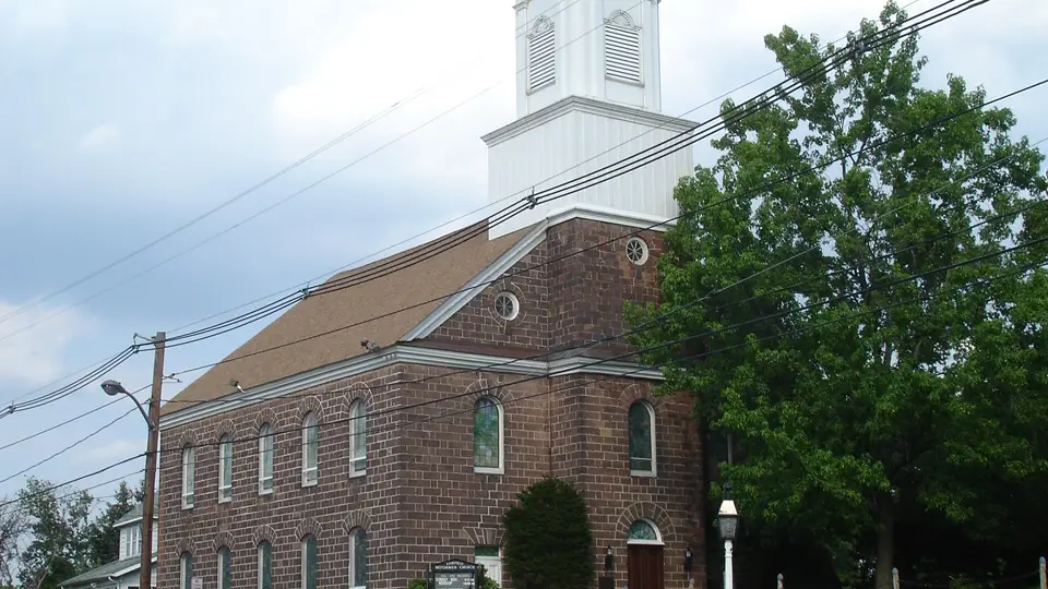
Fairfield is a township in Essex County, New Jersey, with 7,872 residents (2020 Census). It sits at 174 ft (53 m) above sea level. The nearest town is Pine Brook, 2.2 miles SW.
- 7,872residents (2020 Census)
- 174 ftelevation · 53 m
- 10.1 sq miland area · 26.2 km²
- 777 / sq mipopulation density
- 07004main ZIP code (3 in total)
About Fairfield
Fairfield is a township in far northwestern Essex County, in the U.S. state of New Jersey. As of the 2020 United States census, the township's population was 7,872, an increase of 406 (+5.4%) from the 2010 census count of 7,466, which in turn reflected an increase of 403 (+5.7%) from the 7,063 counted in the 2000 census. Fairfield was the least densely populated town in Essex County in 2020.
The first Europeans to settle in the area were Dutch and the place was called Gansegat. Later it was part of Horse Neck and officially part of Newark Township. What is now Fairfield was formed on February 16, 1798, as Caldwell Township from portions of Acquackanonk Township and Newark Township. The area was named for Rev. James Caldwell. It was incorporated as one of New Jersey's initial 104 townships by an act of the New Jersey Legislature on February 21, 1798. Portions of the township were taken to create Livingston (February 8, 1813), Fairmount Township (March 11, 1862, now part of West Orange), Caldwell borough (February 10, 1892), Verona Township (February 17, 1892, now known and including what is now Cedar Grove), North Caldwell (March 31, 1898), Essex Fells (March 31, 1902) and West Caldwell (February 24, 1904). On November 6, 1963, Caldwell Township was renamed as Fairfield Township, based on the results of a referendum passed the previous day. Fairfield was reincorporated as borough on June 8, 1964. In 1978, the borough passed a referendum reincorporating itself as a township, becoming the second of more than a dozen Essex County municipalities to reclassify themselves as townships in order take advantage of federal revenue sharing policies that allocated townships a greater share of government aid to municipalities on a per capita basis. It also has the heaviest population of Italian people by density.
Text: Wikipedia · CC BY-SA 4.0
Fairfield weather: 7-day forecast
Loading the National Weather Service forecast…
Source: National Weather Service (NOAA).
Live webcams in Fairfield
Webcams: Windy.com
Things to do in Fairfield
Top places to visit in and around Fairfield: Bell Labs, Montclair Art Museum and Turtle Back Zoo.
 Bell LabsHistoric house · 15 mi S
 Montclair Art MuseumMuseum · 6.1 mi SE
 Turtle Back ZooZoo · 8.0 mi S
 Drew UniversityGarden · 11 mi SW
Family attractions (2)Museums & galleries (10)Historic sites & landmarks (10)Parks & gardens (10)Hiking trails (4)Waterfalls (1)Scenic viewpoints & peaks (10)Nature reserves & natural wonders (10)Theaters & public art (10)Golf, marinas & outdoor sports (8)
All 75 things to do in Fairfield ›Living in Fairfield
- Median household income
- $115,980
- Median home value
- $688,500
- Median rent
- $2,656/mo
- Median age
- 49.9
Small communities near Fairfield
- Two Bridges1.7 mi NE
- Westville2.6 mi S
- West Paterson5.7 mi E
- Cobbs Corner6.0 mi W
- Taylortown6.1 mi NW
- Albion Place6.7 mi E
- Richfield6.9 mi E
- Powerville6.9 mi W
- Fayson Lakes7.0 mi NW
- Saint Cloud7.6 mi S
- Malapardis7.6 mi SW
- Pompton7.6 mi N
- Hutton Park7.7 mi S
- Athenia7.9 mi E
- Rockaway Valley8.0 mi NW
- Birch Hills8.4 mi SW
Schools in Fairfield
Fairfield has 5 public schools. The elementary school is Adlai E. Stevenson School; the nearest middle school is West Essex Middle School (2.1 mi E); the high school is Essex Campus Academy.
| School | Grades | Students | Students per teacher | Type | Distance |
|---|---|---|---|---|---|
| Adlai E. Stevenson School Fairfield · Fairfield Public School District | PK–2 | 312 | 8.9 | Public | in town |
| Winston S. Churchill School Fairfield · Fairfield Public School District | 3–6 | 401 | 13.4 | Public | in town |
| Essex Junior Academy Fairfield · Essex Regional Educational Services Commission | K–8 | 15 | 3.8 | Public | 1.7 mi E |
| Essex Campus Academy Fairfield · Essex Regional Educational Services Commission | 9–12 | 37 | 12.3 | Public | 1.7 mi E |
| Essex High School Fairfield · Essex Regional Educational Services Commission | 9–12 | 34 | 11.3 | Public | 1.7 mi E |
| West Essex High School North Caldwell · West Essex Regional School District | 9–12 | 1,061 | 11.4 | Public | 1.9 mi E |
Do you know Fairfield? Tell us about it
Help other travelers: share what makes Fairfield special. We review every message before publishing it.
Map of Fairfield
Tap any street on the map to see it in Street View below. Map: © OpenStreetMap contributors.
Fairfield Street View
Drag the image to look around and tap the arrows on the ground to move. If it says there is no imagery, tap a nearby street on the map above.
Open in Google Maps ›Fairfield, NJ population
Fairfield had 7,872 residents in the 2020 Census.
| 2020 Census | 7,872 |
|---|---|
| Density | 777 per sq mi (300 per km²) |
Source: U.S. Census Bureau, Decennial Census.
Fairfield at a glance
| State | New Jersey (NJ) |
|---|---|
| County | Essex County |
| Type | Township |
| Population | 7,872 (2020) |
| Land area | 10.13 sq mi (26.2 km²) |
| Water area | 0.22 sq mi (0.57 km²) |
| Elevation | 174 ft (53 m) |
| Coordinates | 40.8825° N, 74.3046° W |
| ZIP codes | 07004, 07006, 07058 |
| Official website | fairfieldnj.org |
| Census code (GEOID) | 3401322385 |
Sources: U.S. Census Bureau (Gazetteer, ZCTA), USGS GNIS, Wikidata.
Towns near Fairfield
- Pine Brook2.2 mi SW
- West Caldwell2.5 mi S
- North Caldwell2.6 mi SE
- Lincoln Park2.9 mi N
- Singac3.2 mi E
- Caldwell3.3 mi SE
- Montville3.5 mi NW
- Towaco3.8 mi NW
- Essex Fells4.0 mi S
- Lake Hiawatha4.1 mi W
- Roseland4.2 mi S
- Cedar Grove4.3 mi SE
Straight-line distance between town centers.
Frequently asked questions about Fairfield
What county is Fairfield in?
Fairfield is in Essex County, New Jersey.
What is the population of Fairfield, NJ?
7,872 people lived in Fairfield at the 2020 Census.
What is the ZIP code of Fairfield, NJ?
The main ZIP code is 07004. Other ZIP codes: 07006, 07058.
What is the elevation of Fairfield?
174 feet (53 m) above sea level.
What towns are near Fairfield?
Pine Brook (2.2 mi), West Caldwell (2.5 mi), North Caldwell (2.6 mi), Lincoln Park (2.9 mi), Singac (3.2 mi).
Last updated: