Cape St. Claire
Census-designated place in Anne Arundel County, Maryland
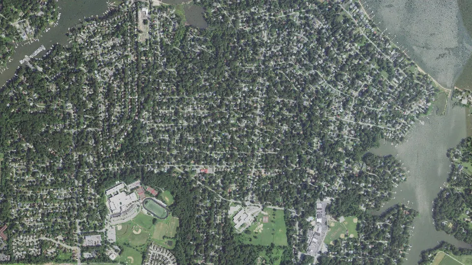
Cape St. Claire is an unincorporated community (census-designated place) in Anne Arundel County, Maryland, with 9,179 residents (2020 Census). It sits at 82 ft (25 m) above sea level. The nearest town is Arnold, 3.2 miles W.
- 9,179residents (2020 Census)
- 82 ftelevation · 25 m
- 2.0 sq miland area · 5.2 km²
- 4,589 / sq mipopulation density
- 21409ZIP code
About Cape St. Claire
Cape St. Claire, a suburb of Annapolis, is a covenanted, unincorporated community as well as a census-designated place (CDP) in Anne Arundel County, Maryland, United States. While the community of Cape St. Claire lies entirely within the CDP and accounts for approximately 80% of the homes and residents, the CDP also includes the smaller communities of Atlantis, Walnut Ridge, Green Holly, and St. Claire Court. The population of the CDP was 8,747 at the 2010 census.
Contained within Cape St. Claire are three marinas, multiple parks and beaches, a shopping center, Broadneck High School, Broadneck Library, Cape St. Claire Elementary School, The Harbour School, and Cape St. Claire Swim Club. Fire protection is provided by the Cape St. Claire Volunteer Fire Company. There are many churches located in the community including: Broadneck Baptist Church, Cape St. Claire United Methodist Church and Christ Our Anchor Presbyterian Church and Saint Andrew By the Bay Roman Catholic Church.
Text: Wikipedia · CC BY-SA 4.0
Cape St. Claire weather: 7-day forecast
Loading the National Weather Service forecast…
Source: National Weather Service (NOAA).
Live webcams in Cape St. Claire
Webcams: Windy.com
Living in Cape St. Claire
- Median household income
- $136,111
- Median home value
- $488,200
- Median rent
- $2,031/mo
- Median age
- 39.9
Do you know Cape St. Claire? Tell us about it
Help other travelers: share what makes Cape St. Claire special. We review every message before publishing it.
Map of Cape St. Claire
Tap any street on the map to see it in Street View below. Map: © OpenStreetMap contributors.
Cape St. Claire Street View
Drag the image to look around and tap the arrows on the ground to move. If it says there is no imagery, tap a nearby street on the map above.
Open in Google Maps ›Cape St. Claire, MD population
Cape St. Claire had 9,179 residents in the 2020 Census.
| 2020 Census | 9,179 |
|---|---|
| Density | 4,589 per sq mi (1,772 per km²) |
Source: U.S. Census Bureau, Decennial Census.
Cape St. Claire at a glance
| State | Maryland (MD) |
|---|---|
| County | Anne Arundel County |
| Type | Census-designated place |
| Population | 9,179 (2020) |
| Land area | 2.00 sq mi (5.2 km²) |
| Water area | 0.53 sq mi (1.37 km²) |
| Elevation | 82 ft (25 m) |
| Coordinates | 39.0436° N, 76.4453° W |
| ZIP code | 21409 |
| Census code (GEOID) | 2412912 |
Sources: U.S. Census Bureau (Gazetteer, ZCTA), USGS GNIS, Wikidata.
Towns near Cape St. Claire
- Arnold3.2 mi W
- Lake Shore4.1 mi NW
- Naval Academy4.5 mi SW
- Annapolis5.9 mi SW
- Parole6.9 mi SW
- Herald Harbor7.0 mi W
- Severna Park7.1 mi NW
- Annapolis Neck7.8 mi S
- Highland Beach7.9 mi S
- Crownsville7.9 mi W
- Arden on the Severn8.3 mi W
- Stevensville8.3 mi SE
Straight-line distance between town centers.
Frequently asked questions about Cape St. Claire
What county is Cape St. Claire in?
Cape St. Claire is in Anne Arundel County, Maryland.
What is the population of Cape St. Claire, MD?
9,179 people lived in Cape St. Claire at the 2020 Census.
What is the ZIP code of Cape St. Claire, MD?
The ZIP code of Cape St. Claire is 21409.
What is the elevation of Cape St. Claire?
82 feet (25 m) above sea level.
What towns are near Cape St. Claire?
Arnold (3.2 mi), Lake Shore (4.1 mi), Naval Academy (4.5 mi), Annapolis (5.9 mi), Parole (6.9 mi).
Last updated: