Cottageville
Census-designated place in Jackson County, West Virginia
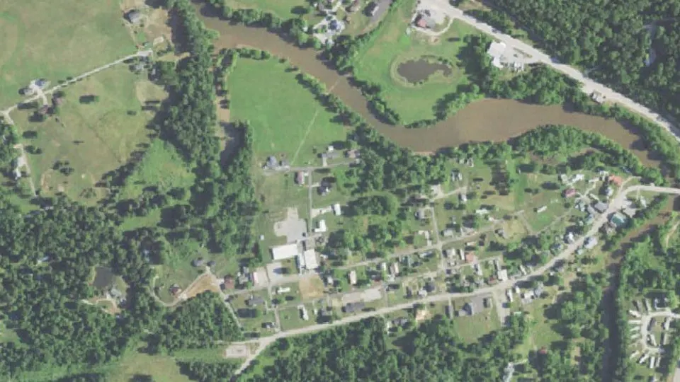
Cottageville is an unincorporated community (census-designated place) in Jackson County, West Virginia, with 114 residents (2020 Census). It sits at 594 ft (181 m) above sea level. The nearest town is Ripley, 7.0 miles SE.
- 114residents (2020 Census)
- 594 ftelevation · 181 m
- 0.1 sq miland area · 0.3 km²
- 846 / sq mipopulation density
- 25239ZIP code
About Cottageville
Cottageville (also Moores Mill, Rhodess Mill, or Wrights Mill) is an unincorporated community in western Jackson County, West Virginia, United States. It lies along West Virginia Route 331 northwest of the city of Ripley, the county seat of Jackson County. Established in 1858, its elevation is 594 feet (181 m). Although Cottageville is unincorporated, it has a post office, with the ZIP code of 25239. As of the 2020 census, Cottageville had a population of 114. It also is the site of the annual Jackson County Junior Fair. Michael Coleman, a well known early Indian fighter, was killed and buried in the area, according to a historical marker placed by the state of WV. The wooden Grist Mill located here since the 1840s burned to the ground in the summer of 1965. Its foundation stones remain. It had remained in operation full-time until 1930, part-time until 1937. Cottageville was a commercial center with a bank, newspaper, tannery, blacksmith, several stores, a railroad station on the B & O and many other businesses in the early part of the twentieth century. Its heyday faded with the closing of the mill and the improvement of roads in the county. The B & O pulled up its tracks to the county seat, Ripley, in the mid-nineteen-sixties. Less than a mile from the old town, the county operated what folks called the "poor farm," an early version of a welfare commune. That closed in the thirties with the New Deal. That land is now the Jackson County Junior Fairgrounds.
Text: Wikipedia · CC BY-SA 4.0
Cottageville weather: 7-day forecast
Loading the National Weather Service forecast…
Source: National Weather Service (NOAA).
Live webcams in Cottageville
Webcams: Windy.com
Living in Cottageville
- Median home value
- $9,999
- Median age
- 39.6
Do you know Cottageville? Tell us about it
Help other travelers: share what makes Cottageville special. We review every message before publishing it.
Map of Cottageville
Tap any street on the map to see it in Street View below. Map: © OpenStreetMap contributors.
Cottageville Street View
Drag the image to look around and tap the arrows on the ground to move. If it says there is no imagery, tap a nearby street on the map above.
Open in Google Maps ›Cottageville, WV population
Cottageville had 114 residents in the 2020 Census.
| 2020 Census | 114 |
|---|---|
| Density | 846 per sq mi (327 per km²) |
Source: U.S. Census Bureau, Decennial Census.
Cottageville at a glance
| State | West Virginia (WV) |
|---|---|
| County | Jackson County |
| Type | Census-designated place |
| Population | 114 (2020) |
| Land area | 0.13 sq mi (0.3 km²) |
| Water area | 0.01 sq mi (0.03 km²) |
| Elevation | 594 ft (181 m) |
| Coordinates | 38.8675° N, 81.8254° W |
| ZIP code | 25239 |
| Census code (GEOID) | 5418124 |
Sources: U.S. Census Bureau (Gazetteer, ZCTA), USGS GNIS, Wikidata.
Towns near Cottageville
- Ripley7.0 mi SE
- Ravenswood7.0 mi NE
- Racine, OH8.3 mi NW
- Leon10.8 mi SW
- New Haven11.3 mi NW
- Syracuse, OH12.1 mi NW
- Hartford City12.2 mi NW
- Clifton14.9 mi NW
- Mason15.2 mi NW
- Middleport, OH15.6 mi NW
- Pomeroy, OH16.0 mi NW
- Point Pleasant16.5 mi W
Straight-line distance between town centers.
Frequently asked questions about Cottageville
What county is Cottageville in?
Cottageville is in Jackson County, West Virginia.
What is the population of Cottageville, WV?
114 people lived in Cottageville at the 2020 Census.
What is the ZIP code of Cottageville, WV?
The ZIP code of Cottageville is 25239.
What is the elevation of Cottageville?
594 feet (181 m) above sea level.
What towns are near Cottageville?
Ripley (7.0 mi), Ravenswood (7.0 mi), Racine (8.3 mi), Leon (10.8 mi), New Haven (11.3 mi).
Last updated: