South Hill
Census-designated place in Pierce County, Washington
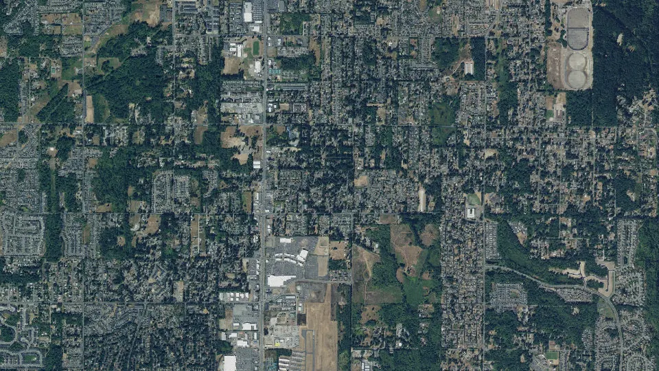
South Hill is an unincorporated community (census-designated place) in Pierce County, Washington, with 64,708 residents (2020 Census). It sits at 535 ft (163 m) above sea level. The nearest town is McMillin, 2.4 miles E.
- 64,708residents (2020 Census)
- 535 ftelevation · 163 m
- 18.6 sq miland area · 48.1 km²
- 3,482 / sq mipopulation density
- 98374main ZIP code (3 in total)
About South Hill
South Hill is a census-designated place (CDP) in Pierce County, Washington, United States. The population was 64,708 at the 2020 census. Located immediately south of Puyallup, the area primarily consists of suburban housing and shopping with several retail shopping centers, residential neighborhoods, and apartment complexes throughout. Because South Hill is unincorporated, its addresses are part of the Puyallup "postal city" or ZCTA.
The area was first settled in the 1880s after a military road was built through the area in the 1850s. Several logging camps, farms, and hunting grounds sprouted up as the area was settled. It also was the main route to the towns of Kapowsin and Eatonville. Population growth was slow until after World War II, when roads improved and people could commute to nearby Tacoma, Fort Lewis, and Seattle.
Most commercial areas are located along the main thoroughfare, Meridian Avenue (State Route 161). Major neighborhoods include Manorwood, Sunrise (Sunrise Master Association), Lipoma Firs, Silvercreek, and Gem Heights. There are also a few popular public parks: Bradley Lake Park, South Hill Community Park/Nathan Chapman Memorial Trail and Wildwood Park.
Text: Wikipedia · CC BY-SA 4.0
South Hill weather: 7-day forecast
Loading the National Weather Service forecast…
Source: National Weather Service (NOAA).
Live webcams in South Hill
Webcams: Windy.com
Living in South Hill
- Median household income
- $113,130
- Median home value
- $543,600
- Median rent
- $2,088/mo
- Median age
- 35.3
Do you know South Hill? Tell us about it
Help other travelers: share what makes South Hill special. We review every message before publishing it.
Map of South Hill
Tap any street on the map to see it in Street View below. Map: © OpenStreetMap contributors.
South Hill Street View
Drag the image to look around and tap the arrows on the ground to move. If it says there is no imagery, tap a nearby street on the map above.
Open in Google Maps ›South Hill, WA population
South Hill had 64,708 residents in the 2020 Census.
| 2020 Census | 64,708 |
|---|---|
| Density | 3,482 per sq mi (1,344 per km²) |
Source: U.S. Census Bureau, Decennial Census.
South Hill at a glance
| State | Washington (WA) |
|---|---|
| County | Pierce County |
| Type | Census-designated place |
| Population | 64,708 (2020) |
| Land area | 18.59 sq mi (48.1 km²) |
| Water area | 0.08 sq mi (0.21 km²) |
| Elevation | 535 ft (163 m) |
| Coordinates | 47.1207° N, 122.2853° W |
| ZIP codes | 98374, 98373, 98375 |
| Census code (GEOID) | 5365922 |
Sources: U.S. Census Bureau (Gazetteer, ZCTA), USGS GNIS, Wikidata.
Towns near South Hill
- McMillin2.4 mi E
- Summit View3.3 mi W
- Orting3.8 mi SE
- Frederickson4.0 mi SW
- Puyallup4.0 mi N
- Clover Creek4.8 mi W
- Alderton5.0 mi NE
- Summit5.0 mi NW
- Tehaleh5.0 mi E
- North Puyallup5.4 mi N
- Graham6.0 mi S
- Elk Plain6.6 mi SW
Straight-line distance between town centers.
Frequently asked questions about South Hill
What county is South Hill in?
South Hill is in Pierce County, Washington.
What is the population of South Hill, WA?
64,708 people lived in South Hill at the 2020 Census.
What is the ZIP code of South Hill, WA?
The main ZIP code is 98374. Other ZIP codes: 98373, 98375.
What is the elevation of South Hill?
535 feet (163 m) above sea level.
What towns are near South Hill?
McMillin (2.4 mi), Summit View (3.3 mi), Orting (3.8 mi), Frederickson (4.0 mi), Puyallup (4.0 mi).
Last updated: