Fort Lewis
Census-designated place in Pierce County, Washington
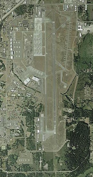
Fort Lewis is an unincorporated community (census-designated place) in Pierce County, Washington, with 14,052 residents (2020 Census). It sits at 410 ft (125 m) above sea level. The nearest town is North Fort Lewis, 2.2 miles NW.
- 14,052residents (2020 Census)
- 410 ftelevation · 125 m
- 10.3 sq miland area · 26.6 km²
- 1,366 / sq mipopulation density
- 98430main ZIP code (2 in total)
About Fort Lewis
Joint Base Lewis–McChord (JBLM) is a U.S. installation located 9.1 miles (14.6 km) south-southwest of Tacoma, Washington, operated by the United States Army. The installation is an amalgamation of Fort Lewis and McChord Air Force Base, which merged on February 1, 2010, to form a joint base as a result of 2005 Base Realignment and Closure Commission recommendations. JBLM is home to I Corps and the 62nd Airlift Wing.
Joint Base Lewis–McChord is a training and mobilization center for all services and is the only Army power projection base west of the Rocky Mountains in the Continental United States. Its geographic location provides rapid access to the deepwater ports of Tacoma, Olympia, and Seattle for deploying equipment. Units can be deployed from McChord Field, and individuals and small groups can also use nearby Sea-Tac Airport. The strategic location of the base provides Air Force units with the ability to conduct combat and humanitarian airlift with the C-17 Globemaster III.
Text: Wikipedia · CC BY-SA 4.0
Fort Lewis weather: 7-day forecast
Loading the National Weather Service forecast…
Source: National Weather Service (NOAA).
Live webcams in Fort Lewis
Webcams: Windy.com
Living in Fort Lewis
- Median household income
- $58,796
- Median rent
- $2,282/mo
- Median age
- 22.9
Do you know Fort Lewis? Tell us about it
Help other travelers: share what makes Fort Lewis special. We review every message before publishing it.
Map of Fort Lewis
Tap any street on the map to see it in Street View below. Map: © OpenStreetMap contributors.
Fort Lewis Street View
Drag the image to look around and tap the arrows on the ground to move. If it says there is no imagery, tap a nearby street on the map above.
Open in Google Maps ›Fort Lewis, WA population
Fort Lewis had 14,052 residents in the 2020 Census.
| 2020 Census | 14,052 |
|---|---|
| Density | 1,366 per sq mi (527 per km²) |
Source: U.S. Census Bureau, Decennial Census.
Fort Lewis at a glance
| State | Washington (WA) |
|---|---|
| County | Pierce County |
| Type | Census-designated place |
| Population | 14,052 (2020) |
| Land area | 10.29 sq mi (26.6 km²) |
| Elevation | 410 ft (125 m) |
| Coordinates | 47.0955° N, 122.5674° W |
| ZIP codes | 98430, 98433 |
| Official website | lewis-mcchord.army.mil |
| Census code (GEOID) | 5324915 |
Sources: U.S. Census Bureau (Gazetteer, ZCTA), USGS GNIS, Wikidata.
Towns near Fort Lewis
- North Fort Lewis2.2 mi NW
- DuPont3.9 mi W
- McChord AFB4.4 mi NE
- Lakewood5.1 mi N
- Steilacoom5.2 mi N
- Ketron Island5.2 mi NW
- Anderson Island6.6 mi NW
- Spanaway6.8 mi E
- Parkland6.9 mi NE
- Nisqually Indian Community7.0 mi SW
- Roy7.4 mi S
- University Place8.3 mi N
Straight-line distance between town centers.
Frequently asked questions about Fort Lewis
What county is Fort Lewis in?
Fort Lewis is in Pierce County, Washington.
What is the population of Fort Lewis, WA?
14,052 people lived in Fort Lewis at the 2020 Census.
What is the ZIP code of Fort Lewis, WA?
The main ZIP code is 98430. Other ZIP codes: 98433.
What is the elevation of Fort Lewis?
410 feet (125 m) above sea level.
What towns are near Fort Lewis?
North Fort Lewis (2.2 mi), DuPont (3.9 mi), McChord AFB (4.4 mi), Lakewood (5.1 mi), Steilacoom (5.2 mi).
Last updated: