Camano
Census-designated place in Island County, Washington
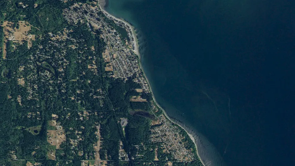
Camano is an unincorporated community (census-designated place) in Island County, Washington, with 17,356 residents (2020 Census). It sits at 52 ft (16 m) above sea level. The nearest town is Warm Beach, 5.3 miles E.
- 17,356residents (2020 Census)
- 52 ftelevation · 16 m
- 39.9 sq miland area · 103.4 km²
- 435 / sq mipopulation density
- 98282ZIP code
About Camano
Camano Island is a large island in Possession Sound, a section of Puget Sound. It is part of Island County, Washington, and is located between Whidbey Island and the mainland (Snohomish County) by the Saratoga Passage to the west and Port Susan and Davis Slough to the east. The island has one road connection to the mainland, via State Route 532 over the Camano Gateway Bridge at the northeast end of the island, connecting to the city of Stanwood.
The island has a total area of 39.77 square miles (103.0 km2), making it one of the largest in the state of Washington. It has a year-round population of 15,661 as of the 2010 census. The population peaks at over 17,000 during the summer months due to part-time residents with vacation homes on the island. It is an unincorporated area with several small communities and shares civic facilities with nearby Stanwood, including its school district, and post office.
Camano Island is home to two state parks, Cama Beach and Camano Island State Park, and several county and local parks.
Text: Wikipedia · CC BY-SA 4.0
Camano weather: 7-day forecast
Loading the National Weather Service forecast…
Source: National Weather Service (NOAA).
Live webcams in Camano
Webcams: Windy.com
Living in Camano
- Median household income
- $105,231
- Median home value
- $670,800
- Median rent
- $1,896/mo
- Median age
- 56.8
Do you know Camano? Tell us about it
Help other travelers: share what makes Camano special. We review every message before publishing it.
Map of Camano
Tap any street on the map to see it in Street View below. Map: © OpenStreetMap contributors.
Camano Street View
Drag the image to look around and tap the arrows on the ground to move. If it says there is no imagery, tap a nearby street on the map above.
Open in Google Maps ›Camano, WA population
Camano had 17,356 residents in the 2020 Census.
| 2020 Census | 17,356 |
|---|---|
| Density | 435 per sq mi (168 per km²) |
Source: U.S. Census Bureau, Decennial Census.
Camano at a glance
| State | Washington (WA) |
|---|---|
| County | Island County |
| Type | Census-designated place |
| Population | 17,356 (2020) |
| Land area | 39.91 sq mi (103.4 km²) |
| Water area | 55.03 sq mi (142.52 km²) |
| Elevation | 52 ft (16 m) |
| Coordinates | 48.1525° N, 122.4621° W |
| ZIP code | 98282 |
| Census code (GEOID) | 5309365 |
Sources: U.S. Census Bureau (Gazetteer, ZCTA), USGS GNIS, Wikidata.
Towns near Camano
- Warm Beach5.3 mi E
- Kayak Point5.6 mi E
- Langley8.3 mi S
- Stanwood8.5 mi NE
- Lake Goodwin8.7 mi E
- Northwest Stanwood9.2 mi NE
- Freeland9.5 mi SW
- Sunday Lake10.3 mi NE
- Silvana10.5 mi E
- Lake Ketchum10.6 mi NE
- Coupeville11.0 mi NW
- Hat Island11.6 mi SE
Straight-line distance between town centers.
Frequently asked questions about Camano
What county is Camano in?
Camano is in Island County, Washington.
What is the population of Camano, WA?
17,356 people lived in Camano at the 2020 Census.
What is the ZIP code of Camano, WA?
The ZIP code of Camano is 98282.
What is the elevation of Camano?
52 feet (16 m) above sea level.
What towns are near Camano?
Warm Beach (5.3 mi), Kayak Point (5.6 mi), Langley (8.3 mi), Stanwood (8.5 mi), Lake Goodwin (8.7 mi).
Last updated: