Mount Clifton
Census-designated place in Shenandoah County, Virginia
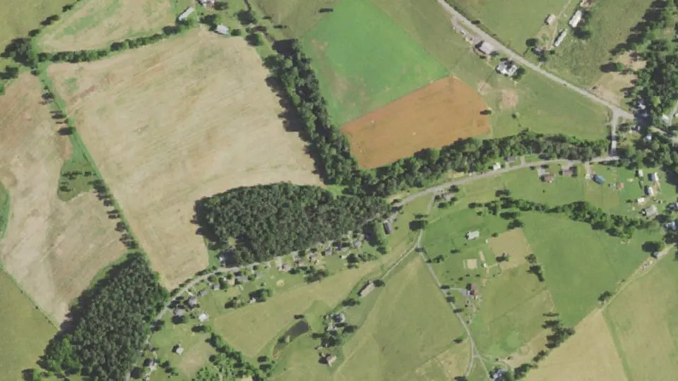
Mount Clifton is an unincorporated community (census-designated place) in Shenandoah County, Virginia, with 110 residents (2020 Census). The nearest town is Hudson Crossroads, 2.3 miles N.
- 110residents (2020 Census)
- 0.4 sq miland area · 1.2 km²
- 246 / sq mipopulation density
- 22842ZIP code
About Mount Clifton
Mount Clifton is a census-designated place in Shenandoah County, in the U.S. state of Virginia. As of the 2020 decennial census the village was noted as having 110 residents with 6 being Native American or Alaska Native, 1 being Asian, 0 Black or African American individuals, 7 of Hispanic or Latino descent, 0 Native Hawaiian and Pacific Islanders, 4 of Some Other Race, 8 of Two or More Races, and 91 White. It was also noted as having 54 housing units, 3 of which are noted as being vacant.
Mt. Clifton most likely got its name from its imposing position overlooking Mill Creek. It was founded sometime in the middle of the 19th century by George Hammon and his sons. They built and operated a store, flour mill, saw mill, and blacksmith shop in the area.
Soon after the Hammon’s arrival the Howard’s Lick Turnpike, the major road from Mt. Jackson to Orkney Springs and West Virginia, opened. A toll house was constructed in Mt. Clifton and the community became a rest stop for the many visitors traveling to resorts in Orkney Springs or West Virginia.
Like in other small communities in the area, commercial, social, educational, and spiritual institutions emerged. These include:
The Mt. Clifton Methodist Church, constructed in 1884.
The Mt. Clifton Store, constructed around 1900.
The Mt. Clifton School, the first of which opened in 1852.
The Mt. Clifton Odd-Fellows, organized in the early 19th century.
The Mt. Clifton Mill, which first began operating in 1813.
The Mt. Clifton Post Office, which opened in 1850 and was located in the local store.
Today, the commercial activities of the community have ceased long ago. The Mt. Clifton Post Office ceased operations in 1900. Both the mill and school shut down in the mid-1940s, followed by the closure of the last remaining store a few decades later.
The church closed in 2020 and most of the structures that once surrounded it are abandoned or demolished.
Text: Wikipedia · CC BY-SA 4.0
Mount Clifton weather: 7-day forecast
Loading the National Weather Service forecast…
Source: National Weather Service (NOAA).
Live webcams in Mount Clifton
Webcams: Windy.com
Do you know Mount Clifton? Tell us about it
Help other travelers: share what makes Mount Clifton special. We review every message before publishing it.
Map of Mount Clifton
Tap any street on the map to see it in Street View below. Map: © OpenStreetMap contributors.
Mount Clifton Street View
Drag the image to look around and tap the arrows on the ground to move. If it says there is no imagery, tap a nearby street on the map above.
Open in Google Maps ›Mount Clifton, VA population
Mount Clifton had 110 residents in the 2020 Census.
| 2020 Census | 110 |
|---|---|
| Density | 246 per sq mi (95 per km²) |
Source: U.S. Census Bureau, Decennial Census.
Mount Clifton at a glance
| State | Virginia (VA) |
|---|---|
| County | Shenandoah County |
| Type | Census-designated place |
| Population | 110 (2020) |
| Land area | 0.45 sq mi (1.2 km²) |
| Water area | 0.00 sq mi (0.00 km²) |
| Coordinates | 38.7609° N, 78.7215° W |
| ZIP code | 22842 |
| Census code (GEOID) | 5153832 |
Sources: U.S. Census Bureau (Gazetteer, ZCTA), USGS GNIS, Wikidata.
Towns near Mount Clifton
- Hudson Crossroads2.3 mi N
- Forestville3.2 mi S
- Mount Jackson4.1 mi E
- Basye4.2 mi NW
- Conicville5.2 mi NE
- Quicksburg5.3 mi SE
- Orkney Springs5.6 mi NW
- Bowmans Crossing7.6 mi E
- New Market8.4 mi S
- Timberville9.3 mi S
- Edinburg9.6 mi NE
- Columbia Furnace9.7 mi NE
Straight-line distance between town centers.
Frequently asked questions about Mount Clifton
What county is Mount Clifton in?
Mount Clifton is in Shenandoah County, Virginia.
What is the population of Mount Clifton, VA?
110 people lived in Mount Clifton at the 2020 Census.
What is the ZIP code of Mount Clifton, VA?
The ZIP code of Mount Clifton is 22842.
What towns are near Mount Clifton?
Hudson Crossroads (2.3 mi), Forestville (3.2 mi), Mount Jackson (4.1 mi), Basye (4.2 mi), Conicville (5.2 mi).
Last updated: