Bluff Dale
Census-designated place in Erath County, Texas
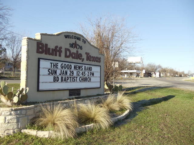
Bluff Dale is an unincorporated community (census-designated place) in Erath County, Texas, with 151 residents (2020 Census). It sits at 912 ft (278 m) above sea level. The nearest town is Tolar, 6.7 miles NE.
- 151residents (2020 Census)
- 912 ftelevation · 278 m
- 0.3 sq miland area · 0.8 km²
- 480 / sq mipopulation density
- 76433ZIP code
About Bluff Dale
Bluff Dale is an unincorporated community and census designated place (CDP) in Erath County, Texas, United States.
As of the 2020 census, Bluff Dale had a population of 151.
The Bluff Dale Independent School District serves area students.
Bluff Dale, Texas is on U.S. Highway 377 and the North Paluxy River in northeastern Erath County. It was originally called Bluff Springs by pioneers who settled nearby; Bluff Dale became the town name when the post office was established in 1877. In 1889, when the Fort Worth and Rio Grande Railway was built, Jack Glenn donated land for the development of a town. The town was incorporated in 1908. By 1915, a bank and newspaper had been developed. In 1936, Bluff Dale had 680 residents, 500 in 1940, 123 in 1980, and 300 in 1989. In 1989, the town had a Garden Club, three churches, a volunteer fire department, five historical markers, and a beautification committee. A gas station–convenience store was built circa 2002. Around 2005, a bank was opened up.
Text: Wikipedia · CC BY-SA 4.0
Bluff Dale weather: 7-day forecast
Loading the National Weather Service forecast…
Source: National Weather Service (NOAA).
Live webcams in Bluff Dale
Webcams: Windy.com
Living in Bluff Dale
- Median home value
- $562,500
- Median age
- 55.4
Do you know Bluff Dale? Tell us about it
Help other travelers: share what makes Bluff Dale special. We review every message before publishing it.
Map of Bluff Dale
Tap any street on the map to see it in Street View below. Map: © OpenStreetMap contributors.
Bluff Dale Street View
Drag the image to look around and tap the arrows on the ground to move. If it says there is no imagery, tap a nearby street on the map above.
Open in Google Maps ›Bluff Dale, TX population
Bluff Dale had 151 residents in the 2020 Census.
| 2020 Census | 151 |
|---|---|
| Density | 480 per sq mi (185 per km²) |
Source: U.S. Census Bureau, Decennial Census.
Bluff Dale at a glance
| State | Texas (TX) |
|---|---|
| County | Erath County |
| Type | Census-designated place |
| Population | 151 (2020) |
| Land area | 0.31 sq mi (0.8 km²) |
| Elevation | 912 ft (278 m) |
| Coordinates | 32.3497° N, 98.0249° W |
| ZIP code | 76433 |
| Census code (GEOID) | 4808932 |
Sources: U.S. Census Bureau (Gazetteer, ZCTA), USGS GNIS, Wikidata.
Towns near Bluff Dale
- Tolar6.7 mi NE
- Lipan11.7 mi N
- Stephenville14.7 mi SW
- Oak Trail Shores14.8 mi NE
- Huckabay15.6 mi W
- Granbury16.4 mi NE
- Canyon Creek16.9 mi E
- Stockton Bend17.6 mi NE
- Glen Rose17.7 mi SE
- Horseshoe Bend17.8 mi NE
- Dennis18.6 mi N
- DeCordova20.1 mi E
Straight-line distance between town centers.
Frequently asked questions about Bluff Dale
What county is Bluff Dale in?
Bluff Dale is in Erath County, Texas.
What is the population of Bluff Dale, TX?
151 people lived in Bluff Dale at the 2020 Census.
What is the ZIP code of Bluff Dale, TX?
The ZIP code of Bluff Dale is 76433.
What is the elevation of Bluff Dale?
912 feet (278 m) above sea level.
What towns are near Bluff Dale?
Tolar (6.7 mi), Lipan (11.7 mi), Stephenville (14.7 mi), Oak Trail Shores (14.8 mi), Huckabay (15.6 mi).
Last updated: