Manderson-White Horse Creek
Census-designated place in Oglala Lakota County, South Dakota
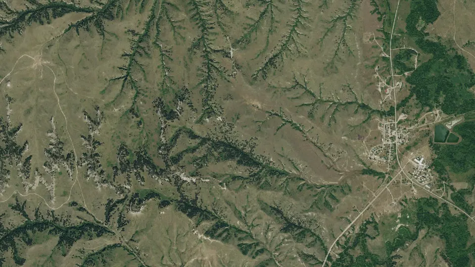
Manderson-White Horse Creek is an unincorporated community (census-designated place) in Oglala Lakota County, South Dakota, with 554 residents (2020 Census). It sits at 3,268 ft (996 m) above sea level. The nearest town is Porcupine, 8.2 miles E.
- 554residents (2020 Census)
- 3,268 ftelevation · 996 m
- 5.7 sq miland area · 14.8 km²
- 97 / sq mipopulation density
- 57756ZIP code
About Manderson-White Horse Creek
Manderson-White Horse Creek or Oyúȟpe (Lakota: Oyúȟpe; the name of a band of the Oglala) is a census-designated place in East Oglala Lakota Unorganized Territory, South Dakota (civil township equivalent) in Oglala Lakota County, South Dakota, United States. The population was 554 at the 2020 census.
Oglala Lakota tribesman, Kicking Bear died here on May 28, 1904. He fought in several battles during the Black Hills War, including Battle of the Greasy Grass. His nephew, Felix Flying Hawk owned a ranch.
According to the Federal Writers' Project, the origin of the name Manderson is obscure.
Text: Wikipedia · CC BY-SA 4.0
Manderson-White Horse Creek weather: 7-day forecast
Loading the National Weather Service forecast…
Source: National Weather Service (NOAA).
Live webcams in Manderson-White Horse Creek
Webcams: Windy.com
Things to do in Manderson-White Horse Creek
Top places to visit in and around Manderson-White Horse Creek: Badlands National Park, Wounded Knee National Historic Landmark and Buffalo Gap National Grassland.
 Badlands National ParkNational park · 36 mi N
 Wounded Knee National Historic LandmarkArchaeological site · 9.0 mi SE
 Buffalo Gap National GrasslandNational forest · 27 mi NWPorcupine ButtePeak · 9.3 mi SE
Historic sites & landmarks (3)Parks & gardens (1)Scenic viewpoints & peaks (3)Nature reserves & natural wonders (1)Theaters & public art (1)
All 9 things to do in Manderson-White Horse Creek ›Schools near Manderson-White Horse Creek
There are no public schools inside Manderson-White Horse Creek. The nearest elementary school is Wolf Creek School - 02 (13 mi S); the nearest high school is Lakota Tech High School - 10 (13 mi S).
| School | Grades | Students | Students per teacher | Type | Distance |
|---|---|---|---|---|---|
| Wolf Creek School - 02 Pine Ridge · Oglala Lakota County School District 65-1 | PK–8 | 567 | 12.3 | Public | 13 mi S |
| Lakota Tech High School - 10 Batesland · Oglala Lakota County School District 65-1 | 9–12 | 414 | 11.5 | Public | 13 mi S |
Do you know Manderson-White Horse Creek? Tell us about it
Help other travelers: share what makes Manderson-White Horse Creek special. We review every message before publishing it.
Map of Manderson-White Horse Creek
Tap any street on the map to see it in Street View below. Map: © OpenStreetMap contributors.
Manderson-White Horse Creek Street View
Drag the image to look around and tap the arrows on the ground to move. If it says there is no imagery, tap a nearby street on the map above.
Open in Google Maps ›Manderson-White Horse Creek, SD population
Manderson-White Horse Creek had 554 residents in the 2020 Census.
| 2020 Census | 554 |
|---|---|
| Density | 97 per sq mi (37 per km²) |
Source: U.S. Census Bureau, Decennial Census.
Manderson-White Horse Creek at a glance
| State | South Dakota (SD) |
|---|---|
| County | Oglala Lakota County |
| Type | Census-designated place |
| Population | 554 (2020) |
| Land area | 5.73 sq mi (14.8 km²) |
| Elevation | 3,268 ft (996 m) |
| Coordinates | 43.2350° N, 102.4915° W |
| ZIP code | 57756 |
| Census code (GEOID) | 4640550 |
Sources: U.S. Census Bureau (Gazetteer, ZCTA), USGS GNIS, Wikidata.
Towns near Manderson-White Horse Creek
- Porcupine8.2 mi E
- Wounded Knee8.9 mi SE
- Oglala11.4 mi W
- Pine Ridge14.7 mi S
- White Clay, NE16.8 mi S
- Kyle20.4 mi NE
- Batesland21.0 mi E
- Allen28.6 mi E
- Gordon, NE33.0 mi SE
- Clinton, NE33.6 mi S
- Rushville, NE36.1 mi S
- Martin38.5 mi E
Straight-line distance between town centers.
Frequently asked questions about Manderson-White Horse Creek
What county is Manderson-White Horse Creek in?
Manderson-White Horse Creek is in Oglala Lakota County, South Dakota.
What is the population of Manderson-White Horse Creek, SD?
554 people lived in Manderson-White Horse Creek at the 2020 Census.
What is the ZIP code of Manderson-White Horse Creek, SD?
The ZIP code of Manderson-White Horse Creek is 57756.
What is the elevation of Manderson-White Horse Creek?
3,268 feet (996 m) above sea level.
What towns are near Manderson-White Horse Creek?
Porcupine (8.2 mi), Wounded Knee (8.9 mi), Oglala (11.4 mi), Pine Ridge (14.7 mi), White Clay (16.8 mi).
Last updated: