Johnson Siding
Census-designated place in Pennington County, South Dakota
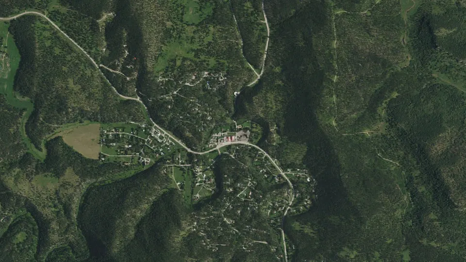
Johnson Siding is an unincorporated community (census-designated place) in Pennington County, South Dakota, with 614 residents (2020 Census). The nearest town is Blackhawk, 6.9 miles NE.
- 614residents (2020 Census)
- 3.7 sq miland area · 9.7 km²
- 164 / sq mipopulation density
- 57702ZIP code
About Johnson Siding
Johnson Siding is a census-designated place in Pennington County, South Dakota, United States. The population as of the 2020 census was 614. It is an unincorporated community, and it is located in the Rimrock Area, approximately 10 miles west of Rapid City. Johnson Siding is surrounded by the Black Hills National Forest. It is the only significant business district in the Rimrock Area, with a general store, deli, casino, tavern, the Johnson Siding Volunteer Fire Department firehouse, the Rimrock Evangelical Free Church meetinghouse, and a community center. However, most inhabitants work in Rapid City or Deadwood.
Johnson Siding is named for a siding on the old Rapid City, Black Hills and Western Railroad (the Crouch Line) which ran up Rapid Creek between Rapid City and the Black Hills Highline at Mystic, which was originally constructed to serve the Johnson Sawmill, located a short distance upstream from the existing town.
Johnson Siding is located on South Dakota Highway 44 at the intersection of Norris Peak Road, a paved county road, which connects the Rapid Creek valley with the Box Elder Creek valley, and Nemo Road to the north.
Johnson Siding was the site of the political convention which first organized the South Dakota Libertarian Party in 1992, at which Costas "Gus" Hercules was nominated to the U.S. Senate. Johnson's Mill was also the head of the Hisega Flume, a wooden waterway constructed high on the south cliffs of the Rapid Creek canyon to supply a small hydroelectric plant at Big Bend near present-day Thunderhead Falls in the early 1900s, one of several National Engineering Landmarks in the Black Hills. This small Dakota Power plant delivered electricity to Rapid City until the community's needs out-grew the plant's capacity. It was shut down in the late 1930s. Dakota Power became a part of Black Hills Power and Light, eventually becoming Black Hills Corporation. A few remnants of the flume are still visible high on the south side of the canyon at the big curve of SD Highway 44 before one gets to Johnson Siding.
Text: Wikipedia · CC BY-SA 4.0
Johnson Siding weather: 7-day forecast
Loading the National Weather Service forecast…
Source: National Weather Service (NOAA).
Live webcams in Johnson Siding
Webcams: Windy.com
Living in Johnson Siding
- Median household income
- $102,716
- Median home value
- $471,700
- Median age
- 52.7
Do you know Johnson Siding? Tell us about it
Help other travelers: share what makes Johnson Siding special. We review every message before publishing it.
Map of Johnson Siding
Tap any street on the map to see it in Street View below. Map: © OpenStreetMap contributors.
Johnson Siding Street View
Drag the image to look around and tap the arrows on the ground to move. If it says there is no imagery, tap a nearby street on the map above.
Open in Google Maps ›Johnson Siding, SD population
Johnson Siding had 614 residents in the 2020 Census.
| 2020 Census | 614 |
|---|---|
| Density | 164 per sq mi (63 per km²) |
Source: U.S. Census Bureau, Decennial Census.
Johnson Siding at a glance
| State | South Dakota (SD) |
|---|---|
| County | Pennington County |
| Type | Census-designated place |
| Population | 614 (2020) |
| Land area | 3.73 sq mi (9.7 km²) |
| Coordinates | 44.0846° N, 103.4380° W |
| ZIP code | 57702 |
| Census code (GEOID) | 4632820 |
Sources: U.S. Census Bureau (Gazetteer, ZCTA), USGS GNIS, Wikidata.
Towns near Johnson Siding
- Blackhawk6.9 mi NE
- Colonial Pine Hills7.8 mi SE
- Summerset8.9 mi NE
- Wonderland Homes9.5 mi NE
- Piedmont9.8 mi N
- Rapid City11.0 mi E
- Hill City12.4 mi SW
- Keystone13.1 mi S
- Rapid Valley15.7 mi E
- Ashland Heights16.0 mi E
- Green Valley16.5 mi E
- Box Elder17.8 mi E
Straight-line distance between town centers.
Frequently asked questions about Johnson Siding
What county is Johnson Siding in?
Johnson Siding is in Pennington County, South Dakota.
What is the population of Johnson Siding, SD?
614 people lived in Johnson Siding at the 2020 Census.
What is the ZIP code of Johnson Siding, SD?
The ZIP code of Johnson Siding is 57702.
What towns are near Johnson Siding?
Blackhawk (6.9 mi), Colonial Pine Hills (7.8 mi), Summerset (8.9 mi), Wonderland Homes (9.5 mi), Piedmont (9.8 mi).
Last updated: