Santee
Town in Orangeburg County, South Carolina
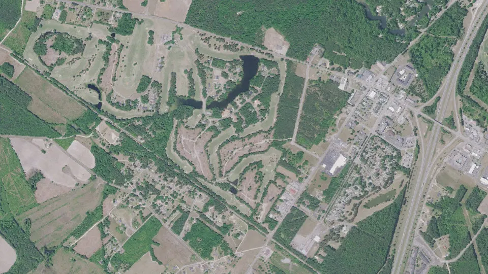
Santee is a town in Orangeburg County, South Carolina, with 797 residents (2020 Census). It sits at 135 ft (41 m) above sea level. The nearest town is Vance, 5.0 miles SE.
- 797residents (2020 Census)
- 135 ftelevation · 41 m
- 2.4 sq miland area · 6.2 km²
- 335 / sq mipopulation density
- 29142ZIP code
About Santee
Santee is a town in Orangeburg County along the Santee River Valley in central South Carolina, United States. It has become a resort town of note located centrally north-south along the Atlantic Seaboard of South Carolina. The region has been rural, with a primarily agricultural economy typical of Orangeburg County, but is now known primarily for its several golf courses in proximity to Lake Marion, Santee State Park and other Lake Marion attractions. Interstate 95 connects its attractions easily with tourists traveling by automobile. I-95 crosses a narrow arm of the lake into the town lands, along a causeway. Lake Marion is a man-made hydroelectric reservoir, which at 110,000 acres (450 km2, 173 sq mi) is one of the fifty largest lakes in the country.
The population was 797 at the 2020 census. The town has been undergoing economic and population growth, and development as rural niches are supplanted by bedroom communities.
Construction of the Santee Cooper Regional Water System can provide millions of gallons of potable water per day to the surrounding five counties centered about Santee. The system was coordinated by the U.S. Department of Agriculture and funded by the Army Corps of Engineers, USEPA, and the South Carolina Department of Commerce. The plant was completed and operational as of June 1, 2008. Work to connect the plant to the five counties (Berkeley, Orangeburg, Dorchester, Calhoun, and Sumter) is underway and being overseen and funded by the same parties. Currently, the RWS serves the town of Santee, with pipeline rapidly being installed to other locations. Incoming businesses from this project are projected to bring thousands of jobs to the area.
The Lake Marion High School & Technology Center is located in the town.
Text: Wikipedia · CC BY-SA 4.0
Santee weather: 7-day forecast
Loading the National Weather Service forecast…
Source: National Weather Service (NOAA).
Live webcams in Santee
Webcams: Windy.com
Living in Santee
- Median household income
- $46,667
- Median home value
- $161,800
- Median rent
- $911/mo
- Median age
- 47.4
Do you know Santee? Tell us about it
Help other travelers: share what makes Santee special. We review every message before publishing it.
Map of Santee
Tap any street on the map to see it in Street View below. Map: © OpenStreetMap contributors.
Santee Street View
Drag the image to look around and tap the arrows on the ground to move. If it says there is no imagery, tap a nearby street on the map above.
Open in Google Maps ›Santee, SC population
Santee had 797 residents in the 2020 Census.
| 2020 Census | 797 |
|---|---|
| Density | 335 per sq mi (129 per km²) |
Source: U.S. Census Bureau, Decennial Census.
Santee at a glance
| State | South Carolina (SC) |
|---|---|
| County | Orangeburg County |
| Type | Town |
| Population | 797 (2020) |
| Land area | 2.38 sq mi (6.2 km²) |
| Water area | 0.02 sq mi (0.05 km²) |
| Elevation | 135 ft (41 m) |
| Coordinates | 33.4847° N, 80.4851° W |
| ZIP code | 29142 |
| Census code (GEOID) | 4563790 |
Sources: U.S. Census Bureau (Gazetteer, ZCTA), USGS GNIS, Wikidata.
Towns near Santee
- Vance5.0 mi SE
- North Santee5.7 mi NE
- Elloree5.8 mi NW
- Eutawville10.2 mi SE
- Summerton11.2 mi NE
- Holly Hill11.6 mi S
- Cameron14.2 mi W
- Bowman14.9 mi SW
- Wyboo16.5 mi E
- Pinewood17.7 mi N
- Paxville19.0 mi N
- Harleyville19.1 mi S
Straight-line distance between town centers.
Frequently asked questions about Santee
What county is Santee in?
Santee is in Orangeburg County, South Carolina.
What is the population of Santee, SC?
797 people lived in Santee at the 2020 Census.
What is the ZIP code of Santee, SC?
The ZIP code of Santee is 29142.
What is the elevation of Santee?
135 feet (41 m) above sea level.
What towns are near Santee?
Vance (5.0 mi), North Santee (5.7 mi), Elloree (5.8 mi), Eutawville (10.2 mi), Summerton (11.2 mi).
Last updated: