Woxall
Census-designated place in Montgomery County, Pennsylvania
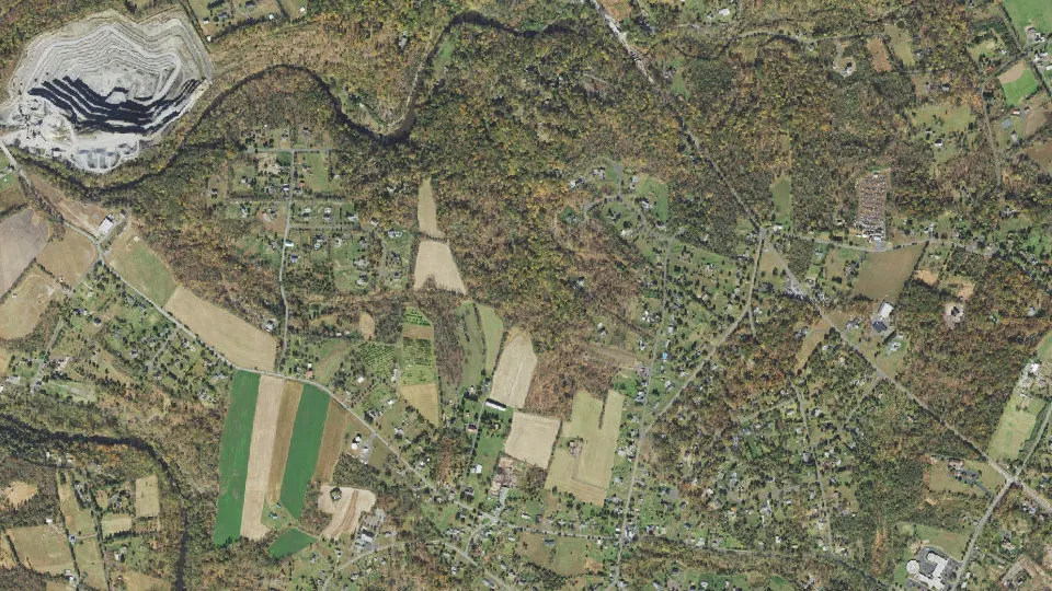
Woxall is an unincorporated community (census-designated place) in Montgomery County, Pennsylvania, with 1,297 residents (2020 Census). It sits at 420 ft (128 m) above sea level. The nearest town is Upper Salford, 1.6 miles S.
- 1,297residents (2020 Census)
- 420 ftelevation · 128 m
- 2.6 sq miland area · 6.7 km²
- 499 / sq mipopulation density
- 18054ZIP code
About Woxall
Woxall or sometimes Woxhall is a census-designated place (CDP) in Montgomery County, Pennsylvania, United States. As of 2020 the majority of the CDP is in the Upper Salford Township, while a small portion is in Marlborough Township.
It is located on the eastern side of the Perkiomen Creek, which flows south into the Schuylkill River. The population was 1,318 at the 2010 census. The CDP is served by the Harleysville post office, with the zip code of 19438.
The village of Woxall was originally known as Kroppestettel, which in Pennsylvania Dutch means Crowtown. The village was later named Mechanicsville. By the end of the eighteenth century, the town contained a hotel and restaurant, town hall, shoe shop, wheelwright, and 12 homes. The village kept the name Mechanicsville until 1888, when a post office was established. A new name needed to be selected for the post office because another Pennsylvania town had the same name. After much discussion, residents submitted the name Noxall, "Knocks All" to postal authorities. The name had been read on the side of a bar of a box of soap in the village store. Evidently, they misread the "N" for a "W" and approved the name Woxall for the post office.
The Village of Woxall grew up near the Old Goshenhoppen Church, erected in 1744, where Lutheran and Reformed congregations met. With the arrival of the railroad in 1868, Salfordville, which prospered without railroad or trolley, grew around an old inn. By 1877, it contained a post office, general store, cigar factory, and 19 homes.
Other villages include Bergey, known in 1893 as Branchville, and Salford, called Rudy in the early 1900s. These two villages, along with Woxall and Salfordville, were noted for their general stores that sold a variety of items including fine clocks, furniture, barrel molasses, and quilting thread.
Woxall can be classified as a rural area, featuring agriculture fields, woods, and some housing developments which have been built since 2002.
The U.S. Census Bureau began defining the CDP for the 2010 U.S. census. At that time, the bureau only defined Woxall CDP as being in Upper Salford Township. The bureau changed the CDP boundary for the 2020 U.S. census.
Text: Wikipedia · CC BY-SA 4.0
Woxall weather: 7-day forecast
Loading the National Weather Service forecast…
Source: National Weather Service (NOAA).
Live webcams in Woxall
Webcams: Windy.com
Living in Woxall
- Median household income
- $137,250
- Median home value
- $456,800
- Median rent
- $1,148/mo
- Median age
- 46.6
Do you know Woxall? Tell us about it
Help other travelers: share what makes Woxall special. We review every message before publishing it.
Map of Woxall
Tap any street on the map to see it in Street View below. Map: © OpenStreetMap contributors.
Woxall Street View
Drag the image to look around and tap the arrows on the ground to move. If it says there is no imagery, tap a nearby street on the map above.
Open in Google Maps ›Woxall, PA population
Woxall had 1,297 residents in the 2020 Census.
| 2020 Census | 1,297 |
|---|---|
| Density | 499 per sq mi (193 per km²) |
Source: U.S. Census Bureau, Decennial Census.
Woxall at a glance
| State | Pennsylvania (PA) |
|---|---|
| County | Montgomery County |
| Type | Census-designated place |
| Population | 1,297 (2020) |
| Land area | 2.60 sq mi (6.7 km²) |
| Water area | 0.01 sq mi (0.04 km²) |
| Elevation | 420 ft (128 m) |
| Coordinates | 40.3183° N, 75.4530° W |
| ZIP code | 18054 |
| Census code (GEOID) | 4286576 |
Sources: U.S. Census Bureau (Gazetteer, ZCTA), USGS GNIS, Wikidata.
Towns near Woxall
- Upper Salford1.6 mi S
- Green Lane1.6 mi NW
- Upper Frederick2.9 mi W
- Marlborough2.9 mi N
- Lower Frederick3.0 mi SW
- Spring Mount3.2 mi S
- Salford3.2 mi NE
- Schwenksville4.2 mi S
- Red Hill4.4 mi N
- Harleysville4.4 mi SE
- Lower Salford4.9 mi SE
- Franconia5.1 mi E
Straight-line distance between town centers.
Frequently asked questions about Woxall
What county is Woxall in?
Woxall is in Montgomery County, Pennsylvania.
What is the population of Woxall, PA?
1,297 people lived in Woxall at the 2020 Census.
What is the ZIP code of Woxall, PA?
The ZIP code of Woxall is 18054.
What is the elevation of Woxall?
420 feet (128 m) above sea level.
What towns are near Woxall?
Upper Salford (1.6 mi), Green Lane (1.6 mi), Upper Frederick (2.9 mi), Marlborough (2.9 mi), Lower Frederick (3.0 mi).
Last updated: