Upper St. Clair
Township in Allegheny County, Pennsylvania
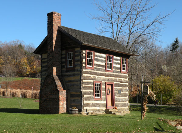
Upper St. Clair is a township in Allegheny County, Pennsylvania, with 21,160 residents (2020 Census). It sits at 1,129 ft (344 m) above sea level. The nearest town is Bridgeville, 2.1 miles NW.
- 21,160residents (2020 Census)
- 1,129 ftelevation · 344 m
- 9.8 sq miland area · 25.4 km²
- 2,156 / sq mipopulation density
- 15241main ZIP code (3 in total)
About Upper St. Clair
Upper St. Clair is a township with home rule status in southern Allegheny County, Pennsylvania, United States, located approximately 11 miles (17.7 km) south of Downtown Pittsburgh, in the South Hills region of Allegheny County. As of the 2020 census, the township population was 21,160.
Around 9% of the township's area is dedicated to 14 parks and multiple fields, totaling approximately 733 acres. The township has six borders with neighboring communities, including South Fayette Township to the west, Bridgeville to the northwest, Scott Township and Mt. Lebanon to the north, Bethel Park to the east, and Peters Township in Washington County to the south.
Text: Wikipedia · CC BY-SA 4.0
Upper St. Clair weather: 7-day forecast
Loading the National Weather Service forecast…
Source: National Weather Service (NOAA).
Live webcams in Upper St. Clair
Webcams: Windy.com
Living in Upper St. Clair
- Median household income
- $163,409
- Median home value
- $431,800
- Median rent
- $2,038/mo
- Median age
- 43.7
Do you know Upper St. Clair? Tell us about it
Help other travelers: share what makes Upper St. Clair special. We review every message before publishing it.
Map of Upper St. Clair
Tap any street on the map to see it in Street View below. Map: © OpenStreetMap contributors.
Upper St. Clair Street View
Drag the image to look around and tap the arrows on the ground to move. If it says there is no imagery, tap a nearby street on the map above.
Open in Google Maps ›Upper St. Clair, PA population
Upper St. Clair had 21,160 residents in the 2020 Census.
| 2020 Census | 21,160 |
|---|---|
| Density | 2,156 per sq mi (832 per km²) |
Source: U.S. Census Bureau, Decennial Census.
Upper St. Clair at a glance
| State | Pennsylvania (PA) |
|---|---|
| County | Allegheny County |
| Type | Township |
| Population | 21,160 (2020) |
| Land area | 9.82 sq mi (25.4 km²) |
| Elevation | 1,129 ft (344 m) |
| Coordinates | 40.3336° N, 80.0842° W |
| ZIP codes | 15241, 15017, 15102 |
| Census code (GEOID) | 4200379274 |
Sources: U.S. Census Bureau (Gazetteer, ZCTA), USGS GNIS, Wikidata.
Towns near Upper St. Clair
- Bridgeville2.1 mi NW
- Bethel Park2.6 mi E
- Lawrence3.0 mi SW
- Mount Lebanon3.5 mi NE
- McMurray3.6 mi S
- Scott3.7 mi N
- Heidelberg4.0 mi N
- Castle Shannon4.1 mi NE
- Peters4.2 mi S
- Thompsonville4.4 mi S
- Glendale4.5 mi N
- Hendersonville4.5 mi SW
Straight-line distance between town centers.
Frequently asked questions about Upper St. Clair
What county is Upper St. Clair in?
Upper St. Clair is in Allegheny County, Pennsylvania.
What is the population of Upper St. Clair, PA?
21,160 people lived in Upper St. Clair at the 2020 Census.
What is the ZIP code of Upper St. Clair, PA?
The main ZIP code is 15241. Other ZIP codes: 15017, 15102.
What is the elevation of Upper St. Clair?
1,129 feet (344 m) above sea level.
What towns are near Upper St. Clair?
Bridgeville (2.1 mi), Bethel Park (2.6 mi), Lawrence (3.0 mi), Mount Lebanon (3.5 mi), McMurray (3.6 mi).
Last updated: