University of Pittsburgh Johnstown
Census-designated place in Cambria County, Pennsylvania
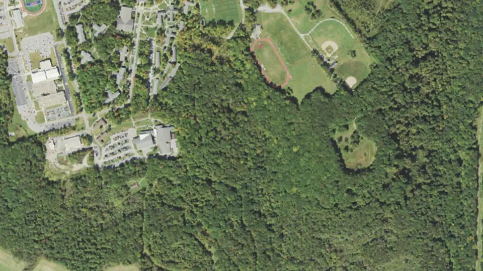
University of Pittsburgh Johnstown is an unincorporated community (census-designated place) in Cambria County, Pennsylvania, with 1,194 residents (2020 Census). The nearest town is Scalp Level, 1.2 miles SW.
- 1,194residents (2020 Census)
- 0.6 sq miland area · 1.5 km²
- 2,043 / sq mipopulation density
- 15934ZIP code
University of Pittsburgh Johnstown weather: 7-day forecast
Loading the National Weather Service forecast…
Source: National Weather Service (NOAA).
Live webcams in University of Pittsburgh Johnstown
Webcams: Windy.com
Things to do in University of Pittsburgh Johnstown
Top places to visit in and around University of Pittsburgh Johnstown: Johnstown Flood Museum, Johnstown Flood National Memorial and Flight 93 National Memorial.
 Johnstown Flood MuseumMuseum · 6.6 mi NW
 Johnstown Flood National MemorialHistoric site · 6.3 mi NE
 Flight 93 National MemorialHistoric site · 15 mi S
 Blue Knob State ParkState park · 13 mi E
Museums & galleries (2)Historic sites & landmarks (10)Parks & gardens (2)Hiking trails (1)Scenic viewpoints & peaks (4)Nature reserves & natural wonders (1)Theaters & public art (1)
All 21 things to do in University of Pittsburgh Johnstown ›Small communities near University of Pittsburgh Johnstown
Schools near University of Pittsburgh Johnstown
There are no public schools inside University of Pittsburgh Johnstown. The nearest elementary school is Richland El Sch (0.9 mi NW); the nearest middle school is Windber Area MS (2.3 mi S); the nearest high school is Richland HS (0.6 mi NW).
| School | Grades | Students | Students per teacher | Type | Distance |
|---|---|---|---|---|---|
| Richland HS Johnstown · Richland SD | 7–12 | 693 | 14.4 | Public | 0.6 mi NW |
| Greater Johnstown Career and Technology Center Johnstown | 9–12 | 14 | 0.6 | Public | 0.7 mi N |
| Richland El Sch Johnstown · Richland SD | K–6 | 831 | 15.7 | Public | 0.9 mi NW |
| Windber Area MS Windber · Windber Area SD | 6–8 | 300 | 17.6 | Public | 2.3 mi S |
| Windber Area HS Windber · Windber Area SD | 9–12 | 337 | 13.0 | Public | 2.3 mi S |
| Windber El Sch Windber · Windber Area SD | PK–5 | 617 | 14.0 | Public | 3.3 mi S |
All schools in and near University of Pittsburgh Johnstown ›
Do you know University of Pittsburgh Johnstown? Tell us about it
Help other travelers: share what makes University of Pittsburgh Johnstown special. We review every message before publishing it.
Map of University of Pittsburgh Johnstown
Tap any street on the map to see it in Street View below. Map: © OpenStreetMap contributors.
University of Pittsburgh Johnstown Street View
Drag the image to look around and tap the arrows on the ground to move. If it says there is no imagery, tap a nearby street on the map above.
Open in Google Maps ›University of Pittsburgh Johnstown, PA population
University of Pittsburgh Johnstown had 1,194 residents in the 2020 Census.
| 2020 Census | 1,194 |
|---|---|
| Density | 2,043 per sq mi (789 per km²) |
Source: U.S. Census Bureau, Decennial Census.
University of Pittsburgh Johnstown at a glance
| State | Pennsylvania (PA) |
|---|---|
| County | Cambria County |
| Type | Census-designated place |
| Population | 1,194 (2020) |
| Land area | 0.58 sq mi (1.5 km²) |
| Coordinates | 40.2626° N, 78.8296° W |
| ZIP code | 15934 |
| Census code (GEOID) | 4278700 |
Sources: U.S. Census Bureau (Gazetteer, ZCTA), USGS GNIS, Wikidata.
Towns near University of Pittsburgh Johnstown
- Scalp Level1.2 mi SW
- Richland1.8 mi NW
- Paint1.8 mi SW
- Windber1.9 mi S
- Geistown3.1 mi NW
- Belmont3.2 mi NW
- Stonycreek4.0 mi NW
- Oakland4.0 mi NW
- Lorain4.2 mi NW
- Salix4.4 mi NE
- Riverside5.1 mi W
- Ferndale5.1 mi W
Straight-line distance between town centers.
Frequently asked questions about University of Pittsburgh Johnstown
What county is University of Pittsburgh Johnstown in?
University of Pittsburgh Johnstown is in Cambria County, Pennsylvania.
What is the population of University of Pittsburgh Johnstown, PA?
1,194 people lived in University of Pittsburgh Johnstown at the 2020 Census.
What is the ZIP code of University of Pittsburgh Johnstown, PA?
The ZIP code of University of Pittsburgh Johnstown is 15934.
What towns are near University of Pittsburgh Johnstown?
Scalp Level (1.2 mi), Richland (1.8 mi), Paint (1.8 mi), Windber (1.9 mi), Geistown (3.1 mi).
Last updated: