Simpson
Census-designated place in Lackawanna County, Pennsylvania
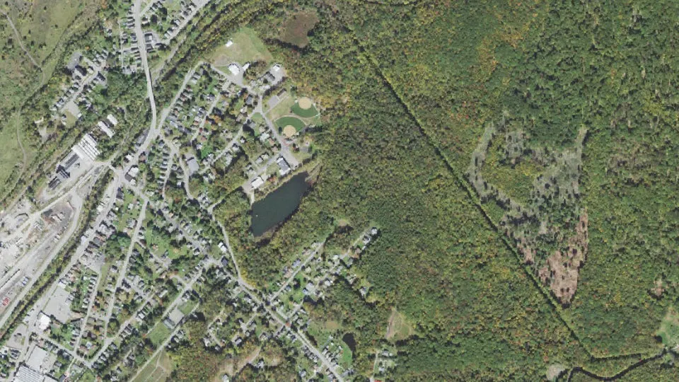
Simpson is an unincorporated community (census-designated place) in Lackawanna County, Pennsylvania, with 1,336 residents (2020 Census). It sits at 1,198 ft (365 m) above sea level. The nearest town is Carbondale, 2.0 miles SW.
- 1,336residents (2020 Census)
- 1,198 ftelevation · 365 m
- 0.9 sq miland area · 2.3 km²
- 1,513 / sq mipopulation density
- 18407ZIP code
About Simpson
Simpson is an unincorporated community and census-designated place in Fell Township, Lackawanna County, Pennsylvania, United States. It is directly north of the city of Carbondale on Pennsylvania Route 171. As of the 2010 census the population of Simpson was 1,275.
Simpson was settled in 1818 and organized in 1845. It is named after Clarence D. Simpson, who was one of the large independent coal magnates in the Northern Anthracite Region. Early industries included trapping, tanning and lumbering. Later, coal mining and railroading became dominant professions. The coal miners were often immigrants from Russia, Poland, and Slovakia. Local businesses of the past include Fell Brewing Co., makers of Pennsylvania Pioneer Beer, Mirtz Premium Ale and Fell Porter. The Klotz Throwing Company and Empire Silk Mill merged to become General Textile Mills or Gentex, another important local business. To these jobs and new quarters, working men brought their families. Many churches and schools were built by these new, proud, industrious Americans. The crowning sports achievement came in 1946 when the Fell High School basketball team won the state championship. The final class graduated from Fell High School in 1975 when a merger formed the Carbondale Area District.
Text: Wikipedia · CC BY-SA 4.0
Simpson weather: 7-day forecast
Loading the National Weather Service forecast…
Source: National Weather Service (NOAA).
Live webcams in Simpson
Webcams: Windy.com
Living in Simpson
- Median household income
- $52,875
- Median home value
- $158,000
- Median rent
- $1,002/mo
- Median age
- 42.3
Do you know Simpson? Tell us about it
Help other travelers: share what makes Simpson special. We review every message before publishing it.
Map of Simpson
Tap any street on the map to see it in Street View below. Map: © OpenStreetMap contributors.
Simpson Street View
Drag the image to look around and tap the arrows on the ground to move. If it says there is no imagery, tap a nearby street on the map above.
Open in Google Maps ›Simpson, PA population
Simpson had 1,336 residents in the 2020 Census.
| 2020 Census | 1,336 |
|---|---|
| Density | 1,513 per sq mi (584 per km²) |
Source: U.S. Census Bureau, Decennial Census.
Simpson at a glance
| State | Pennsylvania (PA) |
|---|---|
| County | Lackawanna County |
| Type | Census-designated place |
| Population | 1,336 (2020) |
| Land area | 0.88 sq mi (2.3 km²) |
| Water area | 0.01 sq mi (0.02 km²) |
| Elevation | 1,198 ft (365 m) |
| Coordinates | 41.5916° N, 75.4776° W |
| ZIP code | 18407 |
| Census code (GEOID) | 4270840 |
Sources: U.S. Census Bureau (Gazetteer, ZCTA), USGS GNIS, Wikidata.
Towns near Simpson
- Carbondale2.0 mi SW
- Fell2.0 mi NW
- Vandling2.5 mi N
- Waymart3.8 mi E
- Forest City4.2 mi N
- Browndale4.5 mi N
- Mayfield4.5 mi SW
- Canaan5.0 mi E
- Clinton5.2 mi NE
- Jermyn5.7 mi SW
- Greenfield6.2 mi W
- South Canaan6.7 mi SE
Straight-line distance between town centers.
Frequently asked questions about Simpson
What county is Simpson in?
Simpson is in Lackawanna County, Pennsylvania.
What is the population of Simpson, PA?
1,336 people lived in Simpson at the 2020 Census.
What is the ZIP code of Simpson, PA?
The ZIP code of Simpson is 18407.
What is the elevation of Simpson?
1,198 feet (365 m) above sea level.
What towns are near Simpson?
Carbondale (2.0 mi), Fell (2.0 mi), Vandling (2.5 mi), Waymart (3.8 mi), Forest City (4.2 mi).
Last updated: