Mertztown
Census-designated place in Berks County, Pennsylvania
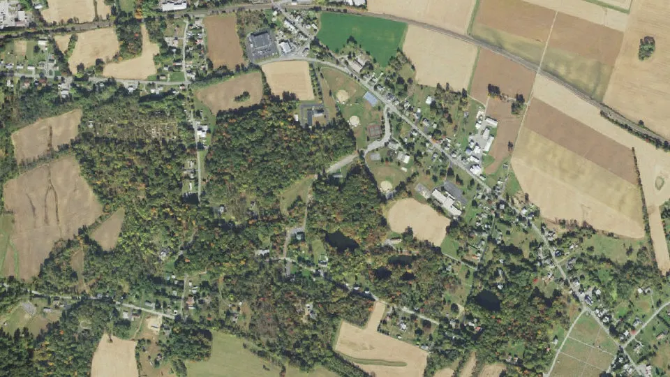
Mertztown is an unincorporated community (census-designated place) in Berks County, Pennsylvania, with 600 residents (2020 Census). It sits at 466 ft (142 m) above sea level. The nearest town is Longswamp, 0.7 miles S.
- 600residents (2020 Census)
- 466 ftelevation · 142 m
- 1.1 sq miland area · 2.7 km²
- 570 / sq mipopulation density
- 19539ZIP code
About Mertztown
Mertztown (Pennsylvania German: Mertzeschteddel) is a census-designated place in Longswamp Township in Berks County, Pennsylvania. It is located near the borough of Topton. As of the 2010 census, the population was 664 residents.
Mertztown is located in Berks County at latitude 40.506 and longitude -75.665. Its elevation is 466 feet. It appears on the United States Geological Survey map for Topton and is in the Eastern Time Zone (UTC-5).
The Reading Railroad which ran through Mertztown, was later acquired by Norfolk Southern as the Reading Line, and remains a heavily used railroad branch. A branch of the Catasauqua and Fogelsville Railroad once passed through the Farmington and Klines Corner section in Mertztown, but the tracks were later removed.
Mertztown was founded in 1823 by Robert Mertz. The population density is .01% Black, .01% Hispanic or other, and 99.8% white. Atlas Minerals, a major mineral company, is located in Mertztown. The company, which moved to Mertztown in 1917, has been based there ever since.
Mertztown is served by Brandywine Heights Area School District, which is based in Mertztown. Gateway Christian School is also located in Mertztown. The area code is 610. The Toad Creek runs east through the village from Topton into the Little Lehigh Creek.
Text: Wikipedia · CC BY-SA 4.0
Mertztown weather: 7-day forecast
Loading the National Weather Service forecast…
Source: National Weather Service (NOAA).
Live webcams in Mertztown
Webcams: Windy.com
Living in Mertztown
- Median household income
- $65,227
- Median home value
- $175,000
- Median age
- 51.9
Do you know Mertztown? Tell us about it
Help other travelers: share what makes Mertztown special. We review every message before publishing it.
Map of Mertztown
Tap any street on the map to see it in Street View below. Map: © OpenStreetMap contributors.
Mertztown Street View
Drag the image to look around and tap the arrows on the ground to move. If it says there is no imagery, tap a nearby street on the map above.
Open in Google Maps ›Mertztown, PA population
Mertztown had 600 residents in the 2020 Census.
| 2020 Census | 600 |
|---|---|
| Density | 570 per sq mi (220 per km²) |
Source: U.S. Census Bureau, Decennial Census.
Mertztown at a glance
| State | Pennsylvania (PA) |
|---|---|
| County | Berks County |
| Type | Census-designated place |
| Population | 600 (2020) |
| Land area | 1.05 sq mi (2.7 km²) |
| Water area | 0.00 sq mi (0.01 km²) |
| Elevation | 466 ft (142 m) |
| Coordinates | 40.5017° N, 75.6646° W |
| ZIP code | 19539 |
| Census code (GEOID) | 4248824 |
Sources: U.S. Census Bureau (Gazetteer, ZCTA), USGS GNIS, Wikidata.
Towns near Mertztown
- Longswamp0.7 mi S
- Topton2.0 mi W
- Breinigsville3.0 mi NE
- Alburtis3.4 mi E
- Bowers4.3 mi W
- Maxatawny4.5 mi W
- District4.7 mi S
- Ancient Oaks4.8 mi NE
- Upper Macungie5.1 mi NE
- Lyons5.2 mi W
- Trexlertown5.3 mi NE
- Dryville5.5 mi SW
Straight-line distance between town centers.
Frequently asked questions about Mertztown
What county is Mertztown in?
Mertztown is in Berks County, Pennsylvania.
What is the population of Mertztown, PA?
600 people lived in Mertztown at the 2020 Census.
What is the ZIP code of Mertztown, PA?
The ZIP code of Mertztown is 19539.
What is the elevation of Mertztown?
466 feet (142 m) above sea level.
What towns are near Mertztown?
Longswamp (0.7 mi), Topton (2.0 mi), Breinigsville (3.0 mi), Alburtis (3.4 mi), Bowers (4.3 mi).
Last updated: