Choctaw
City in Oklahoma County, Oklahoma
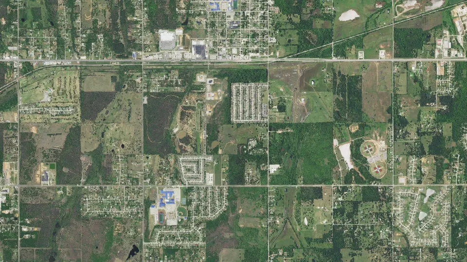
Choctaw is a city in Oklahoma County, Oklahoma, with 12,182 residents (2020 Census). It sits at 1,148 ft (350 m) above sea level. The nearest town is Nicoma Park, 3.1 miles W.
- 12,182residents (2020 Census)
- 1,148 ftelevation · 350 m
- 27.2 sq miland area · 70.5 km²
- 448 / sq mipopulation density
- 73020main ZIP code (2 in total)
About Choctaw
Choctaw is a city in Oklahoma County, Oklahoma, United States, with a population of 12,182 at the 2020 census, a 9.3% increase from 2010. It is the oldest chartered town in Oklahoma Territory. The city is located approximately 10 miles (16.1 km) east of Oklahoma City and is part of the Oklahoma City metropolitan area.
Choctaw became a community in 1890, but was not given actual status as a town until 1893 when a territorial governor was appointed for Oklahoma. It officially celebrated its 100th anniversary in 1993.
In 1950, Choctaw was in an agricultural area. It had a population of 355 in that year. Despite its name, the town has no cultural, historical or governmental ties to the Choctaw Nation of Oklahoma. The tribal headquarters and casino are located in the southeastern part of the state in Durant, Oklahoma, and the Choctaw Capitol Building and annual Labor Day Festival are in Tuskahoma, Oklahoma.
Before Choctaw was chartered, the area included a part of William McClure's 7C Ranch and was known for a trading post and a camping spot near a spring.
A community emerged on the east 80 acres (32 ha) of land John S. Muzzy claimed in the 1889 land run and received a postal designation in early 1890.
The town incorporated in April 1904. When Oklahoma became a state in 1907, the town had 230 residents, four churches, a school, a bank, a newspaper and telephone service. By 1909, the town had three gins. The population grew very little during the Great Depression.
Text: Wikipedia · CC BY-SA 4.0
Choctaw weather: 7-day forecast
Loading the National Weather Service forecast…
Source: National Weather Service (NOAA).
Live webcams in Choctaw
Webcams: Windy.com
Living in Choctaw
- Median household income
- $100,574
- Median home value
- $242,100
- Median rent
- $1,208/mo
- Median age
- 38.9
Do you know Choctaw? Tell us about it
Help other travelers: share what makes Choctaw special. We review every message before publishing it.
Map of Choctaw
Tap any street on the map to see it in Street View below. Map: © OpenStreetMap contributors.
Choctaw Street View
Drag the image to look around and tap the arrows on the ground to move. If it says there is no imagery, tap a nearby street on the map above.
Open in Google Maps ›Choctaw, OK population
Choctaw had 12,182 residents in the 2020 Census.
| 2020 Census | 12,182 |
|---|---|
| Density | 448 per sq mi (173 per km²) |
Source: U.S. Census Bureau, Decennial Census.
Choctaw at a glance
| State | Oklahoma (OK) |
|---|---|
| County | Oklahoma County |
| Type | City |
| Population | 12,182 (2020) |
| Land area | 27.22 sq mi (70.5 km²) |
| Water area | 0.04 sq mi (0.09 km²) |
| Elevation | 1,148 ft (350 m) |
| Coordinates | 35.4850° N, 97.2699° W |
| ZIP codes | 73020, 73066 |
| Official website | choctawcity.org |
| Census code (GEOID) | 4014200 |
Sources: U.S. Census Bureau (Gazetteer, ZCTA), USGS GNIS, Wikidata.
Towns near Choctaw
- Nicoma Park3.1 mi W
- Harrah5.0 mi E
- Jones5.7 mi N
- Spencer6.0 mi W
- Midwest City6.2 mi W
- Del City9.9 mi W
- McLoud10.1 mi SE
- Forest Park10.1 mi W
- Lake Aluma10.5 mi W
- Smith Village10.8 mi W
- Arcadia12.9 mi N
- Valley Brook13.2 mi SW
Straight-line distance between town centers.
Frequently asked questions about Choctaw
What county is Choctaw in?
Choctaw is in Oklahoma County, Oklahoma.
What is the population of Choctaw, OK?
12,182 people lived in Choctaw at the 2020 Census.
What is the ZIP code of Choctaw, OK?
The main ZIP code is 73020. Other ZIP codes: 73066.
What is the elevation of Choctaw?
1,148 feet (350 m) above sea level.
What towns are near Choctaw?
Nicoma Park (3.1 mi), Harrah (5.0 mi), Jones (5.7 mi), Spencer (6.0 mi), Midwest City (6.2 mi).
Last updated: