Bison
Census-designated place in Garfield County, Oklahoma
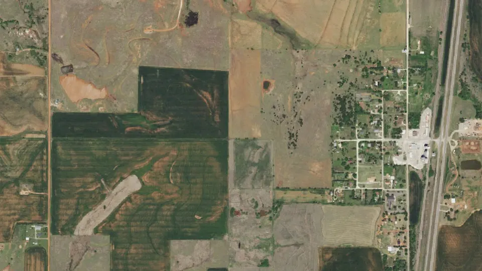
Bison is an unincorporated community (census-designated place) in Garfield County, Oklahoma, with 56 residents (2020 Census). It sits at 1,250 ft (381 m) above sea level. The nearest town is Hennessey, 6.2 miles S.
- 56residents (2020 Census)
- 1,250 ftelevation · 381 m
- 1.1 sq miland area · 2.7 km²
- 53 / sq mipopulation density
- 73720ZIP code
About Bison
Bison is an unincorporated community and census-designated place (CDP) located on US Highway 81 in Garfield County, Oklahoma, United States, consisting of a 30-acre (12 ha) town plat. As of the 2020 census, Bison had a population of 56.
The community was named for nearby Buffalo Springs, a historic stagecoach stop and a watering hole on the Chisholm Trail located about a mile north of Bison. Bison is home to a Catholic community, part of St. Joseph's parish under the Archdiocese of Oklahoma City. The church was erected in 1909, followed by a two-story brick school building operated by the Sisters of the Divine Providence from 1911 to 1934, when the Adorers of the Blood of Christ took over.
Bison's economy is agricultural and oil-based with oil wells on several farms and grain elevators by the Bison Cooperative Association, Star Mill and Burrus Mill companies. Bison was home to Bison State Bank from 1900 until 1933, when it closed due to the Great Depression. The Hotel Woodring was established in 1900 by Irvin and Ella Woodring, the parents of Irvin "Bertie" Woodring, for whom Enid Woodring Regional Airport is named. The post office opened on August 31, 1901. The Bison Mercantile Company was originally established as a grocery store by W.J. Scrichfield in 1900 and operated until 1958 when it was purchased by the Bison Cooperative Association. The co-op was established in 1920, the same year that Oklahoma Gas & Electric brought electricity to the town.
Text: Wikipedia · CC BY-SA 4.0
Bison weather: 7-day forecast
Loading the National Weather Service forecast…
Source: National Weather Service (NOAA).
Nearest webcams to Bison
There are no webcams in Bison itself. These are the closest, 34 miles away or more.
Webcams: Windy.com
Living in Bison
- Median home value
- $64,200
- Median age
- 79.5
Do you know Bison? Tell us about it
Help other travelers: share what makes Bison special. We review every message before publishing it.
Map of Bison
Tap any street on the map to see it in Street View below. Map: © OpenStreetMap contributors.
Bison Street View
Drag the image to look around and tap the arrows on the ground to move. If it says there is no imagery, tap a nearby street on the map above.
Open in Google Maps ›Bison, OK population
Bison had 56 residents in the 2020 Census.
| 2020 Census | 56 |
|---|---|
| Density | 53 per sq mi (20 per km²) |
Source: U.S. Census Bureau, Decennial Census.
Bison at a glance
| State | Oklahoma (OK) |
|---|---|
| County | Garfield County |
| Type | Census-designated place |
| Population | 56 (2020) |
| Land area | 1.06 sq mi (2.7 km²) |
| Elevation | 1,250 ft (381 m) |
| Coordinates | 36.1959° N, 97.8979° W |
| ZIP code | 73720 |
| Census code (GEOID) | 4006350 |
Sources: U.S. Census Bureau (Gazetteer, ZCTA), USGS GNIS, Wikidata.
Towns near Bison
- Hennessey6.2 mi S
- Waukomis6.2 mi N
- Drummond10.6 mi NW
- Douglas13.6 mi E
- Enid14.6 mi N
- Dover14.8 mi S
- Fairmont15.4 mi NE
- Marshall15.7 mi E
- Ames16.4 mi W
- Lahoma17.1 mi NW
- North Enid17.4 mi N
- Lovell17.5 mi SE
Straight-line distance between town centers.
Frequently asked questions about Bison
What county is Bison in?
Bison is in Garfield County, Oklahoma.
What is the population of Bison, OK?
56 people lived in Bison at the 2020 Census.
What is the ZIP code of Bison, OK?
The ZIP code of Bison is 73720.
What is the elevation of Bison?
1,250 feet (381 m) above sea level.
What towns are near Bison?
Hennessey (6.2 mi), Waukomis (6.2 mi), Drummond (10.6 mi), Douglas (13.6 mi), Enid (14.6 mi).
Last updated: