Middlebranch
Census-designated place in Stark County, Ohio
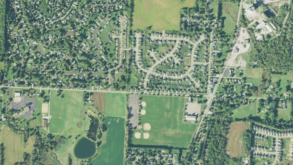
Middlebranch is an unincorporated community (census-designated place) in Stark County, Ohio, with 2,117 residents (2020 Census). It sits at 1,119 ft (341 m) above sea level. The nearest town is North Canton, 3.7 miles SW.
- 2,117residents (2020 Census)
- 1,119 ftelevation · 341 m
- 0.8 sq miland area · 2.2 km²
- 2,519 / sq mipopulation density
- 44652main ZIP code (2 in total)
About Middlebranch
Middlebranch is a census-designated place in northeastern Plain Township, Stark County, Ohio, United States. It is located about 7 miles Northeast of Canton. It has a post office with the ZIP code 44652. The community is part of the Canton–Massillon Metropolitan Statistical Area. The population was 2,117 at the 2020 census. Trains from the Wheeling and Lake Erie Railway often run through the area carrying loads of scrap metal bound for other Ohio cities.
Text: Wikipedia · CC BY-SA 4.0
Middlebranch weather: 7-day forecast
Loading the National Weather Service forecast…
Source: National Weather Service (NOAA).
Live webcams in Middlebranch
Webcams: Windy.com
Living in Middlebranch
- Median household income
- $99,959
- Median home value
- $231,700
- Median rent
- $925/mo
- Median age
- 38.9
Do you know Middlebranch? Tell us about it
Help other travelers: share what makes Middlebranch special. We review every message before publishing it.
Map of Middlebranch
Tap any street on the map to see it in Street View below. Map: © OpenStreetMap contributors.
Middlebranch Street View
Drag the image to look around and tap the arrows on the ground to move. If it says there is no imagery, tap a nearby street on the map above.
Open in Google Maps ›Middlebranch, OH population
Middlebranch had 2,117 residents in the 2020 Census.
| 2020 Census | 2,117 |
|---|---|
| Density | 2,519 per sq mi (972 per km²) |
Source: U.S. Census Bureau, Decennial Census.
Middlebranch at a glance
| State | Ohio (OH) |
|---|---|
| County | Stark County |
| Type | Census-designated place |
| Population | 2,117 (2020) |
| Land area | 0.84 sq mi (2.2 km²) |
| Elevation | 1,119 ft (341 m) |
| Coordinates | 40.8968° N, 81.3322° W |
| ZIP codes | 44652, 44721 |
| Census code (GEOID) | 3949588 |
Sources: U.S. Census Bureau (Gazetteer, ZCTA), USGS GNIS, Wikidata.
Towns near Middlebranch
- North Canton3.7 mi SW
- Greentown4.2 mi NW
- Hartville4.5 mi N
- Harrisburg5.4 mi E
- Louisville5.4 mi SE
- Uniontown5.7 mi NW
- Canton6.4 mi S
- Marlboro7.1 mi NE
- Meyers Lake7.4 mi SW
- Hills and Dales7.5 mi SW
- East Canton7.8 mi S
- Suffield8.2 mi N
Straight-line distance between town centers.
Frequently asked questions about Middlebranch
What county is Middlebranch in?
Middlebranch is in Stark County, Ohio.
What is the population of Middlebranch, OH?
2,117 people lived in Middlebranch at the 2020 Census.
What is the ZIP code of Middlebranch, OH?
The main ZIP code is 44652. Other ZIP codes: 44721.
What is the elevation of Middlebranch?
1,119 feet (341 m) above sea level.
What towns are near Middlebranch?
North Canton (3.7 mi), Greentown (4.2 mi), Hartville (4.5 mi), Harrisburg (5.4 mi), Louisville (5.4 mi).
Last updated: