Atlantic
Census-designated place in Carteret County, North Carolina
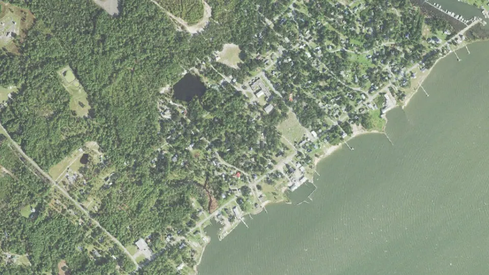
Atlantic is an unincorporated community (census-designated place) in Carteret County, North Carolina, with 468 residents (2020 Census). It sits at 10 ft (3 m) above sea level. The nearest town is Davis, 9.4 miles SW.
- 468residents (2020 Census)
- 10 ftelevation · 3 m
- 0.9 sq miland area · 2.4 km²
- 509 / sq mipopulation density
- 28511ZIP code
About Atlantic
Atlantic is an unincorporated community and census-designated place in eastern Carteret County, North Carolina, United States. As of the 2020 census, Atlantic had a population of 468. It is situated along Core Sound, located in what was known to early settlers of the area as Hunting Quarters. It is the location of the eastern terminus of US-70, and the ferry terminal for access to North Core Banks in the Cape Lookout National Seashore.
The community is located east of the United States Marine Corps installation MCOLF Atlantic which is primarily used for helicopter and aggressor force exercises. The installation sees limited use but is staffed around the clock by a security unit from MCAS Cherry Point.
Atlantic is home to Luther L. Smith and Son Seafood, the last operating fish house in the town. Drum Inlet Marina, the most suitable location to embark to the Outer Banks, is a full-service harbor. Commercial fishing has long been the primary means of earning a living in this community.
Atlantic was the site of the first public high school in Carteret County. It was an incorporated community from 1905 until 1920. It had three different mayors during this time.
Text: Wikipedia · CC BY-SA 4.0
Atlantic weather: 7-day forecast
Loading the National Weather Service forecast…
Source: National Weather Service (NOAA).
Live webcams in Atlantic
Webcams: Windy.com
Living in Atlantic
- Median household income
- $51,071
- Median home value
- $154,300
- Median age
- 35.6
Do you know Atlantic? Tell us about it
Help other travelers: share what makes Atlantic special. We review every message before publishing it.
Map of Atlantic
Tap any street on the map to see it in Street View below. Map: © OpenStreetMap contributors.
Atlantic Street View
Drag the image to look around and tap the arrows on the ground to move. If it says there is no imagery, tap a nearby street on the map above.
Open in Google Maps ›Atlantic, NC population
Atlantic had 468 residents in the 2020 Census.
| 2020 Census | 468 |
|---|---|
| Density | 509 per sq mi (196 per km²) |
Source: U.S. Census Bureau, Decennial Census.
Atlantic at a glance
| State | North Carolina (NC) |
|---|---|
| County | Carteret County |
| Type | Census-designated place |
| Population | 468 (2020) |
| Land area | 0.92 sq mi (2.4 km²) |
| Water area | 0.02 sq mi (0.05 km²) |
| Elevation | 10 ft (3 m) |
| Coordinates | 34.8813° N, 76.3433° W |
| ZIP code | 28511 |
| Census code (GEOID) | 3702480 |
Sources: U.S. Census Bureau (Gazetteer, ZCTA), USGS GNIS, Wikidata.
Towns near Atlantic
- Davis9.4 mi SW
- Marshallberg14.4 mi SW
- Gloucester15.1 mi SW
- Harkers Island16.9 mi SW
- Beaufort20.5 mi SW
- Oriental21.6 mi NW
- Ocracoke23.6 mi NE
- Morehead City24.7 mi SW
- Atlantic Beach25.8 mi SW
- Cherry Branch26.8 mi W
- Vandemere28.0 mi NW
- Mesic28.1 mi NW
Straight-line distance between town centers.
Frequently asked questions about Atlantic
What county is Atlantic in?
Atlantic is in Carteret County, North Carolina.
What is the population of Atlantic, NC?
468 people lived in Atlantic at the 2020 Census.
What is the ZIP code of Atlantic, NC?
The ZIP code of Atlantic is 28511.
What is the elevation of Atlantic?
10 feet (3 m) above sea level.
What towns are near Atlantic?
Davis (9.4 mi), Marshallberg (14.4 mi), Gloucester (15.1 mi), Harkers Island (16.9 mi), Beaufort (20.5 mi).
Last updated: