Shirley
Census-designated place in Suffolk County, New York
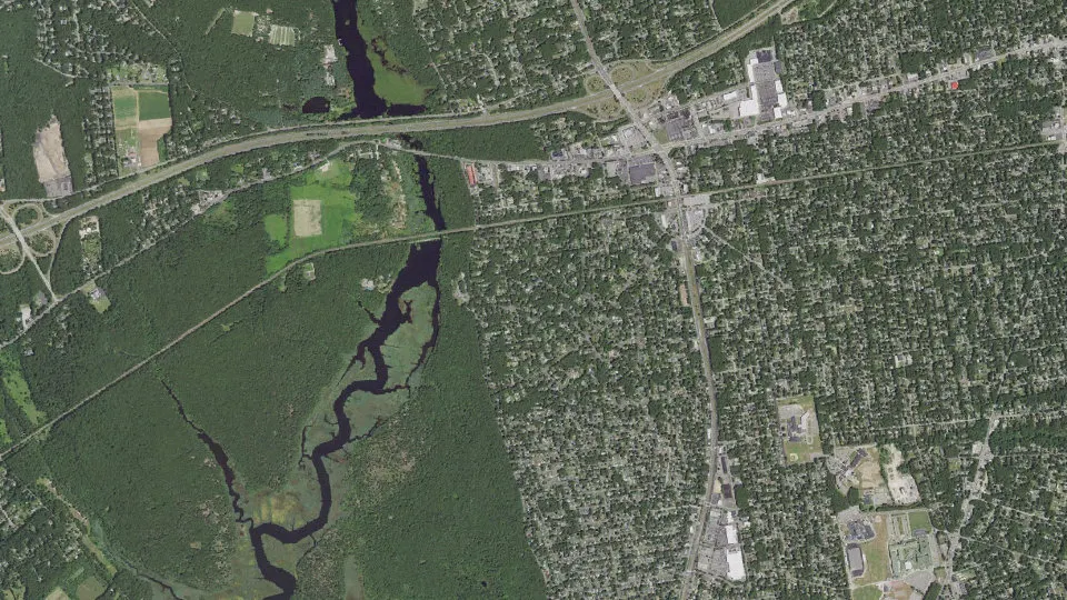
Shirley is an unincorporated community (census-designated place) in Suffolk County, New York, with 26,360 residents (2020 Census). It sits at 52 ft (16 m) above sea level. The nearest town is Mastic, 1.8 miles NE.
- 26,360residents (2020 Census)
- 52 ftelevation · 16 m
- 11.3 sq miland area · 29.3 km²
- 2,330 / sq mipopulation density
- 11967main ZIP code (4 in total)
About Shirley
Shirley is a hamlet (and census-designated place) in Suffolk County, New York, United States. As of the 2020 census, Shirley had a population of 26,360. Shirley is the western terminus of Atlantic Crossing 1, a major submarine telecommunications cable linking the United States with the UK, Germany, and the Netherlands. Soon, the Emerald Express transatlantic communications cable will provide data connectivity between Europe and North America, landing in Shirley.
Shirley is a community in the Town of Brookhaven, on the South Shore of Long Island. It is named for developer Walter T. Shirley, who had the vision in the 1940s to turn the area on Mastic Bay into an affordable enclave. Shirley's company priced its 4,000 four-room homes starting at $4,700, and lots were priced at $295.
Shirley is served by the Mastic–Shirley Long Island Rail Road station. The station was a compromise when both Mastic and Shirley campaigned for it. The Smith Point Bridge is the second of only two bridge crossings from Long Island to Fire Island, allowing beach goers easy access to the ocean without taking a ferry boat.
The 7th Precinct of the Suffolk County Police Department is located in Shirley.
Shirley was once known as Tangiers (named after William "Tangier" Smith) and was home to a few summer bungalows in the early 1900s, most of their owners were from New York City, looking an escape from a vast "urban jungle". Today, most of the "Tangiers-era" still stand, although some were destroyed by hurricanes, winter storms, or arson.
Text: Wikipedia · CC BY-SA 4.0
Shirley weather: 7-day forecast
Loading the National Weather Service forecast…
Source: National Weather Service (NOAA).
Live webcams in Shirley
Webcams: Windy.com
Living in Shirley
- Median household income
- $112,788
- Median home value
- $424,900
- Median rent
- $2,056/mo
- Median age
- 40.3
Do you know Shirley? Tell us about it
Help other travelers: share what makes Shirley special. We review every message before publishing it.
Map of Shirley
Tap any street on the map to see it in Street View below. Map: © OpenStreetMap contributors.
Shirley Street View
Drag the image to look around and tap the arrows on the ground to move. If it says there is no imagery, tap a nearby street on the map above.
Open in Google Maps ›Shirley, NY population
Shirley had 26,360 residents in the 2020 Census.
| 2020 Census | 26,360 |
|---|---|
| Density | 2,330 per sq mi (900 per km²) |
Source: U.S. Census Bureau, Decennial Census.
Shirley at a glance
| State | New York (NY) |
|---|---|
| County | Suffolk County |
| Type | Census-designated place |
| Population | 26,360 (2020) |
| Land area | 11.31 sq mi (29.3 km²) |
| Water area | 0.85 sq mi (2.21 km²) |
| Elevation | 52 ft (16 m) |
| Coordinates | 40.7936° N, 72.8759° W |
| ZIP codes | 11967, 11719, 11950, 11951 |
| Census code (GEOID) | 3667070 |
Sources: U.S. Census Bureau (Gazetteer, ZCTA), USGS GNIS, Wikidata.
Towns near Shirley
- Mastic1.8 mi NE
- Brookhaven2.0 mi SW
- Moriches2.7 mi E
- Mastic Beach2.8 mi SE
- North Bellport3.7 mi W
- Yaphank3.9 mi NW
- Center Moriches4.2 mi E
- Bellport4.5 mi SW
- East Patchogue5.8 mi W
- Medford6.1 mi W
- East Moriches6.3 mi E
- Gordon Heights6.6 mi NW
Straight-line distance between town centers.
Frequently asked questions about Shirley
What county is Shirley in?
Shirley is in Suffolk County, New York.
What is the population of Shirley, NY?
26,360 people lived in Shirley at the 2020 Census.
What is the ZIP code of Shirley, NY?
The main ZIP code is 11967. Other ZIP codes: 11719, 11950, 11951.
What is the elevation of Shirley?
52 feet (16 m) above sea level.
What towns are near Shirley?
Mastic (1.8 mi), Brookhaven (2.0 mi), Moriches (2.7 mi), Mastic Beach (2.8 mi), North Bellport (3.7 mi).
Last updated: