Mattydale
Census-designated place in Onondaga County, New York
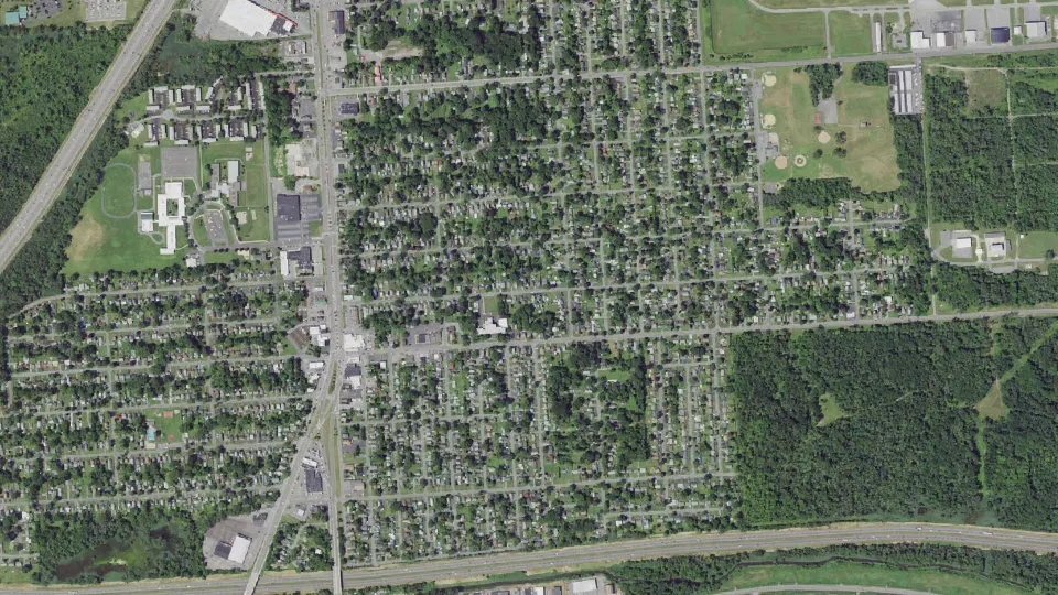
Mattydale is an unincorporated community (census-designated place) in Onondaga County, New York, with 6,296 residents (2020 Census). It sits at 404 ft (123 m) above sea level. The nearest town is Lyncourt, 1.3 miles SE.
- 6,296residents (2020 Census)
- 404 ftelevation · 123 m
- 1.9 sq miland area · 5.0 km²
- 3,278 / sq mipopulation density
- 13211main ZIP code (2 in total)
About Mattydale
Mattydale is a hamlet (and census-designated place) in Onondaga County, New York, United States. As of the 2020 census, Mattydale had a population of 6,296.
Mattydale is a community in the northeast part of the town of Salina and is a northern suburb of Syracuse.
Mattydale was named for the farm of Frank Matty.
Although born in nearby Chittenango, New York, Wizard of Oz author L. Frank Baum spent much of his childhood on the site of Roxboro Road Middle School. He later moved to the Sports-O-Rama roller rink site on the first plank road in the country known as Route 11. Freethought Trail says, "The yellowish hemlock wood of the plank road may have been an inspiration for the Yellow Brick Road". A vacant lot since the Sports-O-Rama skating rink was torn down in 2015, the site previously featured two roadhouses after the Baum family residence. Built in succession following fires, the last roadhouse/hotel succumbed to blazes in 1957 and the final fire in 1958.
Text: Wikipedia · CC BY-SA 4.0
Mattydale weather: 7-day forecast
Loading the National Weather Service forecast…
Source: National Weather Service (NOAA).
Nearest webcams to Mattydale
There are no webcams in Mattydale itself. These are the closest, 48 miles away or more.
Webcams: Windy.com
Living in Mattydale
- Median household income
- $66,940
- Median home value
- $121,900
- Median rent
- $1,163/mo
- Median age
- 39.3
Do you know Mattydale? Tell us about it
Help other travelers: share what makes Mattydale special. We review every message before publishing it.
Map of Mattydale
Tap any street on the map to see it in Street View below. Map: © OpenStreetMap contributors.
Mattydale Street View
Drag the image to look around and tap the arrows on the ground to move. If it says there is no imagery, tap a nearby street on the map above.
Open in Google Maps ›Mattydale, NY population
Mattydale had 6,296 residents in the 2020 Census.
| 2020 Census | 6,296 |
|---|---|
| Density | 3,278 per sq mi (1,266 per km²) |
Source: U.S. Census Bureau, Decennial Census.
Mattydale at a glance
| State | New York (NY) |
|---|---|
| County | Onondaga County |
| Type | Census-designated place |
| Population | 6,296 (2020) |
| Land area | 1.92 sq mi (5.0 km²) |
| Elevation | 404 ft (123 m) |
| Coordinates | 43.0992° N, 76.1388° W |
| ZIP codes | 13211, 13208 |
| Census code (GEOID) | 3646151 |
Sources: U.S. Census Bureau (Gazetteer, ZCTA), USGS GNIS, Wikidata.
Towns near Mattydale
- Lyncourt1.3 mi SE
- North Syracuse2.4 mi N
- Galeville2.6 mi W
- Liverpool3.6 mi W
- Syracuse4.0 mi S
- East Syracuse4.3 mi SE
- Solvay4.7 mi SW
- Lakeland5.3 mi W
- DeWitt5.6 mi SE
- Westvale5.7 mi SW
- Minoa6.8 mi E
- Fairmount6.8 mi SW
Straight-line distance between town centers.
Frequently asked questions about Mattydale
What county is Mattydale in?
Mattydale is in Onondaga County, New York.
What is the population of Mattydale, NY?
6,296 people lived in Mattydale at the 2020 Census.
What is the ZIP code of Mattydale, NY?
The main ZIP code is 13211. Other ZIP codes: 13208.
What is the elevation of Mattydale?
404 feet (123 m) above sea level.
What towns are near Mattydale?
Lyncourt (1.3 mi), North Syracuse (2.4 mi), Galeville (2.6 mi), Liverpool (3.6 mi), Syracuse (4.0 mi).
Last updated: