El Rito
Census-designated place in Rio Arriba County, New Mexico
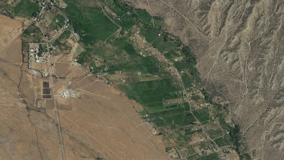
El Rito is an unincorporated community (census-designated place) in Rio Arriba County, New Mexico, with 749 residents (2020 Census). It sits at 6,877 ft (2,096 m) above sea level. The nearest town is Ojo Caliente, 7.7 miles E.
- 749residents (2020 Census)
- 6,877 ftelevation · 2,096 m
- 4.1 sq miland area · 10.6 km²
- 182 / sq mipopulation density
- 87530ZIP code
About El Rito
El Rito (ríto, 'the little river', Tewa: P’iˀą Nugeh Búuˀu) is an unincorporated community in Rio Arriba County, New Mexico, United States. Its elevation is 6,875 feet (2,096 m). The town is located on NM 554, 18 miles (29 km) northwest of Española and 15 miles (24 km) northwest of Ojo Caliente.
El Rito took its name from the creek that passes through the village, originally named El Rito Colorado (the red creek). Tewas call the El Rito region P’iˀą Nugeh 'pink below place' after the El Rito Mountains, known to them as P’iˀą P’in 'pink mountains'. The community was the site of the Tewa pueblo of P’iˀą Nugeh Ówîngeh Kayyee.
El Rito was one of the first Spanish settlements in the Jicarilla Apache lands north of Santa Fe, being settled about 1807. San Juan Nepomuceno Catholic Church is in the town, built between 1827 and 1832. This church has been erroneously claimed to be the oldest church in New Mexico despite multiple churches being built more than 200 year prior to it. The church was restored in the 1980s.
El Rito is surrounded by the Carson National Forest. The community is the home of the Carson National Forest Service – El Rito Ranger District, the El Rito Public Library, the Las Clinicas del Norte, and a campus of Northern New Mexico College. El Rito is the home to a growing number of artists. The El Rito Studio Tour is held in early October Among the artists living in this tiny New Mexico village are Nicholas Herrera known as “The El Rito Santero” and David Michael Kennedy both of whom have work in the Smithsonian.
Text: Wikipedia · CC BY-SA 4.0
El Rito weather: 7-day forecast
Loading the National Weather Service forecast…
Source: National Weather Service (NOAA).
Live webcams in El Rito
Webcams: Windy.com
Living in El Rito
- Median home value
- $332,300
- Median age
- 39.5
Do you know El Rito? Tell us about it
Help other travelers: share what makes El Rito special. We review every message before publishing it.
Map of El Rito
Tap any street on the map to see it in Street View below. Map: © OpenStreetMap contributors.
El Rito Street View
Drag the image to look around and tap the arrows on the ground to move. If it says there is no imagery, tap a nearby street on the map above.
Open in Google Maps ›El Rito, NM population
El Rito had 749 residents in the 2020 Census.
| 2020 Census | 749 |
|---|---|
| Density | 182 per sq mi (70 per km²) |
Source: U.S. Census Bureau, Decennial Census.
El Rito at a glance
| State | New Mexico (NM) |
|---|---|
| County | Rio Arriba County |
| Type | Census-designated place |
| Population | 749 (2020) |
| Land area | 4.11 sq mi (10.6 km²) |
| Water area | 0.00 sq mi (0.00 km²) |
| Elevation | 6,877 ft (2,096 m) |
| Coordinates | 36.3326° N, 106.1741° W |
| ZIP code | 87530 |
| Census code (GEOID) | 3524120 |
Sources: U.S. Census Bureau (Gazetteer, ZCTA), USGS GNIS, Wikidata.
Towns near El Rito
- Ojo Caliente7.7 mi E
- La Madera7.9 mi NE
- Medanales10.8 mi S
- Abiquiu12.3 mi SW
- Lyden15.2 mi SE
- Canova15.4 mi SE
- Chili15.8 mi S
- Los Luceros16.9 mi SE
- Velarde17.0 mi SE
- La Villita17.3 mi SE
- Canjilon17.4 mi NW
- Cañones17.4 mi SW
Straight-line distance between town centers.
Frequently asked questions about El Rito
What county is El Rito in?
El Rito is in Rio Arriba County, New Mexico.
What is the population of El Rito, NM?
749 people lived in El Rito at the 2020 Census.
What is the ZIP code of El Rito, NM?
The ZIP code of El Rito is 87530.
What is the elevation of El Rito?
6,877 feet (2,096 m) above sea level.
What towns are near El Rito?
Ojo Caliente (7.7 mi), La Madera (7.9 mi), Medanales (10.8 mi), Abiquiu (12.3 mi), Lyden (15.2 mi).
Last updated: