Leesburg
Census-designated place in Cumberland County, New Jersey
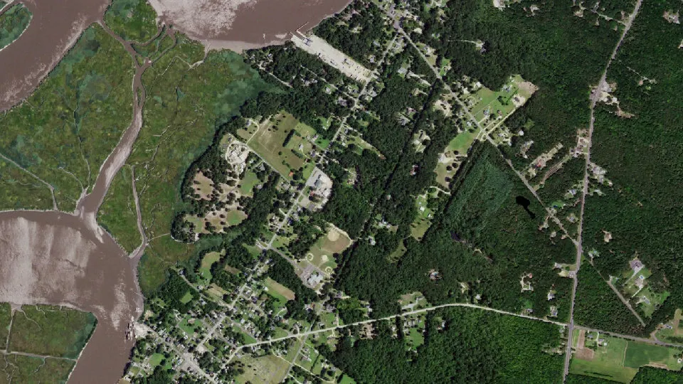
Leesburg is an unincorporated community (census-designated place) in Cumberland County, New Jersey, with 601 residents (2020 Census). It sits at 20 ft (6 m) above sea level. The nearest town is Dorchester, 0.7 miles NE.
- 601residents (2020 Census)
- 20 ftelevation · 6 m
- 1.8 sq miland area · 4.6 km²
- 341 / sq mipopulation density
- 08327ZIP code
About Leesburg
Leesburg is an unincorporated community and census-designated place (CDP) located within Maurice River Township in Cumberland County, in the U.S. state of New Jersey. The area is served as United States Postal Service ZIP Code 08327. As of the 2020 census, Leesburg had a population of 601.
The land that later became the town of Leesburg in the late eighteenth century also was surveyed by John Worledge and John Budd in 1691. Similar to Dorchester, the first settlers to the area were most likely Swedish, though a town was not established until 1795 when John Lee, an Egg Harbor shipwright, founded Leesburg. In doing so, he and his brothers opened the first shipyard—and with it established the industrial destiny of constructing coastal vessels. In 1850 James Ward built a marine railway here to facilitate the repair of larger ships, which were attracted to Maurice River site because it was only six miles from the Delaware Bay.
Though Leesburg's economic base was primarily shipbuilding, two successful early twentieth-century industries were the Leesburg Packing Company, a cannery that seasonally employed 100 persons, and J. C. Fifield and Son, a fertilizer works. Today the only evidence of these industries is WHIBCO Inc., a sandmining company whose administrative offices occupy the buildings of the former Del Bay Shipyard
Bayside State Prison is located in Leesburg. In 1988 the prison was renamed from "Leesburg State Prison," though some Leesburg residents stated dissatisfaction with the renaming since it was the only widely known aspect of the Leesburg community.
Text: Wikipedia · CC BY-SA 4.0
Leesburg weather: 7-day forecast
Loading the National Weather Service forecast…
Source: National Weather Service (NOAA).
Live webcams in Leesburg
Webcams: Windy.com
Living in Leesburg
- Median household income
- $58,750
- Median home value
- $187,500
- Median age
- 66.4
Do you know Leesburg? Tell us about it
Help other travelers: share what makes Leesburg special. We review every message before publishing it.
Map of Leesburg
Tap any street on the map to see it in Street View below. Map: © OpenStreetMap contributors.
Leesburg Street View
Drag the image to look around and tap the arrows on the ground to move. If it says there is no imagery, tap a nearby street on the map above.
Open in Google Maps ›Leesburg, NJ population
Leesburg had 601 residents in the 2020 Census.
| 2020 Census | 601 |
|---|---|
| Density | 341 per sq mi (132 per km²) |
Source: U.S. Census Bureau, Decennial Census.
Leesburg at a glance
| State | New Jersey (NJ) |
|---|---|
| County | Cumberland County |
| Type | Census-designated place |
| Population | 601 (2020) |
| Land area | 1.76 sq mi (4.6 km²) |
| Water area | 0.21 sq mi (0.54 km²) |
| Elevation | 20 ft (6 m) |
| Coordinates | 39.2637° N, 74.9812° W |
| ZIP code | 08327 |
| Census code (GEOID) | 3439870 |
Sources: U.S. Census Bureau (Gazetteer, ZCTA), USGS GNIS, Wikidata.
Towns near Leesburg
- Dorchester0.7 mi NE
- Mauricetown2.4 mi NW
- Heislerville2.8 mi S
- Maurice River3.2 mi NE
- Port Elizabeth3.2 mi N
- Port Norris3.2 mi W
- Commercial3.2 mi W
- Delmont3.8 mi SE
- Laurel Lake5.1 mi NW
- Belleplain5.7 mi E
- Dividing Creek6.4 mi W
- Cumberland-Hesstown7.7 mi NE
Straight-line distance between town centers.
Frequently asked questions about Leesburg
What county is Leesburg in?
Leesburg is in Cumberland County, New Jersey.
What is the population of Leesburg, NJ?
601 people lived in Leesburg at the 2020 Census.
What is the ZIP code of Leesburg, NJ?
The ZIP code of Leesburg is 08327.
What is the elevation of Leesburg?
20 feet (6 m) above sea level.
What towns are near Leesburg?
Dorchester (0.7 mi), Mauricetown (2.4 mi), Heislerville (2.8 mi), Maurice River (3.2 mi), Port Elizabeth (3.2 mi).
Last updated: