Leeds Point
Census-designated place in Atlantic County, New Jersey
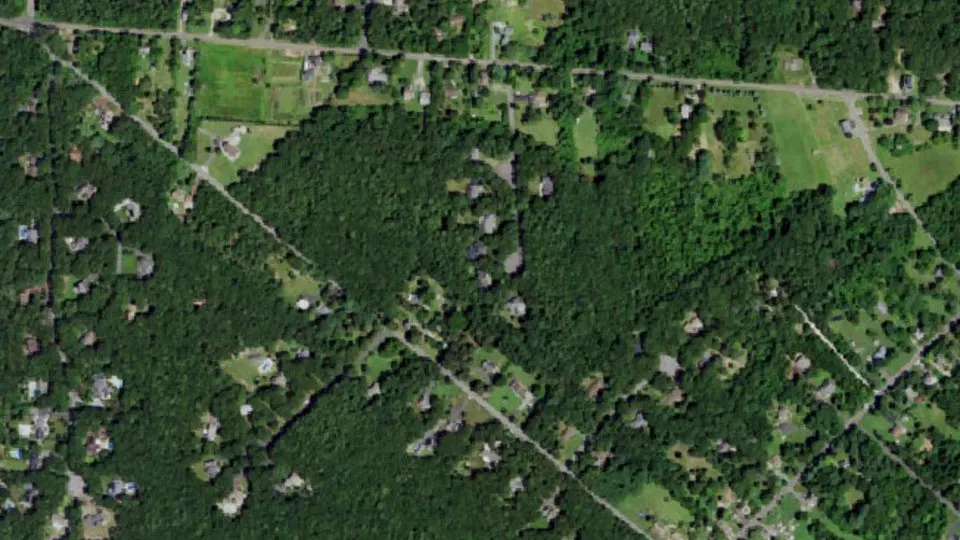
Leeds Point is an unincorporated community (census-designated place) in Atlantic County, New Jersey, with 205 residents (2020 Census). It sits at 43 ft (13 m) above sea level. The nearest town is Oceanville, 0.8 miles SW.
- 205residents (2020 Census)
- 43 ftelevation · 13 m
- 0.2 sq miland area · 0.6 km²
- 847 / sq mipopulation density
- 08205ZIP code
About Leeds Point
Leeds Point (also known as Leeds) is an unincorporated community and census-designated place (CDP) located within Galloway Township, Atlantic County, in the U.S. state of New Jersey. As of the 2020 census, Leeds Point had a population of 205. It is situated on the end of a promontory raised about 30–50 ft above the salt marsh on the south side of Great Bay. Leeds Point is 5.7 miles (9.2 km) northeast of Absecon. Leeds Point has a post office with ZIP Code 08220, which opened on December 18, 1827. The town is named after the Leeds family, whose first American member, Daniel Leeds, Surveyor General of West Jersey around the beginning of the 18th century, after immigrating to New Jersey from the city of Leeds in England, claimed the land which now makes up Leeds Point; some of his descendants lived in Leeds Point from then on. (His descendants also include his son Daniel Leeds and grandson Titan Leeds, who in Philadelphia published one of America's first almanacs.)
The Jersey Devil was born in Leeds Point, according to one legend about the cryptid. The legend claims that in 1735, the thirteenth child of a woman called Mrs. Leeds from the community was transformed into a demon shortly after birth due to her cursing that it would be the devil.
Text: Wikipedia · CC BY-SA 4.0
Leeds Point weather: 7-day forecast
Loading the National Weather Service forecast…
Source: National Weather Service (NOAA).
Live webcams in Leeds Point
Webcams: Windy.com
Do you know Leeds Point? Tell us about it
Help other travelers: share what makes Leeds Point special. We review every message before publishing it.
Map of Leeds Point
Tap any street on the map to see it in Street View below. Map: © OpenStreetMap contributors.
Leeds Point Street View
Drag the image to look around and tap the arrows on the ground to move. If it says there is no imagery, tap a nearby street on the map above.
Open in Google Maps ›Leeds Point, NJ population
Leeds Point had 205 residents in the 2020 Census.
| 2020 Census | 205 |
|---|---|
| Density | 847 per sq mi (327 per km²) |
Source: U.S. Census Bureau, Decennial Census.
Leeds Point at a glance
| State | New Jersey (NJ) |
|---|---|
| County | Atlantic County |
| Type | Census-designated place |
| Population | 205 (2020) |
| Land area | 0.24 sq mi (0.6 km²) |
| Elevation | 43 ft (13 m) |
| Coordinates | 39.4906° N, 74.4433° W |
| ZIP code | 08205 |
| Census code (GEOID) | 3439810 |
Sources: U.S. Census Bureau (Gazetteer, ZCTA), USGS GNIS, Wikidata.
Towns near Leeds Point
- Oceanville0.8 mi SW
- Galloway1.6 mi W
- Smithville1.9 mi W
- Port Republic3.5 mi NW
- Absecon Highlands3.6 mi SW
- Absecon5.3 mi SW
- Stockton University5.6 mi W
- Pomona5.9 mi W
- Mystic Island6.1 mi NE
- Brigantine6.4 mi SE
- New Gretna6.7 mi N
- Atlantic City7.8 mi S
Straight-line distance between town centers.
Frequently asked questions about Leeds Point
What county is Leeds Point in?
Leeds Point is in Atlantic County, New Jersey.
What is the population of Leeds Point, NJ?
205 people lived in Leeds Point at the 2020 Census.
What is the ZIP code of Leeds Point, NJ?
The ZIP code of Leeds Point is 08205.
What is the elevation of Leeds Point?
43 feet (13 m) above sea level.
What towns are near Leeds Point?
Oceanville (0.8 mi), Galloway (1.6 mi), Smithville (1.9 mi), Port Republic (3.5 mi), Absecon Highlands (3.6 mi).
Last updated: