Whitlash
Census-designated place in Liberty County, Montana
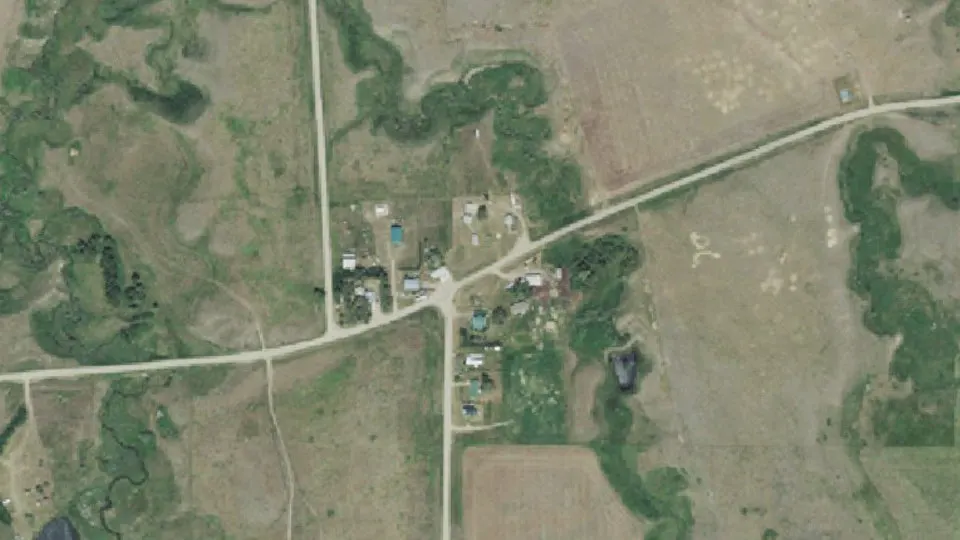
Whitlash is an unincorporated community (census-designated place) in Liberty County, Montana, with 4 residents (2020 Census). It sits at 3,950 ft (1,204 m) above sea level. The nearest town is Sage Creek Colony, 12.8 miles E.
- 4residents (2020 Census)
- 3,950 ftelevation · 1,204 m
- 0.0 sq miland area · 0.1 km²
- 92 / sq mipopulation density
- 59545ZIP code
About Whitlash
Whitlash is an unincorporated community in northwestern Liberty County, Montana, United States, about five miles south of the province of Alberta across the Canada–US border.
Whitlash has a post office and an elementary school that provides educational services in grades prekindergarten through 8. The community is accessible only by unpaved road. The Whitlash–Aden Border Crossing is about five miles to the north. As of the 2020 census, Whitlash had a population of 4.
Whitlash is located near the East Butte of the Sweet Grass Hills which are major historic and physical landmarks of the Great Plains. Sacred to the American Indians, "The Hills" served as hunting grounds, battlegrounds, spiritual grounds, and of course were used for navigational purposes as well.
The post office opened in 1892. The post office moved 6 times, until Alfred and Tom Strode laid out a townsite on Half Breed Creek in 1905. U.S. Customs operated out of the town from 1933 until 1969, when it was moved to the actual border.
Text: Wikipedia · CC BY-SA 4.0
Whitlash weather: 7-day forecast
Loading the National Weather Service forecast…
Source: National Weather Service (NOAA).
Live webcams in Whitlash
Webcams: Windy.com
Do you know Whitlash? Tell us about it
Help other travelers: share what makes Whitlash special. We review every message before publishing it.
Map of Whitlash
Tap any street on the map to see it in Street View below. Map: © OpenStreetMap contributors.
Whitlash Street View
Drag the image to look around and tap the arrows on the ground to move. If it says there is no imagery, tap a nearby street on the map above.
Open in Google Maps ›Whitlash, MT population
Whitlash had 4 residents in the 2020 Census.
| 2020 Census | 4 |
|---|---|
| Density | 92 per sq mi (35 per km²) |
Source: U.S. Census Bureau, Decennial Census.
Whitlash at a glance
| State | Montana (MT) |
|---|---|
| County | Liberty County |
| Type | Census-designated place |
| Population | 4 (2020) |
| Land area | 0.04 sq mi (0.1 km²) |
| Elevation | 3,950 ft (1,204 m) |
| Coordinates | 48.9089° N, 111.2519° W |
| ZIP code | 59545 |
| Census code (GEOID) | 3080275 |
Sources: U.S. Census Bureau (Gazetteer, ZCTA), USGS GNIS, Wikidata.
Towns near Whitlash
- Sage Creek Colony12.8 mi E
- Eagle Creek Colony14.5 mi S
- Sunburst29.6 mi W
- Chester30.4 mi SE
- Joplin32.6 mi SE
- Sweet Grass33.0 mi W
- Kevin34.4 mi W
- Inverness34.5 mi SE
- Shelby39.5 mi SW
- Rudyard40.1 mi SE
- Camrose Colony44.4 mi S
Straight-line distance between town centers.
Frequently asked questions about Whitlash
What county is Whitlash in?
Whitlash is in Liberty County, Montana.
What is the population of Whitlash, MT?
4 people lived in Whitlash at the 2020 Census.
What is the ZIP code of Whitlash, MT?
The ZIP code of Whitlash is 59545.
What is the elevation of Whitlash?
3,950 feet (1,204 m) above sea level.
What towns are near Whitlash?
Sage Creek Colony (12.8 mi), Eagle Creek Colony (14.5 mi), Sunburst (29.6 mi), Chester (30.4 mi), Joplin (32.6 mi).
Last updated: