Whitetail
Census-designated place in Daniels County, Montana
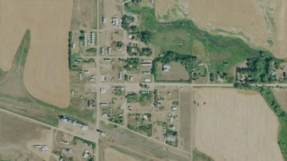
Whitetail is an unincorporated community (census-designated place) in Daniels County, Montana, with 9 residents (2020 Census). It sits at 2,503 ft (763 m) above sea level. The nearest town is Flaxville, 6.4 miles S.
- 9residents (2020 Census)
- 2,503 ftelevation · 763 m
- 0.1 sq miland area · 0.4 km²
- 65 / sq mipopulation density
- 59276ZIP code
About Whitetail
Whitetail is a small, unincorporated village in northern Daniels County, Montana, United States. As of the 2020 census, Whitetail had a population of 9.
The area was first used as a camp along a cattle-driving route in the 1880s. The town grew with the arrival of the Soo Line Railroad in 1914. The line was planned for extension all the way to Glacier National Park, but work was stopped during World War I and the line never went any farther than Whitetail. At its peak the town had more than 500 residents, declining to 248 in 1940 and 125 in 1970. The town's chief industry was the manufacture of silo blowers from 1940, but the plant closed, followed by Whitetail High School in 1940 and the grade school in 1973.
The small checkpoint along Montana's border with Canada, which served about three travelers every day, was set to receive $15 million for upgrades under President Barack Obama's economic stimulus plan. On April 1, 2011, Canada closed its border to northbound traffic through Whitetail. The US followed suit and closed the southbound crossing on January 25, 2013.
A dam along Whitetail Creek forms Whitetail Reservoir.
Text: Wikipedia · CC BY-SA 4.0
Whitetail weather: 7-day forecast
Loading the National Weather Service forecast…
Source: National Weather Service (NOAA).
Nearest webcams to Whitetail
There are no webcams in Whitetail itself. These are the closest, 135 miles away or more.
Webcams: Windy.com
Do you know Whitetail? Tell us about it
Help other travelers: share what makes Whitetail special. We review every message before publishing it.
Map of Whitetail
Tap any street on the map to see it in Street View below. Map: © OpenStreetMap contributors.
Whitetail Street View
Drag the image to look around and tap the arrows on the ground to move. If it says there is no imagery, tap a nearby street on the map above.
Open in Google Maps ›Whitetail, MT population
Whitetail had 9 residents in the 2020 Census.
| 2020 Census | 9 |
|---|---|
| Density | 65 per sq mi (25 per km²) |
Source: U.S. Census Bureau, Decennial Census.
Whitetail at a glance
| State | Montana (MT) |
|---|---|
| County | Daniels County |
| Type | Census-designated place |
| Population | 9 (2020) |
| Land area | 0.14 sq mi (0.4 km²) |
| Elevation | 2,503 ft (763 m) |
| Coordinates | 48.8965° N, 105.1614° W |
| ZIP code | 59276 |
| Census code (GEOID) | 3080125 |
Sources: U.S. Census Bureau (Gazetteer, ZCTA), USGS GNIS, Wikidata.
Towns near Whitetail
- Flaxville6.4 mi S
- Redstone11.2 mi SE
- Scobey13.9 mi SW
- Outlook17.1 mi E
- Plentywood28.7 mi E
- Peerless31.4 mi W
- Medicine Lake40.6 mi SE
- Homestead43.5 mi SE
Straight-line distance between town centers.
Frequently asked questions about Whitetail
What county is Whitetail in?
Whitetail is in Daniels County, Montana.
What is the population of Whitetail, MT?
9 people lived in Whitetail at the 2020 Census.
What is the ZIP code of Whitetail, MT?
The ZIP code of Whitetail is 59276.
What is the elevation of Whitetail?
2,503 feet (763 m) above sea level.
What towns are near Whitetail?
Flaxville (6.4 mi), Redstone (11.2 mi), Scobey (13.9 mi), Outlook (17.1 mi), Plentywood (28.7 mi).
Last updated: