Landusky
Census-designated place in Phillips County, Montana
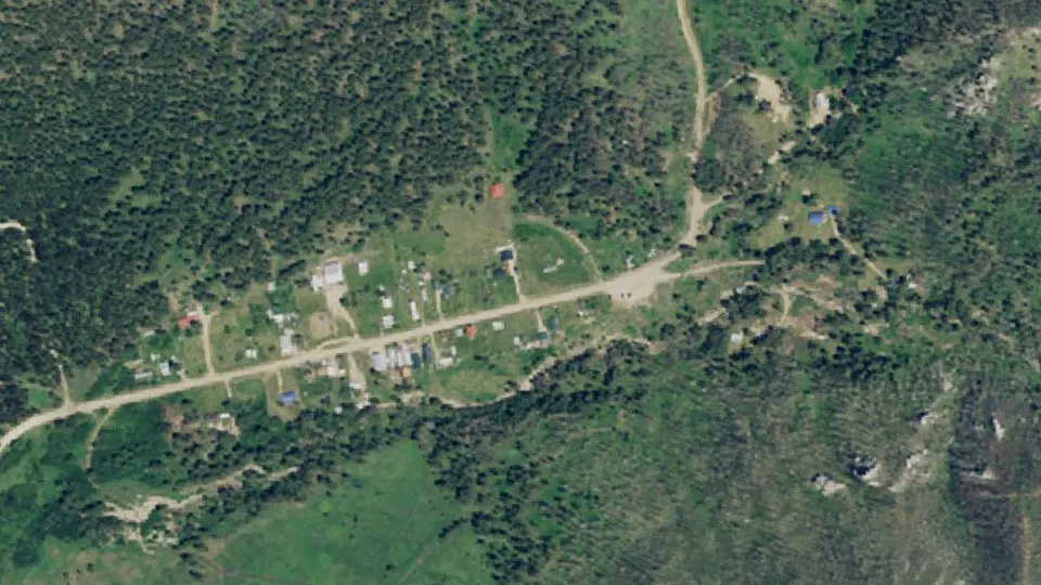
Landusky is an unincorporated community (census-designated place) in Phillips County, Montana, with 22 residents (2020 Census). It sits at 4,026 ft (1,227 m) above sea level. The nearest town is Zortman, 5.3 miles E.
- 22residents (2020 Census)
- 4,026 ftelevation · 1,227 m
- 0.1 sq miland area · 0.2 km²
- 252 / sq mipopulation density
- 59546ZIP code
About Landusky
Landusky is an unincorporated community and census-designated place (CDP) in Phillips County, Montana, United States, with a population of 22 per the 2020 census. It is in the southwestern part of the county, in the southwestern part of the Little Rocky Mountains. It sits in the valley of Rock Creek, between Mill Gulch to the northeast and Montana Gulch to the northwest. Ore Street dead-ends in Landusky and leads southwest out of the Little Rockies 3.5 miles (5.6 km) to Montana Highway 66. The community is served by the Zortman post office, less than 5 miles (8 km) to the northeast across the Little Rockies but 21 miles (34 km) by road.
Landusky was first listed as a CDP prior to the 2020 census.
Episode "Tall Heart, Short Temper" of the 1950s historical drama Television anthology series, Death Valley Days, tells the story of Powell "Pike" Landusky, whom the town is named after. The episode includes how he and his business partner were captured by a war party of Brule Indians. Landusky, notorious for his bad temper and quarrelsome behavior, rampaged against his captors with a frying pan. The warrior braves were struck with awe by the violent spectacle and retreated, even leaving two ponies to calm him down.
Text: Wikipedia · CC BY-SA 4.0
Landusky weather: 7-day forecast
Loading the National Weather Service forecast…
Source: National Weather Service (NOAA).
Nearest webcams to Landusky
There are no webcams in Landusky itself. These are the closest, 127 miles away or more.
Webcams: Windy.com
Living in Landusky
- Median home value
- $56,700
- Median age
- 77.5
Do you know Landusky? Tell us about it
Help other travelers: share what makes Landusky special. We review every message before publishing it.
Map of Landusky
Tap any street on the map to see it in Street View below. Map: © OpenStreetMap contributors.
Landusky Street View
Drag the image to look around and tap the arrows on the ground to move. If it says there is no imagery, tap a nearby street on the map above.
Open in Google Maps ›Landusky, MT population
Landusky had 22 residents in the 2020 Census.
| 2020 Census | 22 |
|---|---|
| Density | 252 per sq mi (97 per km²) |
Source: U.S. Census Bureau, Decennial Census.
Landusky at a glance
| State | Montana (MT) |
|---|---|
| County | Phillips County |
| Type | Census-designated place |
| Population | 22 (2020) |
| Land area | 0.09 sq mi (0.2 km²) |
| Elevation | 4,026 ft (1,227 m) |
| Coordinates | 47.8983° N, 108.6197° W |
| ZIP code | 59546 |
| Census code (GEOID) | 3042325 |
Sources: U.S. Census Bureau (Gazetteer, ZCTA), USGS GNIS, Wikidata.
Towns near Landusky
- Zortman5.3 mi E
- Hays8.0 mi N
- Lodge Pole9.5 mi N
- Fort Belknap Agency36.9 mi N
- Dodson38.4 mi NE
- Roy42.1 mi S
- Winifred42.2 mi SW
- Harlem44.4 mi N
- Malta46.8 mi NE
- North Harlem Colony47.8 mi N
Straight-line distance between town centers.
Frequently asked questions about Landusky
What county is Landusky in?
Landusky is in Phillips County, Montana.
What is the population of Landusky, MT?
22 people lived in Landusky at the 2020 Census.
What is the ZIP code of Landusky, MT?
The ZIP code of Landusky is 59546.
What is the elevation of Landusky?
4,026 feet (1,227 m) above sea level.
What towns are near Landusky?
Zortman (5.3 mi), Hays (8.0 mi), Lodge Pole (9.5 mi), Fort Belknap Agency (36.9 mi), Dodson (38.4 mi).
Last updated: