Fort Shaw
Census-designated place in Cascade County, Montana
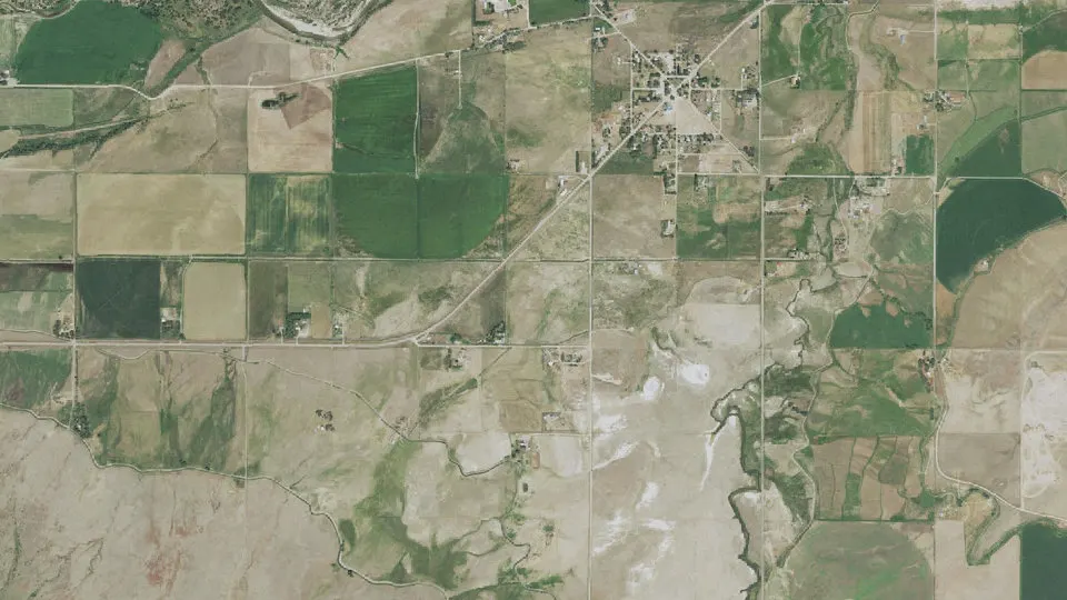
Fort Shaw is an unincorporated community (census-designated place) in Cascade County, Montana, with 256 residents (2020 Census). It sits at 3,504 ft (1,068 m) above sea level. The nearest town is Cascade Colony, 3.9 miles S.
- 256residents (2020 Census)
- 3,504 ftelevation · 1,068 m
- 5.7 sq miland area · 14.7 km²
- 45 / sq mipopulation density
- 59483ZIP code
About Fort Shaw
Fort Shaw is a census-designated place (CDP) in Cascade County, Montana, United States. The population was 256 at the 2020 census, a decrease from 280 at the 2010 census. Named for a former United States military outpost, it is part of the Great Falls, Montana Metropolitan Statistical Area.
First called Camp Reynolds, Fort Shaw is named for Col. Robert G. Shaw of Boston, the first white officer to lead a unit of the United States Colored Troops in the American Civil War. The U.S. government established this fort on the Mullan Road in 1867. A community developed around it. The fort was decommissioned in 1891 and repurposed as an Indian boarding school.
The Fort Shaw Indian girls' basketball team won every game but one from 1902 to 1906. They played in exhibition matches at the 1904 Louisiana Purchase Exposition and earned the title of "World champions".
In 1906 the U.S. Reclamation Service laid out the townsite about 1 mile south of the old fort. The Fort Shaw Historic District and Cemetery is part of the National Register of Historic Places. Portions of the fort that survived are now part of a museum and the historical society offers tours.
Text: Wikipedia · CC BY-SA 4.0
Fort Shaw weather: 7-day forecast
Loading the National Weather Service forecast…
Source: National Weather Service (NOAA).
Live webcams in Fort Shaw
Webcams: Windy.com
Living in Fort Shaw
- Median household income
- $56,413
- Median home value
- $184,500
- Median age
- 58.8
Do you know Fort Shaw? Tell us about it
Help other travelers: share what makes Fort Shaw special. We review every message before publishing it.
Map of Fort Shaw
Tap any street on the map to see it in Street View below. Map: © OpenStreetMap contributors.
Fort Shaw Street View
Drag the image to look around and tap the arrows on the ground to move. If it says there is no imagery, tap a nearby street on the map above.
Open in Google Maps ›Fort Shaw, MT population
Fort Shaw had 256 residents in the 2020 Census.
| 2020 Census | 256 |
|---|---|
| Density | 45 per sq mi (17 per km²) |
Source: U.S. Census Bureau, Decennial Census.
Fort Shaw at a glance
| State | Montana (MT) |
|---|---|
| County | Cascade County |
| Type | Census-designated place |
| Population | 256 (2020) |
| Land area | 5.68 sq mi (14.7 km²) |
| Elevation | 3,504 ft (1,068 m) |
| Coordinates | 47.4969° N, 111.8193° W |
| ZIP code | 59483 |
| Census code (GEOID) | 3028600 |
Sources: U.S. Census Bureau (Gazetteer, ZCTA), USGS GNIS, Wikidata.
Towns near Fort Shaw
- Cascade Colony3.9 mi S
- Sun River5.0 mi NE
- Simms6.3 mi W
- Fair Haven Colony10.9 mi SE
- Fairfield11.1 mi NW
- Vaughn12.7 mi E
- Ulm14.8 mi E
- Sun Prairie15.7 mi E
- Power16.5 mi N
- Cascade16.5 mi S
- Milford Colony21.7 mi SW
- Hardy21.7 mi S
Straight-line distance between town centers.
Frequently asked questions about Fort Shaw
What county is Fort Shaw in?
Fort Shaw is in Cascade County, Montana.
What is the population of Fort Shaw, MT?
256 people lived in Fort Shaw at the 2020 Census.
What is the ZIP code of Fort Shaw, MT?
The ZIP code of Fort Shaw is 59483.
What is the elevation of Fort Shaw?
3,504 feet (1,068 m) above sea level.
What towns are near Fort Shaw?
Cascade Colony (3.9 mi), Sun River (5.0 mi), Simms (6.3 mi), Fair Haven Colony (10.9 mi), Fairfield (11.1 mi).
Last updated: