Wyoming
City in Kent County, Michigan
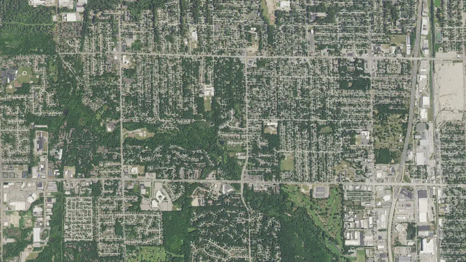
Wyoming is a city in Kent County, Michigan, with 76,501 residents (2020 Census). It sits at 643 ft (196 m) above sea level. The nearest town is Grandville, 2.4 miles W.
- 76,501residents (2020 Census)
- 643 ftelevation · 196 m
- 24.7 sq miland area · 64.1 km²
- 3,092 / sq mipopulation density
- 49519main ZIP code (4 in total)
About Wyoming
Wyoming is a city in Kent County in the U.S. state of Michigan. The population was 76,501 at the 2020 census. Part of the Grand Rapids metropolitan area, Wyoming is bordered by Grand Rapids to the northeast and, after Grand Rapids, it is the second most-populous city in West Michigan.
European-Americans settled the area in 1832 along Buck Creek, and it was organized as Wyoming Township in 1848 after separating from Byron Township. Through the 19th and early 20th centuries, Wyoming remained a rural area providing goods to Grand Rapids, until the Grand Rapids, Holland and Chicago Railway spurred suburbanization. After Grandville was incorporated in 1933 and the General Motors Stamping Division Plant opened, Wyoming faced annexation disputes with Grand Rapids and Grandville until incorporating as a city in 1959.
As a city, Wyoming became a regional retail and entertainment hub on the 28th Street corridor with the opening of Rogers Plaza and Studio 28. Development declined in the 1980s. Growth then shifted to Wyoming's southwest near RiverTown Crossings and later around Metro Health Hospital after 2007, though the GM plant closed in 2009. Since the mid-2010s, the city has focused on redeveloping 28th Street through the City Center project and repurposing the 74-acre former GM property, now called Site 36.
Text: Wikipedia · CC BY-SA 4.0
Wyoming weather: 7-day forecast
Loading the National Weather Service forecast…
Source: National Weather Service (NOAA).
Live webcams in Wyoming
Webcams: Windy.com
Living in Wyoming
- Median household income
- $73,677
- Median home value
- $225,200
- Median rent
- $1,196/mo
- Median age
- 34
Do you know Wyoming? Tell us about it
Help other travelers: share what makes Wyoming special. We review every message before publishing it.
Map of Wyoming
Tap any street on the map to see it in Street View below. Map: © OpenStreetMap contributors.
Wyoming Street View
Drag the image to look around and tap the arrows on the ground to move. If it says there is no imagery, tap a nearby street on the map above.
Open in Google Maps ›Wyoming, MI population
Wyoming had 76,501 residents in the 2020 Census.
| 2020 Census | 76,501 |
|---|---|
| Density | 3,092 per sq mi (1,194 per km²) |
Source: U.S. Census Bureau, Decennial Census.
Wyoming at a glance
| State | Michigan (MI) |
|---|---|
| County | Kent County |
| Type | City |
| Population | 76,501 (2020) |
| Land area | 24.74 sq mi (64.1 km²) |
| Water area | 0.21 sq mi (0.55 km²) |
| Elevation | 643 ft (196 m) |
| Coordinates | 42.8903° N, 85.7067° W |
| ZIP codes | 49519, 49418, 49509, 49548 |
| Official website | wyomingmi.gov |
| Census code (GEOID) | 2688940 |
Sources: U.S. Census Bureau (Gazetteer, ZCTA), USGS GNIS, Wikidata.
Towns near Wyoming
- Grandville2.4 mi W
- Cutlerville3.9 mi SE
- Grand Rapids5.5 mi NE
- Byron Center5.8 mi S
- Kentwood5.8 mi E
- Jenison6.2 mi W
- East Grand Rapids6.4 mi NE
- Walker7.8 mi N
- Hudsonville8.4 mi W
- Comstock Park10.7 mi N
- Dorr11.3 mi S
- Northview11.6 mi NE
Straight-line distance between town centers.
Frequently asked questions about Wyoming
What county is Wyoming in?
Wyoming is in Kent County, Michigan.
What is the population of Wyoming, MI?
76,501 people lived in Wyoming at the 2020 Census.
What is the ZIP code of Wyoming, MI?
The main ZIP code is 49519. Other ZIP codes: 49418, 49509, 49548.
What is the elevation of Wyoming?
643 feet (196 m) above sea level.
What towns are near Wyoming?
Grandville (2.4 mi), Cutlerville (3.9 mi), Grand Rapids (5.5 mi), Byron Center (5.8 mi), Kentwood (5.8 mi).
Last updated: