White Pine
Census-designated place in Ontonagon County, Michigan
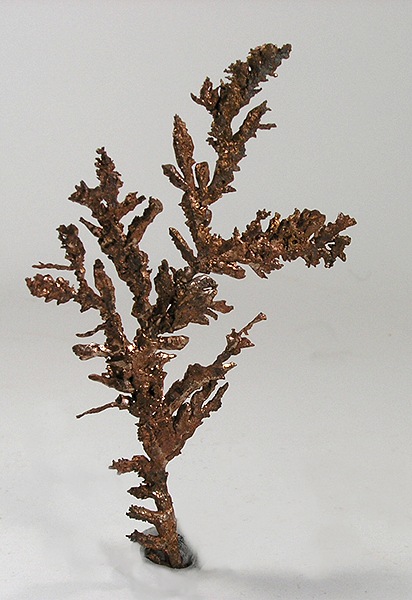
White Pine is an unincorporated community (census-designated place) in Ontonagon County, Michigan, with 339 residents (2020 Census). It sits at 899 ft (274 m) above sea level. The nearest town is Bergland, 10.3 miles S.
- 339residents (2020 Census)
- 899 ftelevation · 274 m
- 5.0 sq miland area · 13.0 km²
- 68 / sq mipopulation density
- 49971ZIP code
About White Pine
White Pine is an unincorporated community and census-designated place (CDP) in Ontonagon County in the U.S. state of Michigan. As of the 2020 census, White Pine had a population of 339. White Pine is located within Carp Lake Township.
Much of White Pine was developed in the 1950s as a company town for miners at the White Pine mine. Mining companies in Michigan often built and leased housing to workers so that miners could live adjacent to mine operations. This allowed mining companies to attract workers with families, which were believed to improve retention rates by ensuring miners were socially and financially invested in the town created by the mining company.
White Pine was developed as a typical post war suburb. Many dwellings were single-story ranch homes, although a trailer park and apartment complex were also built. The community never developed fully as the Copper Range Company envisioned. The automobile transformed how workers commuted where previous mine sites had workers walking from nearby housing to the mine, many workers by the 1950s preferred driving up to 90 miles a day to remain in their current homes rather than move to the company town.
Text: Wikipedia · CC BY-SA 4.0
White Pine weather: 7-day forecast
Loading the National Weather Service forecast…
Source: National Weather Service (NOAA).
Nearest webcams to White Pine
There are no webcams in White Pine itself. These are the closest, 34 miles away or more.
Webcams: Windy.com
Living in White Pine
- Median household income
- $39,861
- Median home value
- $59,500
- Median age
- 63.6
Do you know White Pine? Tell us about it
Help other travelers: share what makes White Pine special. We review every message before publishing it.
Map of White Pine
Tap any street on the map to see it in Street View below. Map: © OpenStreetMap contributors.
White Pine Street View
Drag the image to look around and tap the arrows on the ground to move. If it says there is no imagery, tap a nearby street on the map above.
Open in Google Maps ›White Pine, MI population
White Pine had 339 residents in the 2020 Census.
| 2020 Census | 339 |
|---|---|
| Density | 68 per sq mi (26 per km²) |
Source: U.S. Census Bureau, Decennial Census.
White Pine at a glance
| State | Michigan (MI) |
|---|---|
| County | Ontonagon County |
| Type | Census-designated place |
| Population | 339 (2020) |
| Land area | 5.00 sq mi (13.0 km²) |
| Elevation | 899 ft (274 m) |
| Coordinates | 46.7401° N, 89.5813° W |
| ZIP code | 49971 |
| Census code (GEOID) | 2686960 |
Sources: U.S. Census Bureau (Gazetteer, ZCTA), USGS GNIS, Wikidata.
Towns near White Pine
- Bergland10.3 mi S
- Lake Gogebic10.8 mi S
- Ontonagon15.4 mi NE
- Rockland19.0 mi E
- Ewen20.0 mi SE
- Greenland23.2 mi E
- Mass City23.5 mi E
- Bruce Crossing23.6 mi SE
- Wakefield24.7 mi SW
- Marenisco26.1 mi S
- Ramsay27.2 mi SW
- Bessemer28.7 mi SW
Straight-line distance between town centers.
Frequently asked questions about White Pine
What county is White Pine in?
White Pine is in Ontonagon County, Michigan.
What is the population of White Pine, MI?
339 people lived in White Pine at the 2020 Census.
What is the ZIP code of White Pine, MI?
The ZIP code of White Pine is 49971.
What is the elevation of White Pine?
899 feet (274 m) above sea level.
What towns are near White Pine?
Bergland (10.3 mi), Lake Gogebic (10.8 mi), Ontonagon (15.4 mi), Rockland (19.0 mi), Ewen (20.0 mi).
Last updated: