Queen Anne
Census-designated place in Prince George's County, Maryland
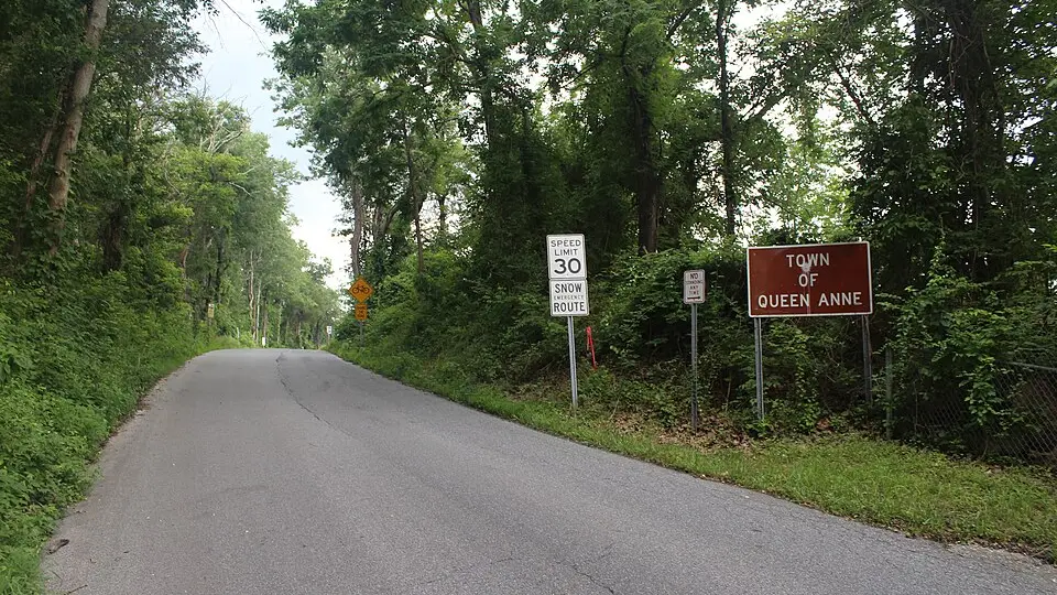
Queen Anne is an unincorporated community (census-designated place) in Prince George's County, Maryland, with 1,405 residents (2020 Census). It sits at 49 ft (15 m) above sea level. The nearest town is Bowie, 3.8 miles NW.
- 1,405residents (2020 Census)
- 49 ftelevation · 15 m
- 8.7 sq miland area · 22.6 km²
- 161 / sq mipopulation density
- 20716ZIP code
About Queen Anne
Queen Anne in Prince George's County, Maryland, United States, is a former port on the Patuxent River. It was delineated as a CDP for the 2010 census, at which time it had a population of 1,280. Per the 2020 census, the population was 1,405.
Text: Wikipedia · CC BY-SA 4.0
Queen Anne weather: 7-day forecast
Loading the National Weather Service forecast…
Source: National Weather Service (NOAA).
Live webcams in Queen Anne
Webcams: Windy.com
Things to do in Queen Anne
Top places to visit in and around Queen Anne: University of Maryland, Six Flags America and Greenbelt Park.
 University of MarylandHistoric house · 14 mi NW
 Six Flags AmericaTheme park · 3.6 mi W
 Greenbelt ParkNational park · 12 mi NW
 Kenilworth Park and Aquatic GardensNational park · 13 mi W
Family attractions (2)Museums & galleries (10)Historic sites & landmarks (10)Parks & gardens (10)Hiking trails (4)Beaches (1)Nature reserves & natural wonders (8)Wineries, breweries & distilleries (1)Theaters & public art (10)Campgrounds & picnic areas (1)Golf, marinas & outdoor sports (2)
All 59 things to do in Queen Anne ›Living in Queen Anne
- Median household income
- $102,727
- Median home value
- $822,600
- Median age
- 58.4
Small communities near Queen Anne
- Kidwells Corner1.0 mi SW
- Queen Anne Knolls1.1 mi S
- Queen Anne Estates1.3 mi S
- Riverwood1.9 mi NE
- Trails End Trailer Park2.0 mi SE
- Davidsonville Woods2.3 mi E
- Velmeade2.4 mi E
- Davidsonville Gardens2.8 mi SE
- The Sands3.0 mi SE
- Royale Glen3.2 mi NE
- Essington subdivision3.2 mi NW
- Hawthorne Woods3.2 mi SE
- Heather Hills subdivision3.3 mi N
- Davidsonville4.3 mi E
- Sherwood Manor4.4 mi N
- Dodon4.5 mi E
Schools near Queen Anne
There are no public schools inside Queen Anne. The nearest elementary school is Pointer Ridge Elementary (1.2 mi W); the nearest middle school is Benjamin Tasker Middle (4.2 mi NW); the nearest high school is Southern High (5.3 mi SE).
| School | Grades | Students | Students per teacher | Type | Distance |
|---|---|---|---|---|---|
| Pointer Ridge Elementary Bowie · Prince George's County Public Schools | K–5 | 416 | 13.4 | Public | 1.2 mi W |
| C. Elizabeth Rieg Mitchellville · Prince George's County Public Schools | K–12 | 148 | 5.9 | Public | 1.8 mi NW |
| Northview Elementary Bowie · Prince George's County Public Schools | PK–5 | 587 | 13.3 | Public | 3.1 mi NW |
| Heather Hills Elementary Bowie · Prince George's County Public Schools | 2–5 | 361 | 15.0 | Public | 3.4 mi NW |
| Davidsonville Elementary Davidsonville · Anne Arundel County Public Schools | K–5 | 689 | 17.2 | Public | 3.7 mi E |
| Imagine Foundations at Leeland PCS Upper Marlboro · Prince George's County Public Schools | K–8 | 480 | 15.0 | Charter | 3.7 mi SW |
Do you know Queen Anne? Tell us about it
Help other travelers: share what makes Queen Anne special. We review every message before publishing it.
Map of Queen Anne
Tap any street on the map to see it in Street View below. Map: © OpenStreetMap contributors.
Queen Anne Street View
Drag the image to look around and tap the arrows on the ground to move. If it says there is no imagery, tap a nearby street on the map above.
Open in Google Maps ›Queen Anne, MD population
Queen Anne had 1,405 residents in the 2020 Census.
| 2020 Census | 1,405 |
|---|---|
| Density | 161 per sq mi (62 per km²) |
Source: U.S. Census Bureau, Decennial Census.
Queen Anne at a glance
| State | Maryland (MD) |
|---|---|
| County | Prince George's County |
| Type | Census-designated place |
| Population | 1,405 (2020) |
| Land area | 8.71 sq mi (22.6 km²) |
| Water area | 0.02 sq mi (0.06 km²) |
| Elevation | 49 ft (15 m) |
| Coordinates | 38.9064° N, 76.7053° W |
| ZIP code | 20716 |
| Census code (GEOID) | 2464495 |
Sources: U.S. Census Bureau (Gazetteer, ZCTA), USGS GNIS, Wikidata.
Towns near Queen Anne
- Bowie3.8 mi NW
- Woodmore3.9 mi W
- Brock Hall4.0 mi SW
- Marlboro Meadows4.5 mi S
- Kettering4.7 mi W
- Fairwood5.1 mi NW
- Brown Station5.8 mi SW
- Mitchellville5.9 mi W
- Marlboro Village6.0 mi SW
- Largo6.6 mi W
- Riva6.8 mi NE
- Lake Arbor6.8 mi W
Straight-line distance between town centers.
Frequently asked questions about Queen Anne
What county is Queen Anne in?
Queen Anne is in Prince George's County, Maryland.
What is the population of Queen Anne, MD?
1,405 people lived in Queen Anne at the 2020 Census.
What is the ZIP code of Queen Anne, MD?
The ZIP code of Queen Anne is 20716.
What is the elevation of Queen Anne?
49 feet (15 m) above sea level.
What towns are near Queen Anne?
Bowie (3.8 mi), Woodmore (3.9 mi), Brock Hall (4.0 mi), Marlboro Meadows (4.5 mi), Kettering (4.7 mi).
Last updated: