Bryans Road
Census-designated place in Charles County, Maryland
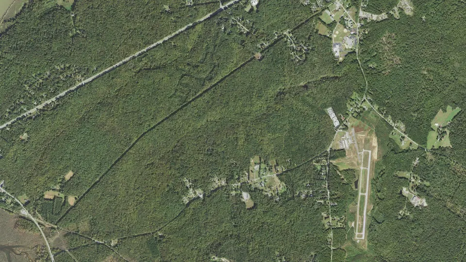
Bryans Road is an unincorporated community (census-designated place) in Charles County, Maryland, with 8,650 residents (2020 Census). It sits at 177 ft (54 m) above sea level. The nearest town is Potomac Heights, 2.2 miles W.
- 8,650residents (2020 Census)
- 177 ftelevation · 54 m
- 15.4 sq miland area · 39.8 km²
- 562 / sq mipopulation density
- 20616ZIP code
About Bryans Road
Bryans Road is a census-designated place (CDP) in Charles County, Maryland, United States. Per the 2020 census, the population was 8,650.
Bryans Road was named after Oliver Norris Bryan, a 19th-century farmer and scientist who owned and operated Locust Grove Farm near Marshall Hall. The area consisted mostly of tobacco farms until the establishment of the Naval Proving Grounds at Indian Head in 1890. Some commercial establishments came about by the early 1920s, when the name "Bryans Road" first appeared on maps. The construction of Maryland Route 210 (Indian Head Highway) during World War II brought new traffic. By the early 1960s, Bryans Road became an established bedroom community for both Indian Head and Washington, D.C.
At the main intersection of Bryans Road, a shopping center includes a supermarket, various gas stations, and assorted retail stores that serves the community. Local residents commute to work at the Indian Head Naval Surface Warfare Center, while others commute to employment centers throughout the greater Washington, D.C. metropolitan area. In 1998, plans for a massive housing development project at Chapman's Landing were thwarted by the Maryland state government, which bought the property to preserve green space under its smart growth policy.
Marshall Hall was listed on the National Register of Historic Places in 1976, and Mount Aventine was listed in the Register in 1996.
Text: Wikipedia · CC BY-SA 4.0
Bryans Road weather: 7-day forecast
Loading the National Weather Service forecast…
Source: National Weather Service (NOAA).
Live webcams in Bryans Road
Webcams: Windy.com
Living in Bryans Road
- Median household income
- $118,361
- Median home value
- $377,300
- Median rent
- $2,169/mo
- Median age
- 37.8
Do you know Bryans Road? Tell us about it
Help other travelers: share what makes Bryans Road special. We review every message before publishing it.
Map of Bryans Road
Tap any street on the map to see it in Street View below. Map: © OpenStreetMap contributors.
Bryans Road Street View
Drag the image to look around and tap the arrows on the ground to move. If it says there is no imagery, tap a nearby street on the map above.
Open in Google Maps ›Bryans Road, MD population
Bryans Road had 8,650 residents in the 2020 Census.
| 2020 Census | 8,650 |
|---|---|
| Density | 562 per sq mi (217 per km²) |
Source: U.S. Census Bureau, Decennial Census.
Bryans Road at a glance
| State | Maryland (MD) |
|---|---|
| County | Charles County |
| Type | Census-designated place |
| Population | 8,650 (2020) |
| Land area | 15.38 sq mi (39.8 km²) |
| Water area | 0.00 sq mi (0.00 km²) |
| Elevation | 177 ft (54 m) |
| Coordinates | 38.6044° N, 77.0922° W |
| ZIP code | 20616 |
| Census code (GEOID) | 2410925 |
Sources: U.S. Census Bureau (Gazetteer, ZCTA), USGS GNIS, Wikidata.
Towns near Bryans Road
- Potomac Heights2.2 mi W
- Indian Head3.4 mi W
- Pomfret4.1 mi SE
- Bensville4.8 mi E
- Mason Neck, VA5.3 mi NW
- Accokeek7.0 mi NE
- Port Tobacco Village7.5 mi SE
- Mount Vernon, VA7.6 mi N
- La Plata7.8 mi SE
- Fort Belvoir, VA8.0 mi N
- Woodlawn, VA9.0 mi N
- Woodbridge, VA9.2 mi W
Straight-line distance between town centers.
Frequently asked questions about Bryans Road
What county is Bryans Road in?
Bryans Road is in Charles County, Maryland.
What is the population of Bryans Road, MD?
8,650 people lived in Bryans Road at the 2020 Census.
What is the ZIP code of Bryans Road, MD?
The ZIP code of Bryans Road is 20616.
What is the elevation of Bryans Road?
177 feet (54 m) above sea level.
What towns are near Bryans Road?
Potomac Heights (2.2 mi), Indian Head (3.4 mi), Pomfret (4.1 mi), Bensville (4.8 mi), Mason Neck (5.3 mi).
Last updated: