New Orleans Station
Census-designated place in Plaquemines Parish, Louisiana
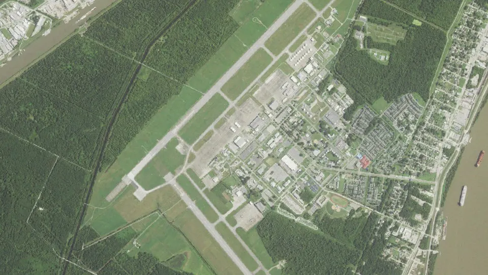
New Orleans Station is an unincorporated community (census-designated place) in Plaquemines Parish, Louisiana, with 2,508 residents (2020 Census). The nearest town is Belle Chasse, 2.6 miles NE.
- 2,508residents (2020 Census)
- 5.2 sq miland area · 13.5 km²
- 482 / sq mipopulation density
- 70058ZIP code
About New Orleans Station
Naval Air Station Joint Reserve Base New Orleans is a base of the United States military located in Belle Chasse, unincorporated Plaquemines Parish, Louisiana, United States. NAS JRB New Orleans is home to a Navy Reserve aggressor squadron and a fleet logistics support squadron, the 159th Fighter Wing (159 FW) of the Louisiana Air National Guard, Coast Guard Air Station New Orleans, a detachment of a Marine Corps Reserve light helicopter attack squadron, as well as other US Navy and US Army activities. The base has a 24/7 operating schedule to support both the 159 FW's NORAD air sovereignty/homeland defense requirements and for Coast Guard Air Station New Orleans search and rescue/maritime law enforcement/port security missions. It contains a military airport known as Alvin Callender Field (IATA: NBG, ICAO: KNBG, FAA LID: NBG) which is located about six nautical miles (12 km) south of the central business district of New Orleans. The base's predecessor, NAS New Orleans, occupied the current location of the University of New Orleans's principal campus until 1957.
Text: Wikipedia · CC BY-SA 4.0
New Orleans Station weather: 7-day forecast
Loading the National Weather Service forecast…
Source: National Weather Service (NOAA).
Live webcams in New Orleans Station
Webcams: Windy.com
Living in New Orleans Station
- Median household income
- $59,474
- Median rent
- $1,825/mo
- Median age
- 25.6
Do you know New Orleans Station? Tell us about it
Help other travelers: share what makes New Orleans Station special. We review every message before publishing it.
Map of New Orleans Station
Tap any street on the map to see it in Street View below. Map: © OpenStreetMap contributors.
New Orleans Station Street View
Drag the image to look around and tap the arrows on the ground to move. If it says there is no imagery, tap a nearby street on the map above.
Open in Google Maps ›New Orleans Station, LA population
New Orleans Station had 2,508 residents in the 2020 Census.
| 2020 Census | 2,508 |
|---|---|
| Density | 482 per sq mi (186 per km²) |
Source: U.S. Census Bureau, Decennial Census.
New Orleans Station at a glance
| State | Louisiana (LA) |
|---|---|
| County | Plaquemines Parish |
| Type | Census-designated place |
| Population | 2,508 (2020) |
| Land area | 5.20 sq mi (13.5 km²) |
| Water area | 0.05 sq mi (0.14 km²) |
| Coordinates | 29.8270° N, 90.0256° W |
| ZIP code | 70058 |
| Census code (GEOID) | 2255074 |
Sources: U.S. Census Bureau (Gazetteer, ZCTA), USGS GNIS, Wikidata.
Towns near New Orleans Station
- Belle Chasse2.6 mi NE
- Woodmere3.2 mi W
- Timberlane3.5 mi N
- Estelle4.2 mi W
- Harvey4.9 mi NW
- Terrytown5.2 mi N
- Gretna6.0 mi N
- Marrero6.6 mi NW
- Jean Lafitte6.8 mi SW
- Poydras8.6 mi E
- Chalmette8.8 mi NE
- Arabi8.9 mi N
Straight-line distance between town centers.
Frequently asked questions about New Orleans Station
What county is New Orleans Station in?
New Orleans Station is in Plaquemines Parish, Louisiana.
What is the population of New Orleans Station, LA?
2,508 people lived in New Orleans Station at the 2020 Census.
What is the ZIP code of New Orleans Station, LA?
The ZIP code of New Orleans Station is 70058.
What towns are near New Orleans Station?
Belle Chasse (2.6 mi), Woodmere (3.2 mi), Timberlane (3.5 mi), Estelle (4.2 mi), Harvey (4.9 mi).
Last updated: