Spottsville
Census-designated place in Henderson County, Kentucky
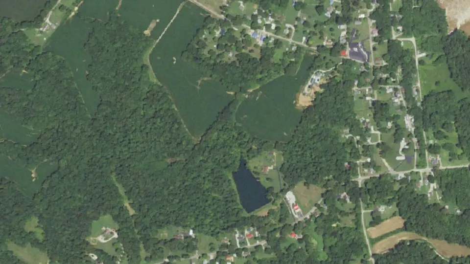
Spottsville is an unincorporated community (census-designated place) in Henderson County, Kentucky, with 274 residents (2020 Census). It sits at 397 ft (121 m) above sea level. The nearest town is Newburgh, 6.5 miles N.
- 274residents (2020 Census)
- 397 ftelevation · 121 m
- 0.5 sq miland area · 1.2 km²
- 581 / sq mipopulation density
- 42458ZIP code
About Spottsville
Spottsville is a census-designated place (CDP) and former coal town in Henderson County, Kentucky, United States. As of the 2020 census, Spottsville had a population of 274.
U.S. Route 60 forms the northern edge of Spottsville, and the Green River forms the eastern edge. The first Spottsville Bridge over the Green River opened on December 17, 1931. In September 2013, the Kentucky Transportation Cabinet determined that the structure was functionally obsolete because of its narrow deck width and was structurally deficient. The new Spottsville Bridge was completed in 2022, with the ribbon being cut by Irma Stanley Day who had cut the ribbon on the original Spottsville Bridge in 1931.
The Green River Lock & Dam is located in the community. Traveling east through Spottsville, one can see the lock to one's right when one crosses the US-60 bridge (the Green River Bridge). One can still see some of the remains of the old locks that were replaced in the mid-1960s; to one's left, one can see a turning bridge for trains (it turns when a barge comes through).
US-60 leads east 19 miles (31 km) to Owensboro and west 11 miles (18 km) to Henderson, the Henderson County seat.
There is one elementary school in Spottsville, serving all of the eastern part of Henderson County (including Beals, Baskett, and Reed). The original Spottsville school, which served all grades, provided Henderson County's first school bus service in 1920. This original Spottsville school burned down in March 1932.
Spottsville was named for Major Samuel Spotts, who shot the first gun at the Battle of New Orleans. The area was visited by the Spanish explorer Hernando de Soto in 1541. His army was attacked near the Ohio River by Indians of a tribe or tribes called variously the Kashinampo, the Quizqui, and the Chiska Cherokee.
From 1904 to 1911 as many as 116 men of the Green River Coal Company mined coal in Spottsville. The Pittsburgh Coal Company operated a 75-man coal camp in Spottsville from 1911 to 1924.
Text: Wikipedia · CC BY-SA 4.0
Spottsville weather: 7-day forecast
Loading the National Weather Service forecast…
Source: National Weather Service (NOAA).
Live webcams in Spottsville
Webcams: Windy.com
Living in Spottsville
- Median household income
- $59,866
- Median home value
- $95,500
- Median age
- 58.5
Do you know Spottsville? Tell us about it
Help other travelers: share what makes Spottsville special. We review every message before publishing it.
Map of Spottsville
Tap any street on the map to see it in Street View below. Map: © OpenStreetMap contributors.
Spottsville Street View
Drag the image to look around and tap the arrows on the ground to move. If it says there is no imagery, tap a nearby street on the map above.
Open in Google Maps ›Spottsville, KY population
Spottsville had 274 residents in the 2020 Census.
| 2020 Census | 274 |
|---|---|
| Density | 581 per sq mi (224 per km²) |
Source: U.S. Census Bureau, Decennial Census.
Spottsville at a glance
| State | Kentucky (KY) |
|---|---|
| County | Henderson County |
| Type | Census-designated place |
| Population | 274 (2020) |
| Land area | 0.47 sq mi (1.2 km²) |
| Water area | 0.01 sq mi (0.02 km²) |
| Elevation | 397 ft (121 m) |
| Coordinates | 37.8552° N, 87.4193° W |
| ZIP code | 42458 |
| Census code (GEOID) | 2172570 |
Sources: U.S. Census Bureau (Gazetteer, ZCTA), USGS GNIS, Wikidata.
Towns near Spottsville
- Newburgh, IN6.5 mi N
- Henderson8.8 mi W
- Anthoston9.1 mi SW
- Curdsville9.5 mi SE
- Stanley10.1 mi E
- Evansville, IN11.1 mi NW
- Hatfield, IN11.3 mi E
- St. Joseph12.3 mi SE
- Melody Hill, IN12.8 mi NW
- Chandler, IN12.8 mi N
- West Louisville13.0 mi SE
- Sorgho13.6 mi SE
Straight-line distance between town centers.
Frequently asked questions about Spottsville
What county is Spottsville in?
Spottsville is in Henderson County, Kentucky.
What is the population of Spottsville, KY?
274 people lived in Spottsville at the 2020 Census.
What is the ZIP code of Spottsville, KY?
The ZIP code of Spottsville is 42458.
What is the elevation of Spottsville?
397 feet (121 m) above sea level.
What towns are near Spottsville?
Newburgh (6.5 mi), Henderson (8.8 mi), Anthoston (9.1 mi), Curdsville (9.5 mi), Stanley (10.1 mi).
Last updated: