Mockingbird Valley
City in Jefferson County, Kentucky
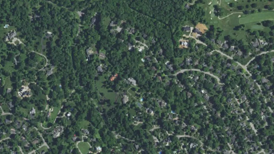
Mockingbird Valley is a city in Jefferson County, Kentucky, with 175 residents (2020 Census). It sits at 446 ft (136 m) above sea level. The nearest town is Rolling Fields, 0.5 miles E.
- 175residents (2020 Census)
- 446 ftelevation · 136 m
- 0.2 sq miland area · 0.5 km²
- 846 / sq mipopulation density
- 40041ZIP code
About Mockingbird Valley
Mockingbird Valley is a home rule-class city in Jefferson County, Kentucky, United States. Since incorporation, there has been some interest in making it a historic preservation district, largely to prevent unwanted development. As of the 2020 census, Mockingbird Valley had a population of 175. It has the highest per capita income of any location in Kentucky and the tenth-highest of any location in the United States.
Located directly to the east of Louisville along the Ohio River, Mockingbird Valley is frequently referred to as a "country enclave" and is noted for its rural feel. It is located on river bluffs and rolling hills, with large homes set back from the road, heavy tree density, bridges and walls using traditional local materials, as well as undisturbed rock outcroppings. One-third of the roads are privately owned, and the entire city is zoned residential except for a small commercial parking lot.
Text: Wikipedia · CC BY-SA 4.0
Mockingbird Valley weather: 7-day forecast
Loading the National Weather Service forecast…
Source: National Weather Service (NOAA).
Live webcams in Mockingbird Valley
Webcams: Windy.com
Living in Mockingbird Valley
- Median household income
- $250,001
- Median home value
- $1,178,600
- Median age
- 60.3
Do you know Mockingbird Valley? Tell us about it
Help other travelers: share what makes Mockingbird Valley special. We review every message before publishing it.
Map of Mockingbird Valley
Tap any street on the map to see it in Street View below. Map: © OpenStreetMap contributors.
Mockingbird Valley Street View
Drag the image to look around and tap the arrows on the ground to move. If it says there is no imagery, tap a nearby street on the map above.
Open in Google Maps ›Mockingbird Valley, KY population
Mockingbird Valley had 175 residents in the 2020 Census.
| 2020 Census | 175 |
|---|---|
| Density | 846 per sq mi (326 per km²) |
Source: U.S. Census Bureau, Decennial Census.
Mockingbird Valley at a glance
| State | Kentucky (KY) |
|---|---|
| County | Jefferson County |
| Type | City |
| Population | 175 (2020) |
| Land area | 0.21 sq mi (0.5 km²) |
| Water area | 0.00 sq mi (0.00 km²) |
| Elevation | 446 ft (136 m) |
| Coordinates | 38.2704° N, 85.6793° W |
| ZIP code | 40041 |
| Census code (GEOID) | 2152842 |
Sources: U.S. Census Bureau (Gazetteer, ZCTA), USGS GNIS, Wikidata.
Towns near Mockingbird Valley
- Rolling Fields0.5 mi E
- Brownsboro Village0.9 mi SE
- Druid Hills1.0 mi E
- Bellewood1.3 mi SE
- Riverwood1.3 mi NE
- Indian Hills1.3 mi N
- Maryhill Estates1.4 mi E
- Windy Hills2.2 mi E
- Glenview2.3 mi NE
- Richlawn2.3 mi SE
- Norbourne Estates2.4 mi SE
- Northfield2.6 mi NE
Straight-line distance between town centers.
Frequently asked questions about Mockingbird Valley
What county is Mockingbird Valley in?
Mockingbird Valley is in Jefferson County, Kentucky.
What is the population of Mockingbird Valley, KY?
175 people lived in Mockingbird Valley at the 2020 Census.
What is the ZIP code of Mockingbird Valley, KY?
The ZIP code of Mockingbird Valley is 40041.
What is the elevation of Mockingbird Valley?
446 feet (136 m) above sea level.
What towns are near Mockingbird Valley?
Rolling Fields (0.5 mi), Brownsboro Village (0.9 mi), Druid Hills (1.0 mi), Bellewood (1.3 mi), Riverwood (1.3 mi).
Last updated: