Fort Knox
Census-designated place in Hardin County, Kentucky
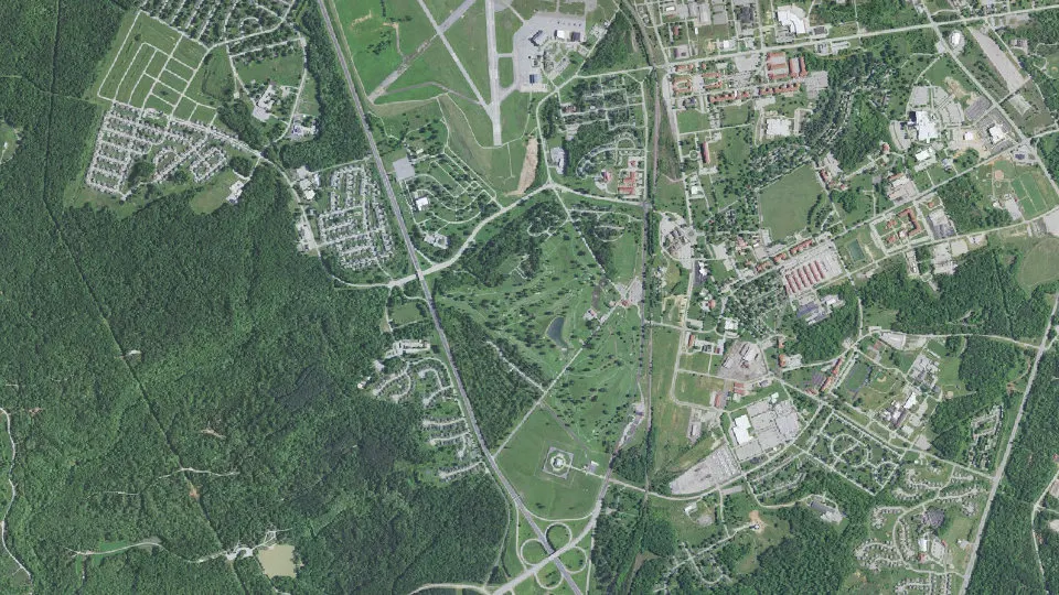
Fort Knox is an unincorporated community (census-designated place) in Hardin County, Kentucky, with 7,742 residents (2020 Census). It sits at 738 ft (225 m) above sea level. The nearest town is Muldraugh, 3.4 miles NW.
- 7,742residents (2020 Census)
- 738 ftelevation · 225 m
- 20.3 sq miland area · 52.5 km²
- 382 / sq mipopulation density
- 40121ZIP code
About Fort Knox
Fort Knox is a United States Army installation in Kentucky, south of Louisville and north of Elizabethtown. It is adjacent to the United States Bullion Depository (also known as Fort Knox), which is used to house a large portion of the United States' official gold reserves.
The 109,000-acre (170 sq mi; 440 km2) base covers parts of Bullitt, Hardin and Meade counties. It currently holds the Army Human Resources Center of Excellence, including the Army Human Resources Command. It is named in honor of Henry Knox, Chief of Artillery in the American Revolutionary War and the first United States secretary of war.
For 60 years, Fort Knox was the home of the U.S. Army Armor Center and School, and was used by both the Army and the Marine Corps to train crews on the American tanks of the day; the last was the M1 Abrams main battle tank. The history of the U.S. Army's Cavalry and Armored forces, and of General George S. Patton's career, is shown at the General George Patton Museum on the grounds of Fort Knox.
In 2011, the U.S. Army Armor School moved to Fort Benning, Georgia, where the Infantry School is also based. In 2014, the U.S. Army Cadet Command relocated to Fort Knox and all summer training for ROTC cadets now takes place there.
On 16 October 2020, V Corps was reactivated at Fort Knox, just over seven years after the colors were last cased in Wiesbaden, Germany, in July 2013.
Text: Wikipedia · CC BY-SA 4.0
Fort Knox weather: 7-day forecast
Loading the National Weather Service forecast…
Source: National Weather Service (NOAA).
Live webcams in Fort Knox
Webcams: Windy.com
Living in Fort Knox
- Median household income
- $82,663
- Median rent
- $1,502/mo
- Median age
- 24
Do you know Fort Knox? Tell us about it
Help other travelers: share what makes Fort Knox special. We review every message before publishing it.
Map of Fort Knox
Tap any street on the map to see it in Street View below. Map: © OpenStreetMap contributors.
Fort Knox Street View
Drag the image to look around and tap the arrows on the ground to move. If it says there is no imagery, tap a nearby street on the map above.
Open in Google Maps ›Fort Knox, KY population
Fort Knox had 7,742 residents in the 2020 Census.
| 2020 Census | 7,742 |
|---|---|
| Density | 382 per sq mi (147 per km²) |
Source: U.S. Census Bureau, Decennial Census.
Fort Knox at a glance
| State | Kentucky (KY) |
|---|---|
| County | Hardin County |
| Type | Census-designated place |
| Population | 7,742 (2020) |
| Land area | 20.29 sq mi (52.5 km²) |
| Water area | 0.11 sq mi (0.27 km²) |
| Elevation | 738 ft (225 m) |
| Coordinates | 37.8916° N, 85.9672° W |
| ZIP code | 40121 |
| Census code (GEOID) | 2128540 |
Sources: U.S. Census Bureau (Gazetteer, ZCTA), USGS GNIS, Wikidata.
Towns near Fort Knox
- Muldraugh3.4 mi NW
- Radcliff5.2 mi S
- Vine Grove5.6 mi S
- West Point6.5 mi N
- Doe Valley9.6 mi NW
- Rineyville10.3 mi S
- Laconia, IN11.6 mi NW
- Ekron11.7 mi W
- Brandenburg13.7 mi NW
- Lebanon Junction13.9 mi E
- Elizabethtown14.2 mi S
- Mauckport, IN15.6 mi NW
Straight-line distance between town centers.
Frequently asked questions about Fort Knox
What county is Fort Knox in?
Fort Knox is in Hardin County, Kentucky.
What is the population of Fort Knox, KY?
7,742 people lived in Fort Knox at the 2020 Census.
What is the ZIP code of Fort Knox, KY?
The ZIP code of Fort Knox is 40121.
What is the elevation of Fort Knox?
738 feet (225 m) above sea level.
What towns are near Fort Knox?
Muldraugh (3.4 mi), Radcliff (5.2 mi), Vine Grove (5.6 mi), West Point (6.5 mi), Doe Valley (9.6 mi).
Last updated: