Beaverdale
Census-designated place in Des Moines County, Iowa
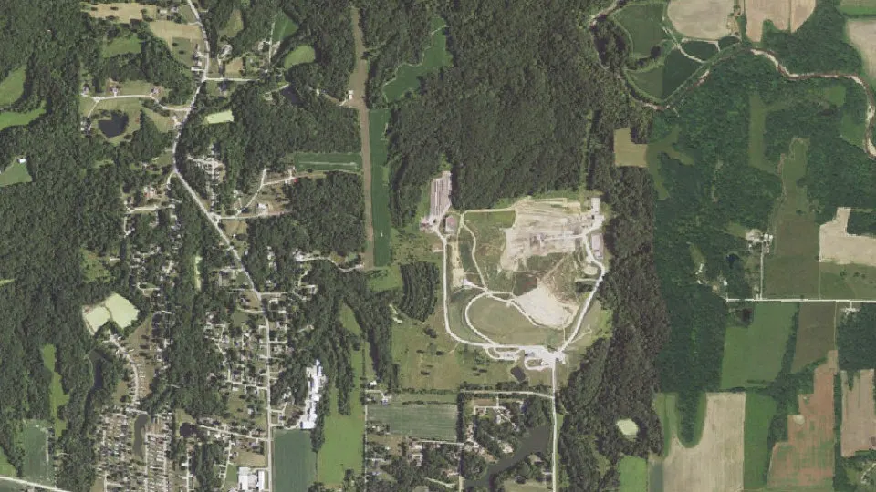
Beaverdale is an unincorporated community (census-designated place) in Des Moines County, Iowa, with 880 residents (2020 Census). It sits at 292 ft (89 m) above sea level. The nearest town is West Burlington, 2.4 miles SE.
- 880residents (2020 Census)
- 292 ftelevation · 89 m
- 3.2 sq miland area · 8.2 km²
- 279 / sq mipopulation density
- 52655ZIP code
About Beaverdale
The Beaverdale neighborhood is one of the largest of the 51 recognized neighborhood associations in the city of Des Moines, Iowa, in the United States. It extends from Forest Avenue at its southernmost border to the city limits at its northern border.
Once considered the rural, western edge of nineteenth century Des Moines, what is now Beaverdale consisted of large land tracts devoted to fruit orchards and truck farms. Early traffic crossed the area on an unpaved stagecoach highway known, since before the Civil War, as the Fort Dodge Stage Road. The road was renamed Beaver Avenue in 1903 and was later improved in 1917 with brick paving. The entire northwest section of Des Moines was commonly known as "Urbandale" until 1917, when the name was formally adopted by an adjacent suburban village. Soon afterwards, city residents from the area met and selected "Beaverdale" as the name to identify their neighborhood.
Most of the subdivisions were developed in the period between 1920 and 1940, when cars were becoming an essential part of every household. A major phase of construction occurred after the economic depression of the 1930s. Federal mortgage financing was created to encourage home buying. The local developers followed a variety of traditional home designs and they incorporated the latest trends in electrical conveniences into their plans. It was during this time, in 1938, that the fashionable "Beaverdale Brick" homes, built by local contractor E.T. McMurray, appeared. For the most part, the subdivisions were laid out in basic grid patterns, a convenient standard throughout Midwestern urban development. Two exceptions, Maryland Park and Ashby Manor, are notable for their winding drives and their early attention to design elements that create distinctive and attractive home settings.
In 2017, the neighborhood celebrated its centennial, marking 100 years of existence. A 116-foot-long Beaverdale mural was painted on the north wall of Uptempo Music, 2714 Beaver Ave.
Text: Wikipedia · CC BY-SA 4.0
Beaverdale weather: 7-day forecast
Loading the National Weather Service forecast…
Source: National Weather Service (NOAA).
Live webcams in Beaverdale
Webcams: Windy.com
Living in Beaverdale
- Median household income
- $57,357
- Median home value
- $170,900
- Median age
- 48.1
Do you know Beaverdale? Tell us about it
Help other travelers: share what makes Beaverdale special. We review every message before publishing it.
Map of Beaverdale
Tap any street on the map to see it in Street View below. Map: © OpenStreetMap contributors.
Beaverdale Street View
Drag the image to look around and tap the arrows on the ground to move. If it says there is no imagery, tap a nearby street on the map above.
Open in Google Maps ›Beaverdale, IA population
Beaverdale had 880 residents in the 2020 Census.
| 2020 Census | 880 |
|---|---|
| Density | 279 per sq mi (108 per km²) |
Source: U.S. Census Bureau, Decennial Census.
Beaverdale at a glance
| State | Iowa (IA) |
|---|---|
| County | Des Moines County |
| Type | Census-designated place |
| Population | 880 (2020) |
| Land area | 3.16 sq mi (8.2 km²) |
| Water area | 0.03 sq mi (0.08 km²) |
| Elevation | 292 ft (89 m) |
| Coordinates | 40.8504° N, 91.1999° W |
| ZIP code | 52655 |
| Official website | beaverdale.org |
| Census code (GEOID) | 1905200 |
Sources: U.S. Census Bureau (Gazetteer, ZCTA), USGS GNIS, Wikidata.
Towns near Beaverdale
- West Burlington2.4 mi SE
- Middletown3.6 mi SW
- Burlington5.0 mi SE
- Danville6.0 mi W
- Gulfport, IL6.7 mi SE
- Oak Hills7.1 mi S
- Augusta7.4 mi SW
- Sperry8.0 mi N
- Wever10.1 mi S
- Carman, IL10.7 mi SE
- Denmark10.8 mi SW
- Mediapolis11.0 mi N
Straight-line distance between town centers.
Frequently asked questions about Beaverdale
What county is Beaverdale in?
Beaverdale is in Des Moines County, Iowa.
What is the population of Beaverdale, IA?
880 people lived in Beaverdale at the 2020 Census.
What is the ZIP code of Beaverdale, IA?
The ZIP code of Beaverdale is 52655.
What is the elevation of Beaverdale?
292 feet (89 m) above sea level.
What towns are near Beaverdale?
West Burlington (2.4 mi), Middletown (3.6 mi), Burlington (5.0 mi), Danville (6.0 mi), Gulfport (6.7 mi).
Last updated: