Wahiawa
Census-designated place in Honolulu County, Hawaii
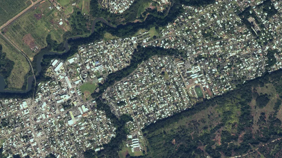
Wahiawa is an unincorporated community (census-designated place) in Honolulu County, Hawaii, with 18,658 residents (2020 Census). It sits at 942 ft (287 m) above sea level. The nearest town is Whitmore Village, 1.1 miles NW.
- 18,658residents (2020 Census)
- 942 ftelevation · 287 m
- 2.3 sq miland area · 5.9 km²
- 8,150 / sq mipopulation density
- 96857ZIP code
About Wahiawa
Wahiawā (Hawaiian pronunciation: [wəhijəˈvaː] ) is a census-designated place (CDP) in Honolulu County, Hawaii, United States, on the island of Oahu. It is in the Wahiawā District, on the plateau or "central valley" between the two volcanic mountains that bookend the island. In Hawaiian, wahi a wā means "place of the wa people". The population was 18,658 at the 2020 census.
Lakes and reservoirs are rare in Hawaii, and Wahiawā is unique in being surrounded on three sides by Lake Wilson (also known as Wahiawā Reservoir or Kaukonahua). The town must be reached by either of two bridges on Kamehameha Highway (State Rte. 80) across the reservoir's narrow north and south arms. Outside of the reservoir, the town used to be surrounded by military bases and agricultural fields, but development is making its way up from the increasingly urbanized southern portion of the central plain. Still, there are significant U.S. Army facilities in the area, including Schofield Barracks, Wheeler Army Airfield, and East Range, an Army training area extending into the hills south and east of town. Schofield Barracks alone is larger than Wahiawā CDP. Wahiawā is also home to the United States Navy's Naval Computer and Telecommunications Area Master Station Pacific and the housing community HMR.
The U.S. postal codes for Wahiawā are 96786 and 96857.
Text: Wikipedia · CC BY-SA 4.0
Wahiawa weather: 7-day forecast
Loading the National Weather Service forecast…
Source: National Weather Service (NOAA).
Live webcams in Wahiawa
Webcams: Windy.com
Living in Wahiawa
- Median household income
- $87,143
- Median home value
- $806,200
- Median rent
- $1,546/mo
- Median age
- 38.8
Do you know Wahiawa? Tell us about it
Help other travelers: share what makes Wahiawa special. We review every message before publishing it.
Map of Wahiawa
Tap any street on the map to see it in Street View below. Map: © OpenStreetMap contributors.
Wahiawa Street View
Drag the image to look around and tap the arrows on the ground to move. If it says there is no imagery, tap a nearby street on the map above.
Open in Google Maps ›Wahiawa, HI population
Wahiawa had 18,658 residents in the 2020 Census.
| 2020 Census | 18,658 |
|---|---|
| Density | 8,150 per sq mi (3,147 per km²) |
Source: U.S. Census Bureau, Decennial Census.
Wahiawa at a glance
| State | Hawaii (HI) |
|---|---|
| County | Honolulu County |
| Type | Census-designated place |
| Population | 18,658 (2020) |
| Land area | 2.29 sq mi (5.9 km²) |
| Water area | 0.25 sq mi (0.65 km²) |
| Elevation | 942 ft (287 m) |
| Coordinates | 21.5007° N, 158.0180° W |
| ZIP code | 96857 |
| Census code (GEOID) | 1572650 |
Sources: U.S. Census Bureau (Gazetteer, ZCTA), USGS GNIS, Wikidata.
Towns near Wahiawa
- Whitmore Village1.1 mi NW
- Wheeler AFB2.1 mi SW
- Waipio Acres2.2 mi S
- Mililani Mauka2.3 mi SE
- Helemano2.4 mi N
- Schofield Barracks3.0 mi W
- Mililani Town3.7 mi S
- Waipio6.1 mi S
- Royal Kunia6.6 mi S
- Waikele6.8 mi S
- Pearl City7.8 mi SE
- Waipahu8.0 mi S
Straight-line distance between town centers.
Frequently asked questions about Wahiawa
What county is Wahiawa in?
Wahiawa is in Honolulu County, Hawaii.
What is the population of Wahiawa, HI?
18,658 people lived in Wahiawa at the 2020 Census.
What is the ZIP code of Wahiawa, HI?
The ZIP code of Wahiawa is 96857.
What is the elevation of Wahiawa?
942 feet (287 m) above sea level.
What towns are near Wahiawa?
Whitmore Village (1.1 mi), Wheeler AFB (2.1 mi), Waipio Acres (2.2 mi), Mililani Mauka (2.3 mi), Helemano (2.4 mi).
Last updated: