Sanibel
City in Lee County, Florida
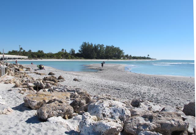
Sanibel is a city in Lee County, Florida, with 6,382 residents (2020 Census). It sits at 3 ft (1 m) above sea level. The nearest town is Captiva, 6.3 miles NW.
- 6,382residents (2020 Census)
- 3 ftelevation · 1 m
- 16.2 sq miland area · 41.9 km²
- 394 / sq mipopulation density
- 33957ZIP code
About Sanibel
Sanibel is an island and city in Lee County, Florida, United States. Its population was 6,382 at the 2020 census, down from 6,469 at the 2010 census. It is part of the Cape Coral-Fort Myers, Florida metropolitan statistical area. The island, also known as Sanibel Island, constitutes the entire city. It is a barrier island—a collection of sand on the leeward side of the more solid coral-rock of Pine Island.
Most of the city proper is at the island's eastern end. After the Sanibel Causeway was built to replace the ferry in 1963, the city was incorporated in 1974, and the residents asserted control over development by establishing the Sanibel Comprehensive Land Use Plan, helping maintain a balance between development and preservation of the island's ecology. In September 2022, the causeway was heavily damaged by Hurricane Ian.
Due to easy causeway access, Sanibel is a popular tourist destination known for its shell beaches and wildlife refuges. More than half the island is made up of wildlife refuges, the largest being J. N. "Ding" Darling National Wildlife Refuge. The island hosts the Sanibel Historical Village and a variety of other museums, including the Bailey-Matthews National Shell Museum.
Text: Wikipedia · CC BY-SA 4.0
Sanibel weather: 7-day forecast
Loading the National Weather Service forecast…
Source: National Weather Service (NOAA).
Live webcams in Sanibel
Webcams: Windy.com
Living in Sanibel
- Median household income
- $108,644
- Median home value
- $957,300
- Median rent
- $811/mo
- Median age
- 67.3
Do you know Sanibel? Tell us about it
Help other travelers: share what makes Sanibel special. We review every message before publishing it.
Map of Sanibel
Tap any street on the map to see it in Street View below. Map: © OpenStreetMap contributors.
Sanibel Street View
Drag the image to look around and tap the arrows on the ground to move. If it says there is no imagery, tap a nearby street on the map above.
Open in Google Maps ›Sanibel, FL population
Sanibel had 6,382 residents in the 2020 Census.
| 2020 Census | 6,382 |
|---|---|
| Density | 394 per sq mi (152 per km²) |
Source: U.S. Census Bureau, Decennial Census.
Sanibel at a glance
| State | Florida (FL) |
|---|---|
| County | Lee County |
| Type | City |
| Population | 6,382 (2020) |
| Land area | 16.18 sq mi (41.9 km²) |
| Water area | 17.02 sq mi (44.09 km²) |
| Elevation | 3 ft (1 m) |
| Coordinates | 26.4510° N, 82.1057° W |
| ZIP code | 33957 |
| Official website | mysanibel.com |
| Census code (GEOID) | 1263700 |
Sources: U.S. Census Bureau (Gazetteer, ZCTA), USGS GNIS, Wikidata.
Towns near Sanibel
- Captiva6.3 mi NW
- St. James City6.6 mi N
- Punta Rassa7.3 mi NE
- Iona10.1 mi NE
- Harlem Heights11.9 mi E
- Fort Myers Beach11.9 mi E
- Pine Island Center12.0 mi N
- Matlacha Isles-Matlacha Shores12.7 mi N
- Matlacha13.0 mi N
- Cypress Lake14.1 mi NE
- McGregor14.2 mi NE
- Pineland14.7 mi N
Straight-line distance between town centers.
Frequently asked questions about Sanibel
What county is Sanibel in?
Sanibel is in Lee County, Florida.
What is the population of Sanibel, FL?
6,382 people lived in Sanibel at the 2020 Census.
What is the ZIP code of Sanibel, FL?
The ZIP code of Sanibel is 33957.
What is the elevation of Sanibel?
3 feet (1 m) above sea level.
What towns are near Sanibel?
Captiva (6.3 mi), St. James City (6.6 mi), Punta Rassa (7.3 mi), Iona (10.1 mi), Harlem Heights (11.9 mi).
Last updated: