Twin Lakes
Census-designated place in Mono County, California
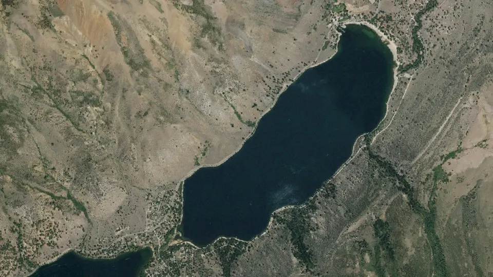
Twin Lakes is an unincorporated community (census-designated place) in Mono County, California, with 45 residents (2020 Census). It sits at 7,106 ft (2,166 m) above sea level. The nearest town is Virginia Lakes, 9.4 miles SE.
- 45residents (2020 Census)
- 7,106 ftelevation · 2,166 m
- 4.2 sq miland area · 10.8 km²
- 11 / sq mipopulation density
- 93517ZIP code
About Twin Lakes
Twin Lakes is an unincorporated community and census-designated place (CDP) in Mono County, California, United States. It is located on the east side of the Sierra Nevada, encompassing the lakes of the same name and extending north down the outlet valley of Robinson Creek. The area is part of Toiyabe National Forest and is 10 miles (16 km) southwest of Bridgeport. It was first listed as a CDP for the 2020 census, with a population of 45.
Mono Village Resort is part of the community. The resort attracts hundreds of fishermen and outdoor enthusiasts every year.
The main tourist attraction of the settlement is the two lakes known as Twin Lakes. Both of these lakes are filled with water from Robinson's Creek which flows down from the top of the mountains and ends at the Bridgeport Reservoir. Both lakes have boat access and the Upper Twin allows for water sports. The area has trailheads for many backcountry hiking trails. The settlement is on the back side of Yosemite which makes it attractive to expert backpackers and horseback tours.
Text: Wikipedia · CC BY-SA 4.0
Twin Lakes weather: 7-day forecast
Loading the National Weather Service forecast…
Source: National Weather Service (NOAA).
Live webcams in Twin Lakes
All 15 webcams near Twin Lakes ›Do you know Twin Lakes? Tell us about it
Help other travelers: share what makes Twin Lakes special. We review every message before publishing it.
Map of Twin Lakes
Tap any street on the map to see it in Street View below. Map: © OpenStreetMap contributors.
Twin Lakes Street View
Drag the image to look around and tap the arrows on the ground to move. If it says there is no imagery, tap a nearby street on the map above.
Open in Google Maps ›Twin Lakes, CA population
Twin Lakes had 45 residents in the 2020 Census.
| 2020 Census | 45 |
|---|---|
| Density | 11 per sq mi (4 per km²) |
Source: U.S. Census Bureau, Decennial Census.
Twin Lakes at a glance
| State | California (CA) |
|---|---|
| County | Mono County |
| Type | Census-designated place |
| Population | 45 (2020) |
| Land area | 4.17 sq mi (10.8 km²) |
| Water area | 1.05 sq mi (2.72 km²) |
| Elevation | 7,106 ft (2,166 m) |
| Coordinates | 38.1629° N, 119.3411° W |
| ZIP code | 93517 |
| Census code (GEOID) | 0681048 |
Sources: U.S. Census Bureau (Gazetteer, ZCTA), USGS GNIS, Wikidata.
Towns near Twin Lakes
- Virginia Lakes9.4 mi SE
- Bridgeport9.5 mi NE
- Mono City13.9 mi SE
- Lee Vining18.6 mi SE
- Walker25.6 mi N
- Coleville30.2 mi N
- June Lake30.3 mi SE
- Yosemite Valley31.8 mi SW
- Topaz34.0 mi N
- Topaz Lake, NV38.6 mi N
- Foresta39.0 mi SW
- Topaz Ranch Estates, NV40.5 mi N
Straight-line distance between town centers.
Frequently asked questions about Twin Lakes
What county is Twin Lakes in?
Twin Lakes is in Mono County, California.
What is the population of Twin Lakes, CA?
45 people lived in Twin Lakes at the 2020 Census.
What is the ZIP code of Twin Lakes, CA?
The ZIP code of Twin Lakes is 93517.
What is the elevation of Twin Lakes?
7,106 feet (2,166 m) above sea level.
What towns are near Twin Lakes?
Virginia Lakes (9.4 mi), Bridgeport (9.5 mi), Mono City (13.9 mi), Lee Vining (18.6 mi), Walker (25.6 mi).
Last updated: