Tamalpais-Homestead Valley
Census-designated place in Marin County, California
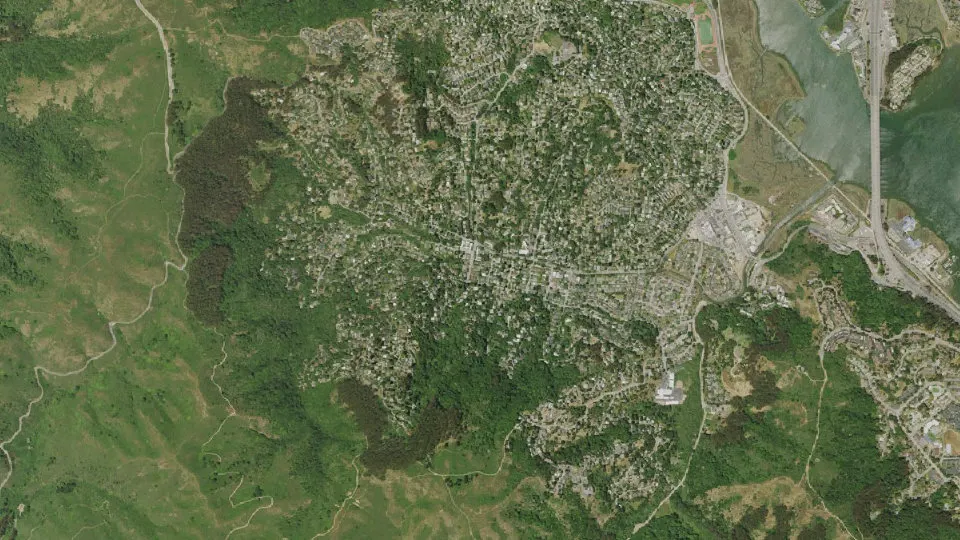
Tamalpais-Homestead Valley is an unincorporated community (census-designated place) in Marin County, California, with 11,492 residents (2020 Census). The nearest town is Marin City, 1.4 miles E.
- 11,492residents (2020 Census)
- 4.7 sq miland area · 12.1 km²
- 2,453 / sq mipopulation density
- 94965ZIP code
About Tamalpais-Homestead Valley
Tamalpais-Homestead Valley is a census-designated place (CDP) in Marin County, California, United States. The population was 11,492 at the 2020 census.
Text: Wikipedia · CC BY-SA 4.0
Tamalpais-Homestead Valley weather: 7-day forecast
Loading the National Weather Service forecast…
Source: National Weather Service (NOAA).
Live webcams in Tamalpais-Homestead Valley
All 24 webcams near Tamalpais-Homestead Valley ›Things to do in Tamalpais-Homestead Valley
Top places to visit in and around Tamalpais-Homestead Valley: Muir Woods National Monument, San Francisco Museum of Modern Art and Alcatraz Federal Penitentiary.
 Muir Woods National MonumentNational park · 2.0 mi NW
 San Francisco Museum of Modern ArtMuseum · 9.9 mi SE
 Alcatraz Federal PenitentiaryMuseum · 7.2 mi SE
 Alcatraz IslandIsland · 7.2 mi SE
Tourist attractions (3)Family attractions (9)Museums & galleries (10)Historic sites & landmarks (10)Parks & gardens (10)Hiking trails (4)Waterfalls (1)Beaches (8)Scenic viewpoints & peaks (10)Nature reserves & natural wonders (10)Wineries, breweries & distilleries (2)Theaters & public art (10)Campgrounds & picnic areas (2)Golf, marinas & outdoor sports (4)
All 93 things to do in Tamalpais-Homestead Valley ›Living in Tamalpais-Homestead Valley
- Median household income
- $243,227
- Median home value
- $1,863,900
- Median rent
- $3,501/mo
- Median age
- 44.5
Small communities near Tamalpais-Homestead Valley
- Tamalpais Valley0.4 mi W
- Tamalpais Valley Junction0.8 mi E
- Almonte1.1 mi NE
- Strawberry Manor1.8 mi NE
- Waldo2.0 mi E
- Reed2.8 mi NE
- Reed2.8 mi NE
- El Campo4.2 mi E
- Escalle4.4 mi N
- Murray Park4.6 mi N
- San Quentin5.2 mi NE
- Seacliff subdivision6.9 mi SE
- Presidio Terrace subdivision7.6 mi SE
- Richmond District7.7 mi SE
- Cerro7.8 mi N
- Los Ranchitos7.9 mi N
Schools near Tamalpais-Homestead Valley
There are no public schools inside Tamalpais-Homestead Valley. The nearest elementary school is Tamalpais Valley Elementary (0.6 mi SE); the nearest middle school is Mill Valley Middle (1.3 mi N); the nearest high school is Tamalpais High (1.0 mi NE).
| School | Grades | Students | Students per teacher | Type | Distance |
|---|---|---|---|---|---|
| Tamalpais Valley Elementary Mill Valley · Mill Valley Elementary | K–5 | 368 | 20.4 | Public | 0.6 mi SE |
| Tamalpais High Mill Valley · Tamalpais Union High | 9–12 | 1,470 | 19.3 | Public | 1.0 mi NE |
| Mill Valley Middle Mill Valley · Mill Valley Elementary | 6–8 | 721 | 15.7 | Public | 1.3 mi N |
| Dr. Martin Luther King Jr. Academy Sausalito · Sausalito Marin City | K–8 | 262 | 14.6 | Public | 1.4 mi E |
| Park Elementary Mill Valley · Mill Valley Elementary | K–5 | 301 | 21.5 | Public | 1.7 mi N |
| Old Mill Elementary Mill Valley · Mill Valley Elementary | K–5 | 261 | 21.8 | Public | 2.0 mi NW |
Do you know Tamalpais-Homestead Valley? Tell us about it
Help other travelers: share what makes Tamalpais-Homestead Valley special. We review every message before publishing it.
Map of Tamalpais-Homestead Valley
Tap any street on the map to see it in Street View below. Map: © OpenStreetMap contributors.
Tamalpais-Homestead Valley Street View
Drag the image to look around and tap the arrows on the ground to move. If it says there is no imagery, tap a nearby street on the map above.
Open in Google Maps ›Tamalpais-Homestead Valley, CA population
Tamalpais-Homestead Valley had 11,492 residents in the 2020 Census.
| 2020 Census | 11,492 |
|---|---|
| Density | 2,453 per sq mi (947 per km²) |
Source: U.S. Census Bureau, Decennial Census.
Tamalpais-Homestead Valley at a glance
| State | California (CA) |
|---|---|
| County | Marin County |
| Type | Census-designated place |
| Population | 11,492 (2020) |
| Land area | 4.69 sq mi (12.1 km²) |
| Water area | 0.06 sq mi (0.16 km²) |
| Coordinates | 37.8791° N, 122.5379° W |
| ZIP code | 94965 |
| Census code (GEOID) | 0677805 |
Sources: U.S. Census Bureau (Gazetteer, ZCTA), USGS GNIS, Wikidata.
Towns near Tamalpais-Homestead Valley
- Marin City1.4 mi E
- Strawberry1.8 mi NE
- Mill Valley2.0 mi N
- Alto2.1 mi NE
- Muir Beach2.6 mi SW
- Sausalito2.9 mi SE
- Belvedere3.6 mi E
- Corte Madera4.0 mi NE
- Kentfield4.1 mi N
- Tiburon4.1 mi E
- Larkspur4.3 mi N
- Ross6.0 mi N
Straight-line distance between town centers.
Frequently asked questions about Tamalpais-Homestead Valley
What county is Tamalpais-Homestead Valley in?
Tamalpais-Homestead Valley is in Marin County, California.
What is the population of Tamalpais-Homestead Valley, CA?
11,492 people lived in Tamalpais-Homestead Valley at the 2020 Census.
What is the ZIP code of Tamalpais-Homestead Valley, CA?
The ZIP code of Tamalpais-Homestead Valley is 94965.
What towns are near Tamalpais-Homestead Valley?
Marin City (1.4 mi), Strawberry (1.8 mi), Mill Valley (2.0 mi), Alto (2.1 mi), Muir Beach (2.6 mi).
Last updated: