San Miguel
Census-designated place in San Luis Obispo County, California
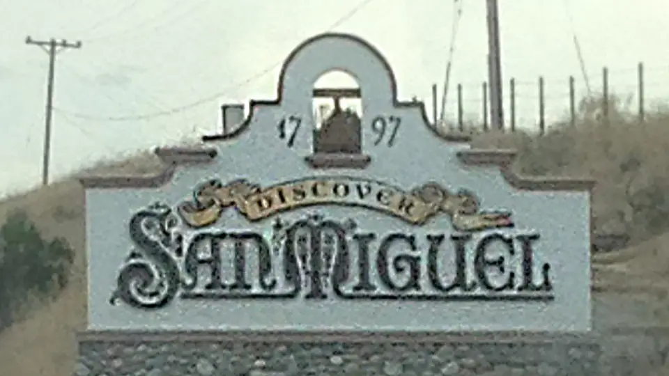
San Miguel is an unincorporated community (census-designated place) in San Luis Obispo County, California, with 3,172 residents (2020 Census). It sits at 636 ft (194 m) above sea level. The nearest town is El Paso de Robles (Paso Robles), 9.0 miles S.
- 3,172residents (2020 Census)
- 636 ftelevation · 194 m
- 1.7 sq miland area · 4.4 km²
- 1,889 / sq mipopulation density
- 93446ZIP code
About San Miguel
San Miguel (Spanish for "St. Michael") is an unincorporated community in San Luis Obispo County, California, United States. As of the 2020 census, the population was 3,172. For statistical purposes, the United States Census Bureau has defined San Miguel as a census-designated place (CDP). San Miguel was founded by the Spanish in 1797, when Mission San Miguel Arcángel was established by Fermín de Lasuén. San Miguel is a tourist destination with historic architecture and vineyards, as part of the Paso Robles wine region.
Text: Wikipedia · CC BY-SA 4.0
San Miguel weather: 7-day forecast
Loading the National Weather Service forecast…
Source: National Weather Service (NOAA).
Live webcams in San Miguel
All 24 webcams near San Miguel ›Things to do in San Miguel
Top places to visit in and around San Miguel: Mission San Miguel Arcángel, Estrella Warbird Museum and J. Lohr Vineyards and Wines.
 Mission San Miguel ArcángelMuseum · in townEstrella Warbird MuseumMuseum · 7.4 mi SE
 J. Lohr Vineyards and WinesWinery · 5.2 mi SE
 Hearst CastleHistoric house · 27 mi W
Family attractions (1)Museums & galleries (7)Historic sites & landmarks (10)Parks & gardens (7)Waterfalls (1)Beaches (3)Scenic viewpoints & peaks (10)Nature reserves & natural wonders (10)Wineries, breweries & distilleries (6)Theaters & public art (2)
All 57 things to do in San Miguel ›Living in San Miguel
- Median household income
- $95,458
- Median home value
- $539,700
- Median rent
- $1,791/mo
- Median age
- 30.4
Small communities near San Miguel
Schools in San Miguel
San Miguel has 2 public schools. The elementary school is Lillian Larsen Elementary; the nearest middle school is Lewis Flamson Junior High (7.9 mi S); the nearest high school is Paso Robles High (9.5 mi S).
| School | Grades | Students | Students per teacher | Type | Distance |
|---|---|---|---|---|---|
| Lillian Larsen Elementary San Miguel · San Miguel Joint Union | K–8 | 448 | 18.7 | Public | in town |
| Pleasant Valley Elementary San Miguel · Pleasant Valley Joint Union Elementary | K–6 | 58 | 14.5 | Public | 5.3 mi SE |
| Kermit King Elementary Paso Robles · Paso Robles Joint Unified | K–6 | 507 | 28.2 | Public | 7.2 mi S |
| Paso Robles Independent Study Center Paso Robles · Paso Robles Joint Unified | K–8 | 37 | 18.5 | Public | 7.9 mi S |
| Lewis Flamson Junior High Paso Robles · Paso Robles Joint Unified | 7–8 | 884 | 19.2 | Public | 7.9 mi S |
| Marie Bauer Early Education Center Paso Robles · Paso Robles Joint Unified | — | — | — | Public | 8.4 mi S |
Do you know San Miguel? Tell us about it
Help other travelers: share what makes San Miguel special. We review every message before publishing it.
Map of San Miguel
Tap any street on the map to see it in Street View below. Map: © OpenStreetMap contributors.
San Miguel Street View
Drag the image to look around and tap the arrows on the ground to move. If it says there is no imagery, tap a nearby street on the map above.
Open in Google Maps ›San Miguel, CA population
San Miguel had 3,172 residents in the 2020 Census.
| 2020 Census | 3,172 |
|---|---|
| Density | 1,889 per sq mi (729 per km²) |
Source: U.S. Census Bureau, Decennial Census.
San Miguel at a glance
| State | California (CA) |
|---|---|
| County | San Luis Obispo County |
| Type | Census-designated place |
| Population | 3,172 (2020) |
| Land area | 1.68 sq mi (4.4 km²) |
| Elevation | 636 ft (194 m) |
| Coordinates | 35.7534° N, 120.6924° W |
| ZIP code | 93446 |
| Census code (GEOID) | 0668266 |
Sources: U.S. Census Bureau (Gazetteer, ZCTA), USGS GNIS, Wikidata.
Towns near San Miguel
- El Paso de Robles (Paso Robles)9.0 mi S
- Bradley9.8 mi NW
- Lake Nacimiento10.1 mi W
- Whitley Gardens12.3 mi SE
- Templeton13.7 mi S
- Oak Shores16.3 mi W
- Atascadero18.5 mi S
- Shandon18.7 mi E
- Creston19.0 mi SE
- San Ardo22.2 mi NW
- Garden Farms23.7 mi S
- Cayucos24.4 mi SW
Straight-line distance between town centers.
Frequently asked questions about San Miguel
What county is San Miguel in?
San Miguel is in San Luis Obispo County, California.
What is the population of San Miguel, CA?
3,172 people lived in San Miguel at the 2020 Census.
What is the ZIP code of San Miguel, CA?
The ZIP code of San Miguel is 93446.
What is the elevation of San Miguel?
636 feet (194 m) above sea level.
What towns are near San Miguel?
El Paso de Robles (Paso Robles) (9.0 mi), Bradley (9.8 mi), Lake Nacimiento (10.1 mi), Whitley Gardens (12.3 mi), Templeton (13.7 mi).
Last updated: