Palo Cedro
Census-designated place in Shasta County, California
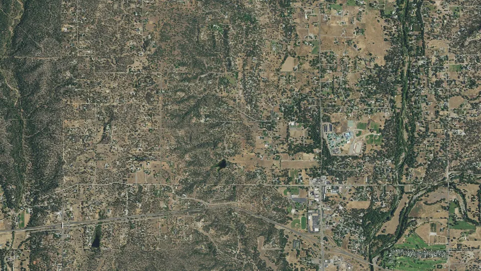
Palo Cedro is an unincorporated community (census-designated place) in Shasta County, California, with 2,931 residents (2020 Census). It sits at 469 ft (143 m) above sea level. The nearest town is Millville, 4.0 miles E.
- 2,931residents (2020 Census)
- 469 ftelevation · 143 m
- 8.2 sq miland area · 21.2 km²
- 358 / sq mipopulation density
- 96073ZIP code
About Palo Cedro
Palo Cedro (Spanish for "Cedar Wood") is a census-designated place (CDP) in Shasta County, California, United States. It is 8 miles (13 km) east of Redding. Its population is 2,931 as of the 2020 census, up from 1,269 from the 2010 census.
Originally, indigenous Native Americans lived in Northern California, including what is now Shasta County, prior to European American settlement. European American exploration of inland California started in 1769 and continued on into the 19th century. Cow Creek, a Sacramento River tributary that runs south through Palo Cedro, was a conduit for entrance into the Sacramento Valley by Hudson Bay Fur Company trappers including Alexander McLeod (1829) and John Work (1832). The town is named after cedarwood trees originally indigenous to the area in the 19th century.
As of the 2020 census, Palo Cedro has a population density of 360 people per square mile (140/km2). Award-winning country musician Merle Haggard lived in Palo Cedro for decades until his death on April 6, 2016.
Text: Wikipedia · CC BY-SA 4.0
Palo Cedro weather: 7-day forecast
Loading the National Weather Service forecast…
Source: National Weather Service (NOAA).
Live webcams in Palo Cedro
All 24 webcams near Palo Cedro ›Living in Palo Cedro
- Median household income
- $120,152
- Median home value
- $551,600
- Median rent
- $1,375/mo
- Median age
- 41.6
Do you know Palo Cedro? Tell us about it
Help other travelers: share what makes Palo Cedro special. We review every message before publishing it.
Map of Palo Cedro
Tap any street on the map to see it in Street View below. Map: © OpenStreetMap contributors.
Palo Cedro Street View
Drag the image to look around and tap the arrows on the ground to move. If it says there is no imagery, tap a nearby street on the map above.
Open in Google Maps ›Palo Cedro, CA population
Palo Cedro had 2,931 residents in the 2020 Census.
| 2020 Census | 2,931 |
|---|---|
| Density | 358 per sq mi (138 per km²) |
Source: U.S. Census Bureau, Decennial Census.
Palo Cedro at a glance
| State | California (CA) |
|---|---|
| County | Shasta County |
| Type | Census-designated place |
| Population | 2,931 (2020) |
| Land area | 8.18 sq mi (21.2 km²) |
| Water area | 0.11 sq mi (0.28 km²) |
| Elevation | 469 ft (143 m) |
| Coordinates | 40.5693° N, 122.2505° W |
| ZIP code | 96073 |
| Census code (GEOID) | 0655296 |
Sources: U.S. Census Bureau (Gazetteer, ZCTA), USGS GNIS, Wikidata.
Towns near Palo Cedro
- Millville4.0 mi E
- Bella Vista5.6 mi N
- Redding6.1 mi W
- Anderson8.6 mi S
- Jones Valley9.1 mi N
- Shasta Lake10.1 mi NW
- Mountain Gate11.0 mi N
- Happy Valley11.3 mi SW
- Centerville11.4 mi W
- Keswick11.9 mi W
- Shasta12.0 mi W
- Cottonwood12.8 mi S
Straight-line distance between town centers.
Frequently asked questions about Palo Cedro
What county is Palo Cedro in?
Palo Cedro is in Shasta County, California.
What is the population of Palo Cedro, CA?
2,931 people lived in Palo Cedro at the 2020 Census.
What is the ZIP code of Palo Cedro, CA?
The ZIP code of Palo Cedro is 96073.
What is the elevation of Palo Cedro?
469 feet (143 m) above sea level.
What towns are near Palo Cedro?
Millville (4.0 mi), Bella Vista (5.6 mi), Redding (6.1 mi), Anderson (8.6 mi), Jones Valley (9.1 mi).
Last updated: