Corona
City in Riverside County, California
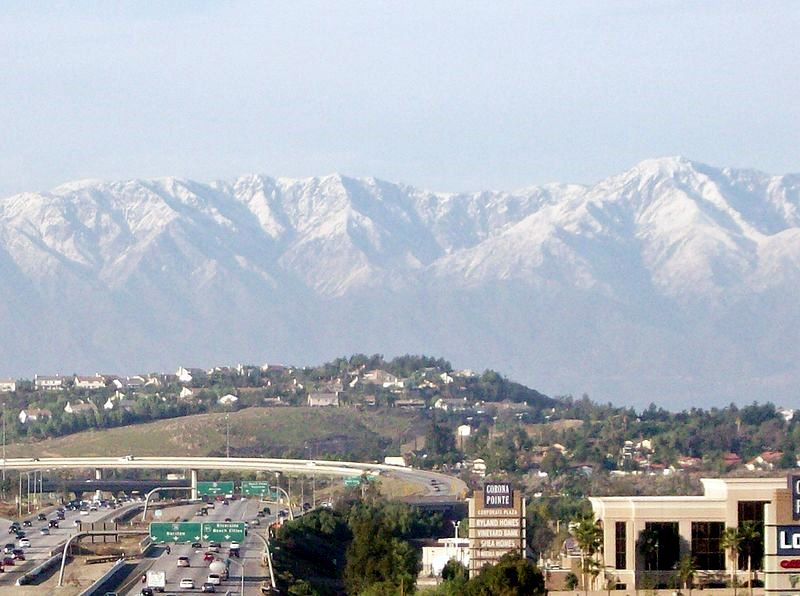
Corona is a city in Riverside County, California, with 157,136 residents (2020 Census). It sits at 679 ft (207 m) above sea level. The nearest town is Coronita, 2.8 miles W.
- 157,136residents (2020 Census)
- 679 ftelevation · 207 m
- 39.9 sq miland area · 103.4 km²
- 3,938 / sq mipopulation density
- 92882main ZIP code (3 in total)
About Corona
Corona (Spanish for "Crown") is a city in northwestern Riverside County, California, United States, directly bordering Orange and San Bernardino counties. Its current mayor is Jacque Casillas. At the 2020 census, the city had a population of 157,136, up from 152,374 at the 2010 census. Corona is surrounded by Riverside to the east, Norco to the north and northeast, Yorba Linda to the northwest, Cleveland National Forest and the Santa Ana Mountains to the west, southwest, and south. Several unincorporated communities are along the rest of the city's borders. Downtown Corona is approximately 48 miles (77 km) southeast of Downtown Los Angeles and 95 miles (153 km) north-northwest of San Diego.
Corona, located along the western edge of Southern California's Inland Empire region, is known as the "Circle City" due to Grand Boulevard's 3 mi (4.8 km) circular layout. It is one of the most residential cities in the Inland Empire, but also has a large industrial portion on the northern half, being the headquarters of companies such as Fender Musical Instruments Corporation, Monster Beverage Corporation, and sports car manufacturer Saleen.
Text: Wikipedia · CC BY-SA 4.0
Corona weather: 7-day forecast
Loading the National Weather Service forecast…
Source: National Weather Service (NOAA).
Live webcams in Corona
All 24 webcams near Corona ›Living in Corona
- Median household income
- $109,242
- Median home value
- $700,700
- Median rent
- $2,228/mo
- Median age
- 37.5
Do you know Corona? Tell us about it
Help other travelers: share what makes Corona special. We review every message before publishing it.
Map of Corona
Tap any street on the map to see it in Street View below. Map: © OpenStreetMap contributors.
Corona Street View
Drag the image to look around and tap the arrows on the ground to move. If it says there is no imagery, tap a nearby street on the map above.
Open in Google Maps ›Corona, CA population
Corona had 157,136 residents in the 2020 Census.
| 2020 Census | 157,136 |
|---|---|
| Density | 3,938 per sq mi (1,520 per km²) |
Source: U.S. Census Bureau, Decennial Census.
Corona at a glance
| State | California (CA) |
|---|---|
| County | Riverside County |
| Type | City |
| Population | 157,136 (2020) |
| Land area | 39.90 sq mi (103.4 km²) |
| Water area | 0.02 sq mi (0.05 km²) |
| Elevation | 679 ft (207 m) |
| Coordinates | 33.8620° N, 117.5655° W |
| ZIP codes | 92882, 92879, 92881 |
| Official website | ci.corona.ca.us |
| Census code (GEOID) | 0616350 |
Sources: U.S. Census Bureau (Gazetteer, ZCTA), USGS GNIS, Wikidata.
Towns near Corona
- Coronita2.8 mi W
- El Cerrito3.0 mi SE
- Home Gardens3.3 mi E
- Norco4.5 mi N
- El Sobrante6.0 mi E
- Eastvale7.1 mi N
- Silverado8.7 mi SW
- Temescal Valley9.1 mi SE
- Chino10.1 mi NW
- Williams Canyon10.1 mi SW
- Chino Hills10.8 mi NW
- Anaheim11.1 mi W
Straight-line distance between town centers.
Frequently asked questions about Corona
What county is Corona in?
Corona is in Riverside County, California.
What is the population of Corona, CA?
157,136 people lived in Corona at the 2020 Census.
What is the ZIP code of Corona, CA?
The main ZIP code is 92882. Other ZIP codes: 92879, 92881.
What is the elevation of Corona?
679 feet (207 m) above sea level.
What towns are near Corona?
Coronita (2.8 mi), El Cerrito (3.0 mi), Home Gardens (3.3 mi), Norco (4.5 mi), El Sobrante (6.0 mi).
Last updated: