Berry Creek
Census-designated place in Butte County, California
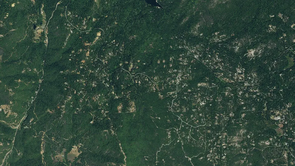
Berry Creek is an unincorporated community (census-designated place) in Butte County, California, with 1,637 residents (2020 Census). It sits at 1,995 ft (608 m) above sea level. The nearest town is Cherokee, 6.9 miles W.
- 1,637residents (2020 Census)
- 1,995 ftelevation · 608 m
- 57.1 sq miland area · 147.9 km²
- 29 / sq mipopulation density
- 95916ZIP code
About Berry Creek
Berry Creek (formerly, Berry Valley) is a census-designated place about 25 miles (40 km) northeast of Oroville, California in hilly terrain at 2,000 feet (610 m) above mean sea level. The community is located along the Oroville-Quincy Highway on the shore of Madrone Lake. The community is home to Berry Creek Elementary School (K-8), 2 small mountain churches, 1 mini mart w/ gas, 1 small community park. Berry Creek is home to the annual Berry Festival which is held during August.
Berry Creek is inside Area code 530 and wired phone numbers follow the format (530) 589-xxxx. The community's ZIP code is 95916, and is shared with the community of Brush Creek (which is about 4 mi (6.4 km) east on Oroville-Quincy Highway). As of the 2020 census, Berry Creek had a population of 1,637.
There is a California Department of Forestry and Fire Protection fire station at an area called Harts Mill just south of the community. This is a historic name for a community once located at 39°37′25″N 121°26′08″W. Harts Mill was probably a mining community named for a stamp mill. The USGS lists a variant name of Virginia Mill for the area. The CDF Fire Dept is located in Berry Creek approximately 2 mi (3.2 km) past the U.S. Post Office on Hwy 162 (Nearest cross street: Berry Creek Rd/Bloomer Hill Rd). There are two main mountains in Berry Creek to distinguish areas. Bloomer Hill (mountain nearest the Post Office) and Bald Rock mountain (mini mart and community park). The Berry Festival is always held on Bald Rock mountain.
Berry Creek was mostly destroyed by the Bear Fire on September 9, 2020.
Text: Wikipedia · CC BY-SA 4.0
Berry Creek weather: 7-day forecast
Loading the National Weather Service forecast…
Source: National Weather Service (NOAA).
Live webcams in Berry Creek
All 24 webcams near Berry Creek ›Living in Berry Creek
- Median household income
- $45,673
- Median home value
- $249,200
- Median rent
- $1,344/mo
- Median age
- 54.2
Do you know Berry Creek? Tell us about it
Help other travelers: share what makes Berry Creek special. We review every message before publishing it.
Map of Berry Creek
Tap any street on the map to see it in Street View below. Map: © OpenStreetMap contributors.
Berry Creek Street View
Drag the image to look around and tap the arrows on the ground to move. If it says there is no imagery, tap a nearby street on the map above.
Open in Google Maps ›Berry Creek, CA population
Berry Creek had 1,637 residents in the 2020 Census.
| 2020 Census | 1,637 |
|---|---|
| Density | 29 per sq mi (11 per km²) |
Source: U.S. Census Bureau, Decennial Census.
Berry Creek at a glance
| State | California (CA) |
|---|---|
| County | Butte County |
| Type | Census-designated place |
| Population | 1,637 (2020) |
| Land area | 57.12 sq mi (147.9 km²) |
| Water area | 0.06 sq mi (0.15 km²) |
| Elevation | 1,995 ft (608 m) |
| Coordinates | 39.6318° N, 121.4056° W |
| ZIP code | 95916 |
| Census code (GEOID) | 0606070 |
Sources: U.S. Census Bureau (Gazetteer, ZCTA), USGS GNIS, Wikidata.
Towns near Berry Creek
- Cherokee6.9 mi W
- Yankee Hill7.5 mi NW
- Kelly Ridge7.8 mi SW
- Forbestown10.3 mi SE
- Oroville East10.4 mi SW
- Robinson Mill11.1 mi SE
- Concow11.2 mi NW
- Oroville12.5 mi SW
- South Oroville13.0 mi SW
- Butte Valley13.0 mi W
- Thermalito13.4 mi SW
- Paradise13.6 mi NW
Straight-line distance between town centers.
Frequently asked questions about Berry Creek
What county is Berry Creek in?
Berry Creek is in Butte County, California.
What is the population of Berry Creek, CA?
1,637 people lived in Berry Creek at the 2020 Census.
What is the ZIP code of Berry Creek, CA?
The ZIP code of Berry Creek is 95916.
What is the elevation of Berry Creek?
1,995 feet (608 m) above sea level.
What towns are near Berry Creek?
Cherokee (6.9 mi), Yankee Hill (7.5 mi), Kelly Ridge (7.8 mi), Forbestown (10.3 mi), Oroville East (10.4 mi).
Last updated: